From sandstone Country and nineteenth-century orchards to Crown Ridge, the planned postwar neighbourhood and the community that lives here today.
Unlinked and excluded from search indexing 1943 aerial: NSW Spatial Services [25]
The short version
Older than it looks
East Lindfield grew in layers. Streets were taking shape in the west by the 1890s, Crown Ridge sold strongly in 1920–21, and much of the capital-city grid was occupied before 1943.
The familiar 1950s and 1960s suburb came later, largely through Crown land releases east of Melbourne Road. New streets filled with houses, and the shops and community centre gave the growing neighbourhood a heart of its own. People had been calling the area East Lindfield for decades, although it did not become a separately designated suburb until 1994. Its history did not stop there. The churches, clubs, school, halls and shops have continued to change with the people who use them.
Before suburbia
Country, timber and orchards
People have lived on this Country for tens of thousands of years. Ku-ring-gai Council commonly refers to Darramuragal or Darug people, while Wallumedegal and Garigal connections may also form part of the story. The names that survive do not fit neatly within modern suburban boundaries. Colonisation disrupted clan structures, and “Ku-ring-gai” itself was a name coined by John Fraser in 1892. The continuing Aboriginal connection is older than any of these labels. [58]
The country was never empty bush. Hawkesbury Sandstone ridges fall through Gordon and Moores creeks towards Middle Harbour. Rock overhangs, creek-side sandstone and sheltered foreshore country offered places for engravings, shelters, art, grinding grooves, middens and other traces of long occupation. Those possibilities belong especially to the suburb's bushland edges and waterways, rather than to any one address named here. [58]
Colonisation brought violence, displacement, clearing, pressure on food supplies and epidemic disease. Aboriginal people still moved through this changed landscape. One local recollection has them travelling up from Middle Harbour to pick fruit at the Archbold orchard, following a path between the harbour valleys and the cultivated ridge long after European settlement began. [59]
Timber and the first colonial road
Between about 1805–09 and 1819, the government Lane Cove Sawing Establishment worked the wider Lindfield district. By 1816 its camp held roughly 48 convicts. Timber travelled on jinkers to the Lane Cove River and then by water to Sydney. The camp track, later Fiddens Wharf Road, became Ku-ring-gai's first colonial road, so the district's earliest traffic faced west to the river while the steep Middle Harbour country remained hard to reach. [62]
The old road names preserve that river-facing geography. Grosvenor Road began as Dick's Road, after Richard Archbold, and ran down towards the Lane Cove River. Bradfield Road was earlier Hyndes Wharf Road and, before that, Cooks Wharf Road. Treatts Road and Tryon Road followed grant boundaries. These were practical farm and wharf routes long before they became suburban streets. [86]
Grants spread along the ridge
George Cadby, a veteran of the NSW Veteran Corps, was promised 100 acres west of the ridge in 1831 and authorised to occupy it in 1833. He soon asked for six convicts to work the holding. His land stretched along the main road from Bent and Balfour streets towards the site of Lindfield Public School, then west beyond Ivey Street. Cadby's Road probably followed parts of today's Beaconsfield Parade, Ivey Street and Grosvenor Road. Although his grant lay outside modern East Lindfield, it helps explain how settlement first gathered along the ridge and the routes leading down to the river. [86]
Clanville: the estate beneath western East Lindfield
Daniel Dering Mathew's 1819 grant comprised 400 acres from today's Pacific Highway to Archbold Road and from Boundary Street north to Tryon Road. Named Clanville, it covered much of western East Lindfield. Mathew felled timber and ran cattle before selling to Richard Archbold in 1824. [59]
Richard and Mary Archbold established orchards using hired and assigned convict labour. After Richard died in 1836, Mary and the older children kept them operating until her death in 1850. Gerald Archbold built Clanville cottage, and an 1858 plan records its orchard, cultivated paddocks and entrance from Lane Cove Road. Early residents later remembered Aboriginal visitors from Middle Harbour coming to pick Archbold fruit.
The Archbolds later added land beyond the original Clanville grant. Their holdings reached into modern East Lindfield between Tryon, Sydney, Carnarvon and Melbourne roads, and north and east from Boundary Street and Archbold Road. On former Fitzgerald grant land farther south, an Archbold orchard was later leased to the Chinese market gardener Ah Coon. Other former grant land west of the highway was worked by Why Tiy and Kwong Shing. Those gardens were not all in East Lindfield, but they belong to the wider farming economy from which the suburb emerged. [87]
The estate remained in trust until the youngest of the Archbolds' eight surviving children turned 21. In 1858 it was divided into eight nominal 50-acre allotments. Family members later reassembled parts, but by the 1880s title notices show the 400-acre holding fragmenting into private parcels. East of Archbold Road, meanwhile, much of the rocky future suburb remained Crown land.
The 400-acre Clanville estate on an 1835 Parish of Gordon map. The assessment's red outline marks its separate study site, not East Lindfield. GML Heritage / NSW Land Registry records. [59]Clanville divided into eight 50-acre family portions in 1858. The plan also records the cottage, orchard and cultivated paddocks. GML Heritage / NSW Land Registry records. [59]The original cottage named Lindfield on Gordon Road, photographed around 1920. Ku-ring-gai Library Local History Collection / Ku-ring-gai Historical Society collection. [78]The 1894 Lindfield Park plan marks “W. List” and the cottage beside Lindfield Lane, Bent Street and the railway platform. Biosis / State Library of NSW. [78]The full Lindfield Park subdivision brochure for the auction of 14 April 1894. Its plan places the railway, Gordon Road, Bent Street and the List property in their original setting. Ku-ring-gai Historical Society. [86]
Railway hopes, an unbuilt tramway and Crown sales
The eastern side of modern East Lindfield entered the market through both real and speculative transport schemes. Parliament authorised the privately promoted Willoughby and Gordon Tramway in July 1887. Its promoters imagined a line from the St Leonards cable tramway toward the Parish of Gordon and spoke of nearby land rising from £120 to £500 an acre. The scheme was amended several times but never completed. [61]
Even so, the July 1888 Government Gazette described future East Lindfield land by its distance from the proposed tramway terminus. The September sale offered large numbered Crown portions, generally several acres each, on a 25 per cent deposit with upset prices mostly from £30 to £70 an acre. Its descriptions already name Melbourne, Wellington, Carlyle, Tryon, Ruskin and Carnarvon roads alongside routes later altered or lost. A substantial group was reoffered in 1890, proving that the transition was gradual rather than an immediate sell-out. [60]
The railway was the scheme that finally arrived. The single-track North Shore line from Hornsby to St Leonards opened on 1 January 1890, with a platform at Lindfield, and reached Milsons Point and the harbour ferry in May 1893. By September 1894 the developing district had more than fifty families. A local progress committee was already pressing for postal facilities at the platform because letters collected by tradespeople could be delayed. It may have been an earlier form of the Lindfield Progress Association usually dated to 1897, although the thread between the two groups is still unclear. [60][62]
The 1888 survey of 195 portions captures the future suburb as acreage, creeks, reserves and newly named roads. State Library of NSW. [5]
Residents begin to organise
The progress committee did the practical work of a neighbourhood council. In August 1895 it reported that the water supply would be extended, asked for extra trains, including a missing Saturday midday service, and joined other northern groups in pressing for a bridge across the harbour. [63]
In November 1899 residents formed a newly organised progress association, suggesting a reorganisation after the 1894–95 body rather than a simple unbroken foundation story. Charles R. Potter became president, with future shire president William Cowan and F. K. Cliff as vice-presidents. Its immediate program covered a recreation reserve, harbour bridge, better telephone facilities and a public school.
By February 1900 the association had secured a second daily mail delivery, a post box and another postal assistant. It was also pursuing a school, park, lower water rates, full telephone service, improvements at Milsons Point station, ashes for local roads and a harbour bridge, while finding time to organise a first-aid class. One proposal reached directly into the future East Lindfield. The association wanted unemployed men put to work opening Tryon Road to Middle Harbour, allowing a large area of Crown land to be sold. [63]
More of this story is waiting in the Ku-ring-gai Historical Society collection. Its catalogue lists an archive box, a folder and microfiche for the Lindfield Progress Association from the late 1890s into the early 1900s. A newspaper report from 1902 also mentions an illustrated annual pamphlet about roads, schools, post and telephone services, parks, drainage, railways, water rates and the harbour bridge. [63]
“There's our Post Office, so it is.” Lindfield's temporary post office in June 1907, thirteen years after residents first pressed for postal facilities near the railway platform. Ku-ring-gai Historical Society. [86]
Aboriginal occupation of the sandstone ridges, creeks and Middle Harbour over many thousands of years.
Lane Cove timber establishment and convict camp in the wider district.
Daniel Dering Mathew received the 400-acre Clanville grant, covering much of western East Lindfield.
Richard Archbold acquired Clanville.
After Richard's death, Mary Archbold and the older children continued the orchards.
Clanville was divided into eight 50-acre family allotments.
A private tramway was authorised but never built. The Crown began marketing the eastern acreage around it.
Lindfield station opened and unsold Crown portions were offered again.
The line reached Milsons Point as the developing suburb grew beyond fifty families.
1894–1962
How East Lindfield was subdivided
From large grants to suburban blocks
On the old land maps, East Lindfield lies in the Parish of Gordon, County of Cumberland. This was a surveying district rather than a church parish. The first maps show broad grants and numbered Crown portions. Later plans cut them into estates, streets and house blocks, allowing the suburb to emerge on paper piece by piece.
The State Library's c.1850s Parish of Gordon map records grantees, waterways and the sparse road framework before an East Lindfield street grid existed. An 1888 plan then advertised 195 numbered portions from close to Lindfield station eastward toward Middle Harbour, with dimensions, acreage, roads, reserves and topography.
An 1891 Royal Commission looked back on a Crown land auction near Lindfield platform on 24 October 1888. More than 503 acres sold for an average of £50 11s 1d an acre, with individual blocks ranging from £30 to £210. The surviving plan advertises 25 September, so it may show an earlier stage of the same sales rather than the auction described to the commission.
An 1890 version colours another group of the 195 portions red for auction. Plan 118G goes a step further, writing areas and prices beside individual Lindfield lot numbers. Its date is missing, but it turns the numbered shapes on the map into real pieces of land with contemporary values.
Parish of Gordon, County of Cumberland, c.1850s: grants and grantees before East Lindfield's street grid. State Library of NSW, Maps/0005. [5]Plan of 195 portions at “Gordon”, offered 25 September 1888. State Library of NSW, Z/SP/L9/151. [5]The 1890 sale sheet marks another selection of the 195 portions in red. State Library of NSW, Z/SP/G8/138. [5]Plan 118G records Lindfield lot numbers, areas and price notations. Its exact date remains unresolved. State Library of NSW, Z/SP/G8/139. [5]
The Archbold family had acquired about 50 acres by 1881 within present Tryon, Melbourne, Woodlands and Sydney roads. Myles McRae held another 55 acres to the west. An 1894 Crown Lands plan offered 195 portions and captures the early road framework before most of East Lindfield's familiar grid existed.
Woodlands Estate was offered in 1906. Nine of its fifty lots brought £630 at the first December auction. The Plateau Estate followed in 1913 around Wellington and Melbourne roads, with residential lots and a reserve for public buildings. Twelve Plateau lots sold for 13 to 18 shillings per foot, totalling £672. The 1920 Woodlands Extension sold 57 of 60 lots fronting Archbold, Woodlands, Carnarvon and Ruskin for £6,300.
A small 1916 classified advertisement catches one parcel between those larger estate sales. Arthur Rickard & Co offered a Lindfield corner allotment at Melbourne Road and Wellington Road for £100, payable at 30 shillings per month. The notice supplies neither dimensions nor an estate name, but it proves that this future East Lindfield intersection was already part of the residential land market four years before Crown Ridge's first auction. [131]
Crown Ridge was the decisive subdivision. Its first auction plan of 17 April 1920 already laid out Brisbane, Adelaide and Melbourne between Sydney and Wellington roads, with Brisbane marked 66 feet wide. Fifty-five blocks sold for £8,300. A second release sold 21 lots despite a violent thunderstorm. The November 1921 reissue promoted level building land, garden soil, healthy home sites and Torrens title, on a £5 deposit and 36 monthly payments. Free cars met buyers at Lindfield station. Every purchaser even received a Golden Casket ticket.
Two smaller names fill the gap before the building boom. Arthur Rickard advertised Chimo Estate in 1923: seventeen deep blocks with Middle Harbour views, measuring 66 by 260–332 feet and priced at £55–£85. For auction on 29 April 1939, the Lindfield Heights Estate offered ten sites between Tryon and Wellington roads, close to Melbourne Road and nearly opposite the school. The sale plan arranged five blocks along each road, with drainage easements behind them. A protective building covenant and five-year payment terms accompanied the offer. [79]
The maps also settle one easy point of confusion. There was no separate “Wellington Estate”. Wellington Road was already named on nineteenth-century plans and later bordered Plateau, Crown Ridge, Chimo, Lindfield Heights and the Highland Estate.
A February 1921 government notice records Ku-ring-gai Council's proposal to make almost the whole shire a residential district, excluding shops, industry, public amusements and advertising hoardings. The listed Lindfield exceptions were road frontages along Lane Cove Road and the east side of Lindfield Avenue between Tryon Road and Woodside Avenue. This helps explain why new estates such as Crown Ridge were promoted as residential landscapes while commerce remained concentrated on selected corridors. The notice invited objections and does not by itself prove that the proposal was finally declared. [138]
A second proposal in February 1924 shows that the system had already moved on. It proposed abolishing residential districts proclaimed in November 1922 and February 1923 and replacing them with almost the whole shire, again excluding parks, reserves and specified lands. The local exclusions now included the north-eastern side of Archbold Road from Carnarvon to Woodlands, Middle Harbour lots 113–120 in Austin Chapman's subdivision, the south-eastern side of Tryon Road from Lane Cove Road to the railway, and the north-eastern side of Sydney Road from Brisbane Avenue to Tryon Road. This establishes the changing geography of residential control, but the notice again records a proposal rather than its final enactment. [141]
A July 1925 proclamation places Lots 1, 2, 33 and 34 of DP9998, on Sydney Road between Brisbane Avenue and Tryon Road, in a formal residential district. This securely ties DP9998 to Crown Ridge and shows that part of the estate was under residential planning control by 1925. [11]
Postwar planning widened the focus beyond residential exclusions. In March 1946 Ku-ring-gai Council proposed preparing a scheme for land at East Roseville, East Lindfield, East Killara, East Gordon and part of St Ives, shown on its Resolution Map AA32. The stated purpose was satisfactory development and the correction of defects in the area. Residents could inspect the map and suggest adding or removing land until 11 April. By June, Council had passed the resolution, sent a certified copy to the Minister for approval and opened a further fourteen-day boundary-submission period. On 9 August Minister J. J. Cahill approved the resolution and gave Council two years to prepare the scheme. This proves approval to prepare it, not that the finished scheme was delivered or enacted. [153]
Two months later, the Lands Department announced that a special area of home sites at East Lindfield was among five Sydney districts proposed for staged notification. The notice establishes official intent in October 1946, but gives no boundary, number of sites or release date. It therefore cannot be assumed to describe the particular Crown sales documented from 1954 onward. [158]
A 1929 advertisement offered Adelaide Avenue land measuring 66 by 158 feet for £200. By the 1943 aerial, much of Crown Ridge was built up. East of Melbourne Road, however, large areas remained bush until Crown releases in 1958 and 1962. [79]
Land sales were also transforming the older centre around the station. The 1911 Heart of Lindfield Estate spread across both sides of the railway between Milson, Balfour, Gordon and the streets around the village. It was outside modern East Lindfield, but its bold auction poster shows how completely the railway had changed the district from farms and timber tracks into a residential market. [86]
Crown Lands at Lindfield and Gordon, auctioned 3 March 1894. State Library of NSW. [7]Plateau Estate around Wellington and Melbourne roads, October 1913. State Library of NSW. [7]First Crown Ridge subdivision, 17 April 1920. Brisbane Avenue is one of the original 66-foot-wide approaches. State Library of NSW. [7]The complete estate, 5 November 1921, showing earlier sold blocks and the remaining southern release. State Library of NSW. [7]Heart of Lindfield Estate auction poster, 16 December 1911. The land lay around the station rather than in East Lindfield, but the poster captures the railway-led subdivision boom reshaping the wider district. Ku-ring-gai Historical Society. [86]
Historic subdivision sequence and 1943 development pattern. Ku-ring-gai Heritage Study. [3]
The final Crown releases
East of Melbourne Road, much of the land was still bush in 1943. It was released in stages: 31 blocks in 1954, 28 in 1956, 20 home sites in 1958, another eight East Lindfield and East Killara blocks in 1959, then 29 allotments in 1962. The eastern streets filled gradually, sale by sale, rather than appearing in one postwar sweep. [55]
The 1958 sale required a 10 per cent deposit with ten annual instalments at four per cent and limited each buyer to one lot. The 1962 release covered Karoo and Sylvan avenues and Canberra Crescent, with reserve prices printed directly on the blocks and a 20 per cent deposit.
Twenty East Lindfield Crown home sites offered on 8 February 1958. State Library of NSW, Z/SP/L9/109. [8]Twenty-nine allotments offered on 25 August 1962, with reserve prices printed on the plan. State Library of NSW, Z/SP/L9/104. [8]
One important map still waits in the Ku-ring-gai Historical Society collection: “Crown Lands, East Lindfield”, prepared by J. E. Green & Co in 1899, accession 973104. Its precise coverage will remain a mystery until the original can be inspected.
The little lanes through Crown Ridge
One of Crown Ridge's most distinctive features is still easy to walk. Narrow pedestrian lanes run from avenue to avenue between Tryon and Woodlands roads. They do not form a single straight passage. Each section meets the next avenue at a different point, so a walk through the estate steps sideways between Brisbane, Adelaide, Perth and Hobart avenues.
Ku-ring-gai Council's heritage study identifies them as a staggered network of pedestrian rights of way created with the 1920 subdivision. Their practical purpose was probably to let people cross the long residential blocks without walking around to Sydney or Melbourne roads. The surviving plans do not explain the stagger. Each path appears to have been fitted into the lot arrangement of its own block rather than surveyed as one continuous lane, but the reason for that choice has not yet been found. [3]
Brisbane Avenue's unusual entrance
Brisbane Avenue was an original entrance into Crown Ridge from Sydney Road, not a later addition. The forked or split form is clearly visible in the NSW Government's 1943 aerial imagery. Ku-ring-gai Council's heritage study identifies splayed road intersections as a characteristic feature of Crown Ridge, which provides a credible explanation for this unusual geometry.
The result was a formal entrance rather than an ordinary right-angle corner. The splay made turning easier, improved visibility and gave Crown Ridge a broader sense of arrival. Its two arms enclose a central island, perhaps intended for planting or estate display, though no description of the original landscaping has survived.
Brisbane Avenue's split entrance at Sydney Road was already established by 1943. NSW Spatial Services historical imagery. [25]
1939–1954
Building the suburb, house by house
By the late 1930s the lines on the subdivision maps were filling with brick houses, and East Lindfield had become one of Ku-ring-gai's busiest building districts.
In October 1939 architect Adrian Ashton was preparing a two-storey East Lindfield residence. Construction published the completed Adelaide Avenue house in 1942. Native trees had been retained, and Armstrong and Swainson built a single-storey garage wing off the entrance, three round-headed lounge windows and an octagonal two-storey rear wing with a sunroom below the owner's bedroom. The article specified biscuit-coloured brick with raked horizontal joints. [80]
Other notices mention the brick “Mary Alice cottage” in Brisbane Avenue in 1940, a brick residence for J. C. Morrell, and 1941 approvals in Wellington Road, Sydney Road, Perth Avenue and Melbourne Road. One was a two-storey Melbourne Road house and garage for Mrs J. M. Murray. A June list adds £2,100 of semi-detached brick cottages in Brisbane Avenue for owner-builder L. Hobbs, while architect Guy Crick called tenders in September for another two-storey brick residence somewhere in East Lindfield. Street numbers are mostly absent, leaving the identity of those houses hidden among the buildings that survive today. [117][118]
A January 1941 report said East Lindfield had the greatest building activity in Ku-ring-gai during 1940. It linked the expansion to a new city bus service, fresh subdivisions and improved housing finance. By September a social column observed a rapid spread of new two-storey dwellings as families returned from flats to home ownership. [119]
Hobart Avenue appears repeatedly. In July 1936 Construction recorded a brick dwelling in “Hobart Street” for M. J. Knowles and a residence in Hobart Avenue for E. E. Woodley. That December came a brick residence and garage for B. H. Mullaney, followed in January 1942 by a brick bungalow and garage for E. H. Eyre. Without street numbers, none can yet be matched to number 34 or another surviving house. [12]
Road grading was already being formalised in 1930. Council fixed levels for Adelaide Avenue from Melbourne Road to Sydney Road, Melbourne Road from Adelaide Avenue to Tryon Road, Owen Street from Archbold Road to Sydney Road, and half of Tryon Road from the park gates to Melbourne Road. Fixing a level established the approved road grade; the notice does not prove that every associated work was completed immediately. [151]
By October 1937 the Water Board reported completed sewers available for household connection along Soldiers' Memorial Park, Loombah Road, Robinson Street, Tryon Road and Brisbane Avenue, with connections required within sixty days. The notice identifies the lines, but does not prove that every nearby house connected within that period. [161]
Council adopted more detailed levels in April 1941 for Melbourne Road from Adelaide Avenue through the Perth and Hobart intersections. In October 1946 the Metropolitan Water Board approved a semi-mobile booster unit at Sydney Road, East Lindfield, as one of four measures intended to prevent serious summer supply gaps. By 6 November it had been installed and had raised pressure during heavy consumption from 17 to 37 pounds per square inch. A December report called the temporary boosters very successful. This proves operation and measured improvement, but not a permanent solution. [13][159][160]
In January and February 1951, Water Board notices announced sewer mains along both sides of Hobart Avenue from Sydney Road towards Melbourne Road. [13]
An architectural archive holds another unfinished puzzle, a house for Mrs F. Morris on Lot 4, Tryon Road. E. Lindsay Thompson and Spooner prepared plans, elevations, sections and details in 1948, followed by wrought-iron details in 1950 and garage alterations in 1955. The catalogue gives no modern street number, so the house has not yet been recognised. [56]
The blackout nobody authorised, June 1942
War reached East Lindfield through confusion as well as direct precautions. On 17 June 1942 newspapers reported that householders had been ordered to observe a full blackout for two nights. National Emergency Services Minister Robert Heffron said no district could be blacked out without ministerial approval, no request had come from the Services for East Lindfield and only windows facing the sea were covered by the current direction. He promised an immediate inquiry into why a suburb described as seven miles inland had received the order. [124]
Ku-ring-gai chief warden W. W. Service said he had not known that a complete blackout had been ordered. Section warden K. M. Scotter said he had acted on instructions from a superior authority after receiving a telephone call asking why he had not enforced the blackout; he then visited homes, some of which also received police visits. The next day's account records the wardens' competing explanation that they believed they were following official orders issued after press reports about stricter coastal brown-out precautions following the Japanese shelling of Sydney. Heffron repeated that no Services request or ministerial approval existed for East Lindfield. [124][125]
A regional retelling shows how uncertainty spread. It reported, without substantiating the claim, that one East Lindfield resident had allegedly been told Newcastle was being heavily shelled. Heffron declined to comment. This is evidence of wartime rumour, not proof that such shelling occurred. [126]
Fire on the bush edge, 1945
Suburbia still ended abruptly at dense scrub. On 9 January 1945 a bushfire spread across more than two square miles north of Roseville golf links. Six houses in Melbourne Road and four in Wellington Road were threatened. Soldiers joined firefighters and more than fifty civilians, while crews from Gordon, Chatswood and Neutral Bay burned breaks through what the newspaper called almost impenetrable country. The report captures how exposed the young western streets remained while the land farther east was still largely bush. [94]
The threat returned on 2 February 1946. Fires around Springdale Road and Fairlight Avenue threatened homes in Killara and East Lindfield. Brigades from headquarters, Lane Cove and Gordon worked with hundreds of civilians and children. The fires were too large for hoses, so crews burned breaks; in places flames almost reached back fences. This was a separate outbreak from the January 1945 fire. [175]
Scribbly gums as part of the garden, 1947
Two years later, the Sydney Morning Herald's gardening columnist “Waratah” attacked the routine clearing of native shade trees from new suburban building blocks. One praised example was a Tryon Road garden where a few smooth, white-barked scribbly gums had been retained as a corner group. The column is a contemporary aesthetic judgment, not evidence for a particular address or owner, but it records an early effort to make the bush trees part of the new suburb rather than remove them all. [164]
A Canadian war bride at home, 1945
A full-page Sydney Morning Herald Magazine feature photographed Canadian war bride Mrs W. B. Wight and her daughter Wendy-Sue in their East Lindfield home in December 1945. Wight had arrived in Australia in 1944 and had become treasurer of the Canadian Women's Association of New South Wales. The article described her Sydney-born husband as a squadron leader in the “R.A.F.” who was still serving at Darwin. It did not give the family's street address or his first name. [149]
The photographs showed mother and daughter in matching clothes, looking through a family album, gardening and baking. The newspaper framed domestic skill, motherhood and a softening Canadian accent as signs of becoming Australian. That staged and gendered presentation is evidence of how one postwar magazine explained migration and assimilation, not a complete account of Wight's experience. [149]
From interwar edge to postwar suburb
The first Roseville Bridge opened across Middle Harbour in 1924, giving the district a direct road connection towards the northern beaches. A Ku-ring-gai Historical Society photograph shows the low two-lane bridge in July 1949, with the baths and wooded slopes beside it. The present higher bridge replaced it in 1966. This improving eastern road network formed part of the setting in which East Lindfield expanded after the war. [87][88]
The official aerial record makes the change visible. Crown Ridge is already established in 1943, but bush still dominates east of Melbourne Road. By 1965 the later eastern streets and houses have transformed that edge of the suburb.
The first Roseville Bridge in July 1949, with the Roseville Baths on the wooded shore. Ku-ring-gai Historical Society; bridge photograph courtesy of Killara High School. [87]East Lindfield in 1943. NSW Spatial Services historical imagery. [25]East Lindfield in 1965. NSW Spatial Services historical imagery. [25]
The Highland Estate, 1950
A much larger building program arrived in late 1950. Newspapers called it the Highland Estate in “Wellington Street”, almost certainly Wellington Road. L. J. Hooker Ltd, Rex Investments Ltd and Tyler Bros Pty Ltd set out to build 70 houses. More than 20 were finished or nearly finished by November, 70 to 80 men were working continuously, and the whole project was valued at about £300,000. [80]
The group considered about 600 Australian and American plans before settling on three adaptable designs with architects Bridekirk and Vote. Buyers could change the fronts, roofs and finishes or reverse the plan. Prices from £5,350 to £7,500 included landscaping, roads, kerbs and gutters. Every block had at least a 60-foot frontage and about 9,000 square feet of land.
A February 1951 sales advertisement used the fuller, plural name Highlands New Garden Estate. It promoted near-complete three-bedroom bungalows with sun patios on Sylvan, Pleasant and Allambie avenues off Wellington Road, near the Wynyard bus and school. This directly locates the building program within the later street pattern, but does not prove that every advertised house was completed. [137]
By November, advertisements from the same L. J. Hooker office supplied the first lot-level detail found within those streets. Lot 53 Sylvan Avenue remained a bushland building site, offered for £950 with views, services and septic provision. Lot 55 Allambie Avenue, near the route 207 terminus, carried a new three-bedroom texture-brick corner bungalow with an open fire, two sun decks, garage, storeroom and landscaped grounds, priced at £8,250. The contrast shows that finished houses and undeveloped sites were being marketed side by side as the area filled. [142]
A clue in the sandstone: brick shortages led the developers to buy a brickworks and open their own sandstone quarries. The newspapers never said where those quarries were.
1927–1975
East Lindfield in old photographs
Old photographs bring back the rough roads, young gardens and pockets of bush that written records can only hint at. Some were filed under names so broad that their East Lindfield connection is easy to miss.
Four street scenes from 1927 capture Russell Avenue, Grosvenor Road, Bayswater Road and Middle Harbour Road. There are unsealed roads, open drains, horse-drawn vehicles, newly planted street trees and a mixture of Federation and interwar houses. This was the wider Lindfield district while East Lindfield was taking shape. The State Library of NSW holds the set as Residential streetscenes, Lindfield, N.S.W., PXA 635/505–508.
Russell Avenue, Lindfield, 1927. State Library of NSW, PXA 635/505. [15]Grosvenor Road, Lindfield, 1927. State Library of NSW, PXA 635/506. [15]Bayswater Road, Lindfield, 1927. State Library of NSW, PXA 635/507. [15]Middle Harbour Road, Lindfield, 1927. State Library of NSW, PXA 635/508. [15]
Three 1942 photographs by Sydney press photographer Sam Hood show Meadow Lea newly finished at 22 Sydney Road. They spent years hidden in plain sight under the catalogue title “Flats (taken for Building Publishing Co)”.
Eastern arterial roadway and masonry-culvert works in East Lindfield Soldiers Memorial Park, 1934. State Archives NSW image via the State Library of NSW. [14]Meadow Lea from Sydney Road in 1942, photographed by Sam Hood. Mitchell Library, State Library of NSW. [16]The entrance, young garden and newly finished frontage of Meadow Lea, 1942. Sam Hood / Mitchell Library, State Library of NSW. [16]A third 1942 view records the original garden walls, gate and neighbouring houses. Sam Hood / Mitchell Library, State Library of NSW. [16]Brisbane Avenue in 1943: established interwar houses, young street trees and overhead services. State Archives NSW image via the State Library of NSW. [14]President's Day at Lindfield Bowling Club, 1954, showing the young green and recently opened clubhouse. Norm Danvers / Mitchell Library, State Library of NSW. [14]Two bowlers on President's Day, 1954. Norm Danvers / Mitchell Library, State Library of NSW. [14]
Names on the map
How East Lindfield's streets got their names
A walk through East Lindfield takes in Australian capitals, an early farming family and names that were already on the surveyor's map before most of the houses existed. The street signs record successive stages of the suburb's development.
The capital cities, added over time
Sydney Road, Melbourne Road, Adelaide Avenue, Brisbane Avenue, Perth Avenue, Hobart Avenue and Canberra Crescent form a capital-city group identified by the Ku-ring-gai Historical Society. The pattern developed across more than one subdivision: Melbourne Road appears in the nineteenth-century Crown-land records, while the Crown Ridge sales of 1920–21 filled out the familiar cluster of avenues. Canberra Crescent appears in the later eastern Crown-land layout. [81][60][10]
The first Crown Ridge auction plan, dated 17 April 1920, already shows Brisbane and Adelaide avenues between Sydney, Melbourne and Wellington roads. Perth and Hobart appear on the 1921 plan. These names gave the new estate a recognisable geography of its own, even while buyers were still choosing empty blocks. [7][10]
Landowners, an admiral and older roads
Street
The story behind the name
Archbold Road
The historical society identifies Richard Archbold, who acquired the Clanville estate in 1824, as its namesake. Richard and Mary Archbold developed orchards and raised a large family here. After his death in 1836, Mary and the older children continued the farm. The road preserves the name of a family whose land shaped much of the district. [178]
Tryon Road
Heritage NSW suggests Rear Admiral Sir George Tryon, commander of the Royal Navy's Australian Station in the 1880s, as the likely namesake. The road also followed an early land-grant boundary. By 1900 the progress association was campaigning to open it towards Middle Harbour, turning an old boundary into a route for the growing suburb. [177][86][63]
Carlyle Road and Ruskin Road
The spelling is Carlyle. The two names suggest the Victorian writers Thomas Carlyle and John Ruskin, a plausible literary pairing. Both roads were already named in the 1888 Crown-land sale descriptions, placing them in the suburb's older surveyed road system. [60][179]
Wellington Road
Wellington was also on the 1888 map, decades before the main Crown Ridge sales. It became a spine of the growing neighbourhood, linking later estates with the school and civic centre. The name could refer to the Duke of Wellington or to New Zealand's capital; the local naming decision is still unresolved. [60][179]
Woodlands Road
The name belongs to the estate-building story. Woodlands Estate was auctioned in 1906, and the Woodlands Extension of 1920 offered blocks fronting Woodlands, Archbold, Carnarvon and Ruskin roads. The road keeps that early estate name in everyday use. [182]
Middle Harbour Road
A name that describes the landscape: the road points east from the railway ridge towards Middle Harbour. Like the earlier routes down to Lane Cove River, it recalls how strongly the waterways shaped movement through the district. [86][179]
Hughes Place
The short street beside the shops was formally named on 27 August 1959, as the new shopping and civic centre took shape. Its naming belongs to the planned postwar suburb rather than the older estate roads. [181]
Allambie, Crana, Karoo and Sylvan avenues
These names appear together in the 1958 Crown Lands plan, when new streets were opening across eastern East Lindfield. They mark the next stage of the suburb's expansion beyond the interwar capital-city avenues. [8][179]
East Lindfield's capital-city streets listed by the Ku-ring-gai Historical Society, September 2009. [81]
Private buses and the city connection
The railway stopped at Lindfield, leaving the growing neighbourhood to the east without an easy connection. Private route 183 filled the gap. A Roseville to Archbold Road service was running by October 1926 and reached Lindfield by December. By 1935 it was operated by H. W. (or A.) Driver, the same Mr Driver remembered by early pupils at Lindfield East school.
September 1939 brought a direct road and bus connection to the city. The rebuilt Cammeray Bridge and Eastern Valley Way opened to traffic, and an East Lindfield to Wynyard service began using the new route through Northbridge. [186]
By April 1941 the city service was numbered route 207. An Anzac Day notice scheduled an East Lindfield bus from Carrington Street at 3.40 am for the dawn service. That month a real-estate analysis credited the rebuilt Suspension Bridge and fast, regular buses with turning the previously dormant corridor between Northbridge and East Lindfield into an active field of subdivision, lot sales and new-home construction. [112][113]
The route was shaping road policy too. In May 1941 Ku-ring-gai and Willoughby representatives asked the Main Roads Commissioner to declare its path along Eastern Valley Way and through Roseville a secondary road. Ku-ring-gai undertook to prepare a works schedule and traffic count. The surviving report records the proposal, not its final approval. [114]
Demand soon outran orderly boarding. On 23 October 1941 the Transport Minister, union officials and an omnibus starter inspected the 5.30 pm peak at Wynyard Square. A newspaper photograph showed passengers crowding onto an East Lindfield bus. On 3 November the department tested painted parallel queue lines after pushing and jostling had become especially severe on the route. Police marshalled the first trial; officials called it promising, although some passengers resisted joining the end and wet weather remained an obvious problem. The experiment was being considered as a model for congestion elsewhere in Sydney. [120][121]
A tram shutdown produced a temporary extension in December 1945. With no Sydney or Newcastle trams running from Saturday afternoon until normal Monday services, the Road Transport and Tramways Commissioner asked people to avoid unnecessary travel and expanded selected feeder buses. East Lindfield and Palm Beach services were extended to North Sydney station on Saturday and Sunday. The notice records a weekend contingency, not a permanent change to the East Lindfield route. [150]
Route 207's normal city connection was restored on 5 May 1946. The feeder arrangement was discontinued and East Lindfield buses again ran through to Wynyard during off-peak hours. Existing peak-period travel restrictions continued, so the announcement does not establish unrestricted all-day through service. [154]
On 11 January 1948, augmented route 207 services began after the last tram ran between Wynyard and Vale Street, Cammeray, the previous night. Route 202 to Northbridge was augmented at the same time, and a supplementary peak-hour bus linked Wynyard with the northern end of Suspension Bridge. The report gives a precise start date but no route 207 timetable or frequency. [173]
By 1948 private route 183 ran through Archbold Road, Owen Street, Sydney Road, Adelaide Avenue and Melbourne Road, returning through Tryon and Middle Harbour roads. It changed owners several times, stopped briefly in November 1955 and resumed in August 1956, later becoming part of routes 556, 557 and 558. Crown Ridge had been sold in 1921 with free cars from the station. The bus helped turn it into a place from which people could commute every day. [24]
Route 207 grew with the suburb. On 8 October 1989 it gained an extension to Lindfield Garden Village beyond its East Lindfield end. By 1994, buses terminating within East Lindfield used Crana Avenue at the shops instead of Tryon Road. The 2026 bus network map still shows service to both places, with the city connection running through North Sydney. [185]
From 1921 campaign to 1929 opening
Lindfield East Public School
Mrs Grace Sullivan of Tryon Road began campaigning for a local school in 1921. A 1926 application carried 51 names. The Government Gazette called tenders for a new Lindfield East school building in July 1928; the two-classroom school opened on 27 May 1929.
A 1998 compulsory-acquisition notice identifies the school land more precisely. The original 2.004-hectare Lot 474 DP 752031 was dedicated for a public-school site on 1 June 1928. A 6,349-square-metre Lot 589 addition was dedicated on 23 December 1938, followed by a 23.8-square-metre Lot 842 addition on 26 March 1976. The notice does not explain why the already dedicated parcels required compulsory acquisition in 1998 and does not date construction on either addition. [172]
Seventeen children attended on opening day and 49 were enrolled by year's end. Headmaster Warren Brown, who served from 1930 to 1948, made the school famous for roses and dahlias. In 1932 it won a statewide school-garden competition. [18]
The garden had already attracted vice-regal attention. On 7 August 1931 Governor Sir Philip Game and Lady Game came to the school for a tree-planting ceremony. A newspaper photographer caught them among pupils, parents and freshly turned earth, only two years after the school opened. [93]
The pupils' garden remained a contender. At the Teachers' Federation Horticultural Society's spring show in October 1933, Lindfield East tied with Ryde for second place in the school-garden section, behind Punchbowl. A newspaper photograph published in March 1934 shows the curved flower beds and pergola they had made. [183] That spring, Lindfield East won the category for fourth-class schools and under, ahead of Pitt Town. A Hawkesbury newspaper called it “the show school of the northern suburbs”. [191]
Former pupils remembered about 60 children in three composite classes, open fires, gathering wood from the bush, going barefoot in the Depression and spending Empire Day prize money at Mr Mortimer's General Store on Melbourne Road. Mr Driver's private bus linked the neighbourhood to Roseville station.
Brian Manning, who began kindergarten in 1930, remembered bread-and-butter or Marmite sandwiches, the daily Union Jack ceremony, Empire Day bonfires assembled over several weeks, and Warren Brown's skill as both gardener and tennis player. Dick Urlett recalled concertina doors joining classrooms for group lessons, repeated mathematics work in composite classes and the headmaster's firm discipline.
Urlett and classmates grafted and planted the radiata pines that later towered over the playground. Brown's prize rose garden occupied the later tennis-court site, while two sandstone columns visible in early photographs still survived outside the science laboratory when the school history was written. [46]
The pupils' community role extended beyond the school grounds. By January 1941 they had raised money for wool and materials and sent more than 100 knitted articles to the 1st Australian Anti-aircraft Comforts Fund. In October 1952 the Daily Mirror put East Lindfield pupils on its front page as they presented flowers to Billy Hughes's private nurse during the former prime minister's grave illness at his Lindfield home. [110][111]
A school serving the whole neighbourhood
Official notices show that the school building also became local civic infrastructure. It was a Gordon electoral district booth for the New South Wales liquor-closing-hours referendum on 15 February 1947, then a Commonwealth polling place for the proposed Constitution Alteration (Rents and Prices) on 29 May 1948. These records establish the venue, not how local electors voted. [128][130]
Between those votes, the Commonwealth Rationing Commission used Lindfield East Public School as a metropolitan issuing centre for the new 1948 ration cards. Residents could attend between 9 am and 5 pm on Saturday 29 or Sunday 30 November 1947, bringing the name panel from the old food card to obtain new clothing, meat, tea and butter cards. The notice placed the school in a Sydney-wide weekend distribution network while postwar rationing remained part of ordinary family life. [129]
Weekly theatre in the school grounds
In 1949 headmaster Mr Ball introduced weekly pupil plays on an improvised outdoor stage, with Education Department approval. He said acting developed poise and self-confidence. The school supplied costumes and hoped within three years to build a permanent amphitheatre with a stage and dressing rooms. [132]
By September 1951 that ambition had become an active building project. The Parents and Citizens' Association mothers' committee organised a Saturday fete, selling butter and potatoes among other goods, to raise funds for completing an open-air theatre at the school. Mrs H. B. Turner was to open the fete. This proves progress beyond the 1949 proposal, but the short report does not establish when the theatre was finished or whether it included every planned feature. [140]
The illustrated feature used a third-class performance of Little Black Sambo, with children in blackface, as its main example. The photographs preserve a racist practice and story then presented to children as entertainment. They are included here as evidence of period attitudes, not as nostalgic endorsement. [132]
The first Spring Flower Show, 1952
The Parents and Citizens' Association held its first Spring Flower Show at the school in September 1952. Fathers, daughters and sons were to compete in ten decorative-flower classes, with penny votes deciding the winners. The organisers said adding a men's section had increased entries by several hundred. The Mothers' Club prepared a dolls' stall, and its president, Mrs J. Humphrey, was to open the show. The newspaper report was published before the event, so it does not establish attendance, results or money raised. [148]
Parents build the school library, 1954
On 20 February 1954 Director-General of Education Dr H. S. Wyndham opened a new library at a garden party in the school grounds. The Parents and Citizens' Association had raised £2,000, the Education Department supplied the furniture and fittings, and pupils' fathers erected the building through Saturday working bees. This contemporary report resolves the opening date as 1954; it does not identify the photographed guests in Ku-ring-gai Library's separately catalogued library-opening image. [157]
Many of these memories were gathered for Fiona Garlick's Lindfield East Public School: A Celebration, 75 Years 1929–2004. Ku-ring-gai Library holds the book in its local history collection, alongside a shorter Ku-ring-gai Historical Society booklet about Lindfield and East Lindfield. [52]
The school's curved garden beds and pergola pictured in March 1934. Daily Telegraph via Newspapers.com. [183]Lindfield East pupils, 1932. Archived school collection. [46]Former pupil Brian Manning returned to the school in 2014 and shared memories of its early years. [46]The original brick frontage still announces “Lindfield East Public School 1928”, despite the much larger campus that grew around it. [46]
A campus in transition, 1950s–1979
The pressure appeared before the building sequence. On the first school day of 1947, all new East Lindfield pupils were accommodated, but the headmaster reported that one teacher had no room. Two days later an illustrated report showed infant pupils seated outside. In fine weather, classes were alternating between indoor and outdoor lessons while the school awaited additional accommodation. [163][166]
Ku-ring-gai Library's photographs then follow the little bush school as it became a larger postwar campus. One picture of the library opening carries two catalogue dates, 1956 in its title and 1950 in its notes. A contemporary newspaper report independently dates the library's opening to 20 February 1954. [157]
In August 1954 an amended proposal for new school buildings was estimated at £180,000; drawings and specifications had been prepared, but tenders had not been called. Later Government Gazette tender lists called for school additions in 1955, repainting of an existing ex-army hut in 1958, relocation of two-room aluminium buildings in June 1965 and aluminium awnings in July. These notices establish proposed work and the presence of the hut, but do not prove completion or connect any later photograph to a particular notice. The library images show a demountable arriving by truck in 1977, crowded grounds in 1978 and foundations for a permanent building in 1979. [53][162][163]
Guests entering the school library. The catalogue title says 1956; its notes say the official opening was in 1950. Ku-ring-gai Library. [53]Class 4H dancing around a maypole, 1976. Ku-ring-gai Library. [53]Children playing in front of a school building, about 1977. Ku-ring-gai Library. [53]A demountable classroom arriving by truck, about 1977. Ku-ring-gai Library. [53]The portable classroom being prepared for use, 1977. Ku-ring-gai Library. [53]Children and the school buildings, 1978. Ku-ring-gai Library. [53]The demountable classroom in the grounds, 1978. Ku-ring-gai Library. [53]The school playground, 1978. Ku-ring-gai Library. [53]Buildings and playground, 1978. Ku-ring-gai Library. [53]Students and staff at assembly, 1978. Ku-ring-gai Library. [53]Foundations for a new permanent building, 1979. Ku-ring-gai Library. [53]Excavation for the 1979 building project. Ku-ring-gai Library. [53]
A wider classroom, 1969–1994
School life also stretched well beyond the campus. On 2 November 1969, 53 Lindfield East pupils joined 42 children from Ungarie Central School for a tour of the Royal Australian Navy's HMAS Stalwart at Garden Island. The visitors stayed aboard so long that planned visits to the museum and AMP building were cancelled. [167]
In early 1990 Lindfield East became Sydney's third public primary school to offer Hebrew classes. Nearly 70 children enrolled, exceeding the NSW Board of Jewish Education's expectations. Rabbi David Rogut led the inaugural assembly in the school library; Rachel Zweig and Rachelle Lever taught the program. The report documents a school elective and its opening, not the religion or background of every pupil shown. [168]
By April 1992 a later education report said that Rachelle Lever had more than 100 pupils studying Hebrew at Lindfield East. Across ten state schools, the Board reported enrolments rising from 260 in 1991 to 370 in 1992. These are the newspaper's contemporary reported figures, not an independently audited roll. [169]
At the end of 1994, more than 200 parents and friends attended a concert by the school's Academy BJE students at North Shore Synagogue. Organised by Rachel Zweig, it featured Hebrew songs and Israeli dances; Rabbi David Rogut spoke, and books and certificates were awarded. The report appeared in January 1995, after the event. [171]
The P&C becomes incorporated, 1994
The Parents and Citizens Association had already been active for decades, including fundraising for the open-air theatre in 1951 and the library opened in 1954. On 11 February 1994 a Government Gazette notice formally incorporated the Lindfield East Public School Parents and Citizens Association under the Parents and Citizens Associations Incorporation Act 1976. This records its legal incorporation, not the organisation's founding. [170]
Composer Nigel Westlake, whose film scores include Babe, attended Lindfield East Public School. In his 2002 ABC interview he recalled growing up in a household of professional musicians. [96]
A deliberately planned centre
The shops and civic centre
Before Hughes Place, schoolchildren remembered spending their Empire Day prize money at Mr Mortimer's General Store on Melbourne Road in the early 1930s. The visually checked 1932-33 Sands directory supplies an independent match. Under the Melbourne Road heading “From Adelaide avenue”, it lists J. W. Sinclair and then “Mortimer Mrs. M., store”. It gives no street number or side of the road, so the exact lot remains unresolved. [46][104]
In April 1949 Council was considering Melbourne Road and Wellington Road sites for an East Lindfield shopping area. Mayor E. Solomon called a public meeting in May 1951, and residents drew up an ambitious off-street centre influenced by American shopping-centre models for 6½ acres between Wellington Road and Allambie Avenue. [19]
The 1952 plan: 16 uniform lock-up shops; baby health centre; doctor and dentist rooms; community building; parking; service station; covered walks; landscaped screening; and a safe play area where parents could leave children while shopping. The residents' committee proposed community or co-operative ownership.
Only part of the scheme was built. Its central ideas survive in the arrangement of shops, off-street parking, park and community buildings. The short link between Pleasant Avenue and Wellington Road was officially named Hughes Place on 27 August 1959 and gazetted on 11 September.
The shopping centre takes shape
Sydney Ancher designed the completed East Lindfield Shopping Centre for Ku-ring-gai Council in 1958. His name belongs to the shops themselves. No surviving record yet connects him with the community hall.
The shops had another opening moment on 21 March 1960, when East Lindfield Groceries Supply opened a 4,000-square-foot supermarket at Hughes Place. Builders remade part of an existing row of seven shops, sinking concrete piers through soft ground to shale and spanning the enlarged space with a 90-foot steel beam. The Sydney Morning Herald published a photograph of its long, glazed frontage in a feature the next day. This dates the supermarket, not the first opening of the whole centre. [187]
The new East Lindfield supermarket's long shopfront in March 1960. Sydney Morning Herald via Newspapers.com. [187]
On 10 May 1960 the new centre also served as a public-health station. A compulsory lung X-ray schedule directed Ku-ring-gai residents over fourteen who had not been radiologically examined within the preceding twelve months to attend one of the listed mobile locations. The Wellington Road shopping centre operated from 10 a.m. to 8 p.m. that day. [165]
Shopkeepers through the years
The 1960 supermarket now has a firm opening date, while the wider early shop-by-shop roll remains incomplete. East Lindfield Pharmacy says it has served the community for more than 60 years, placing a chemist at 5 Hughes Place by about the mid-1960s even though its exact opening date and first owners remain unknown.
The centre commonly called the Dukes Green shops is the individually numbered retail row on Hughes Place, beside Dukes Green on Wellington Road. Its principal shopfronts run from 1–15 Hughes Place, with service businesses also recorded at 17. Council calls the adjoining public car park 9 Wellington Road, which explains older directory references to the Wellington Road shops.
A changing row of local shops
October 1962: Woolworths advertised sales-assistant vacancies for its East Lindfield branch at Hughes Place. A May 1963 advertisement called the branch East Lindfield Food Fair. Neither advertisement identifies its shop number or opening date. [188][190]
By the mid-1960s: a chemist was established at 5 Hughes Place. Later recollections name David Doig and then Peter Farmer. Elias Mihalarias and Afonso Pires became the present pharmacy owners in December 2018.
May 2000: the first located registered entity using Deli in the Park began. A second operator used the name from February 2011 at 13–15 Hughes Place.
February 2004: Council listed a supermarket, chemist, medical practice, newsagent, butcher and hair salon at the East Lindfield centre.
December 2006: Jack Hu registered East Lindfield Spine and Rehabilitation Centre. It became North Shore Spine Centre in 2017.
June 2010: Tim Gorman began trading as Butchers Delight East Lindfield at 11 Hughes Place.
2012: IGA Plus Liquor was recorded at The Mall, Shop 7. Current address records place the supermarket at 1–3 Hughes Place, making “Shop 7” an internal tenancy number rather than street number 7.
About 2013: Lawrence and Joanne Martelli acquired Topline Fruit at 7 Hughes Place, according to their 2022 local-business profile.
September 2015: a school visit brought together Jack Hu, Bobby Ivanoff of Deli in the Park, Tim Gorman of Butcher's Delight, Lawrence Martelli of Topline Fruit, Rachel Petraglia of Bake My Day and pharmacist Peter Farmer.
2018: Council completed a neighbourhood-centre streetscape upgrade.
December 2020–March 2021: Dukes Green Cafe was registered and new owners renamed Deli in the Park. It was a change of name at the same café premises, not a separate shop.
Advertisements would help fill the gaps, but the suburban papers most likely to carry them are poorly represented online after 1958. One North Shore Times profile of Butcher's Delight survives because Ku-ring-gai Rotary reprinted it in a newsletter.
The shops in photographs
Ku-ring-gai Library catalogues a particularly important Bill Riley photograph, East Lindfield Shopping Centre, Lindfield [circa 1978]. Its online viewer currently points to an unreachable legacy image server, but the catalogue record provides the details needed to request a copy from Ku-ring-gai Local History. [32]
Later photographs show Deli in the Park in December 2014, the supermarket arcade and outdoor tables beneath the trees, Kat and Brad inside East Village Providores in 2023, and the low shop row opening onto Dukes Green.
Deli in the Park at 13–15 Hughes Place, December 2014. [33]East Lindfield IGA and the covered Hughes Place arcade in an undated location photograph. [66]The outdoor tables beneath the mature trees beside Dukes Green Cafe, showing how the shops open into the landscaped green. [67]Kat and Brad inside East Village Providores at 6/11 Hughes Place, 2023. [34]The surviving low shop row and landscaped green in a current leasing photograph, accessed August 2026; the photograph's date is not stated. [35]
Sport made by hand
Soldiers Memorial, Tryon and Wellington ovals
Soldiers Memorial Oval / Lindfield Oval
After the First World War, returned soldiers sought a local ground for their children. Council set aside part of a Tryon Road public reserve dedicated in 1904. Volunteers and Council carved the oval from a rocky sandstone ridge and built the Gates of Remembrance. The surrounding 88-hectare reserve became Soldiers Memorial Park in 1922. Cricket began in 1923.
The formal entrance comprises two sandstone arches with wrought-iron pedestrian gates and a matching vehicle gate between them. Architect Henry Lockley designed the gates, which Major-General Sir Charles Rosenthal officially opened on 4 November 1922. Their lintels preserve the original name, Lindfield Memorial Recreation Ground. Four honour-roll plaques carry almost 200 names of local First World War servicemen. [64]
The gates remained a ceremonial focus. On 28 April 1946 a Lindfield Anzac service addressed by Brigadier McIlveen was held at the local picture theatre, followed by a wreath placed at the gates. The report called the reserve East Lindfield Park, preserving a contemporary local name for the site. [155]
On the night of 21 February 1946, an explosion and fire devastated the weatherboard pavilion. The next morning's reports differed slightly: the Sydney Morning Herald said it was almost destroyed, while the Daily Telegraph called it destroyed and quoted Tryon Road resident R. Oliver saying it had almost disappeared within half an hour. The latter report described a 100-foot-long, 200-person pavilion, flames 100 feet high, hundreds of residents at the scene and estimated damage of £2,500. Gordon, Lane Cove and Crow's Nest brigades attended while police investigated. Newspapers reported a belief that gelignite was involved and mentioned homeless men sleeping there, but neither report established the cause or accused those men. [152]
Club histories recall fundraising for new facilities from 1954. In August 1959, the Lindfield Rugby Union Club advertised an annual ball at Chatswood's Windsor Gardens, with proceeds intended for a children's recreation centre at Lindfield. [184] At the oval, an older timber building was relocated above new showers and dressing rooms; rugby histories date the clubhouse's completion to 1960. A second playing field, now Tryon Oval, followed in 1968. [65]
Wellington Oval
Lindfield Soccer Club formed in 1957 and soon needed more space. Council offered the future Wellington Oval on condition that the club clear the vegetation. Parents and players held weekend working bees, then Council top-dressed and seeded the ground. The oval belongs to the great late-1950s and early-1960s growth of junior sport.
The present sportsground remains a single field backed by bushland near Carroll Creek, with cricket and soccer facilities. [65]
East Lindfield Progress Association formed in 1944, meeting in the Church of England Hall on Tryon Road and holding annual gatherings at Lindfield's Masonic Hall. It helped create the co-operative society that restored the 183 bus and the Community Centre Association that developed a permanent local meeting place. [54]
Sport quickly became part of its work. Australian sprint champion John Treloar ran 100 yards in 9.6 seconds at the 1947 meeting. At the 1948 carnival, Treloar and Morris Curotta gave exhibition sprints and Peter Mullins contested the pole vault and high jump, with proceeds aiding Lindfield Parents and Citizens Association. Treloar recovered from a poor start to win an uphill, into-the-wind 100 yards by half a yard in 10 1/5 seconds. In 1949, children raced at Lindfield Memorial Park while the program moved between gymnastics and a military display. [174] The oval had already drawn famous cricketers. On 23 September 1944, Stan McCabe, Bill O'Reilly, Sid Barnes and prominent interstate players were advertised against Lindfield District Club at East Lindfield Oval, with proceeds for the Australian Red Cross. [147]
The Test stars returned in September 1945. McCabe, Barnes and O'Reilly were named in a combined grade XI to play Lindfield at what the newspaper called Lindfield East Oval. The next day's report recorded Chegwyn's XI at 7/267 against East Lindfield's 74. Barnes hit six sixes and ten fours in an 88 made in 30 minutes, Ron Saggers scored 66, and O'Reilly took 2/18. Fourteen-year-old Bryan Taylor made 19 for Lindfield and W. Robins retired on 37. [147]
A separate Lindfield East side appears in Willoughby–Ku-ring-gai B-grade results in 1937–38. It beat Lodge Willoughby in October 1937, scoring 170 and 0/6 against 130 and 43, with Brown making 59 and Kneeves 43. In December 1938 it made 97 and dismissed Avondale for 26 and 19; Brown made 39. The reports establish the team and results but do not name the grounds, so they cannot be tied to Lindfield Oval from this evidence alone. [115][116]
There were less glamorous battles too. In October 1949 association president H. H. Hilder complained that the Water Board had surveyed East Lindfield for sewerage more than ten years earlier and kept putting the work off. He described a nearly built-out suburb full of young children. Sewer mains finally reached Hobart Avenue in 1951. [50]
After fourteen years of campaigning over buses, shops, community buildings and even paspalum, the association wound up in St Peter's Church Hall on 29 September 1958. Its assets passed to the Community Centre Association, and its minutes and correspondence went into the local archive. [54]
The 1922 memorial gates at the formal entrance to Lindfield Soldiers Memorial Park. Photograph provided by Ku-ring-gai Council, 2022; NSW War Memorials Register, CC BY 4.0. [64]The two playing fields of the Tryon Oval / Lindfield Oval complex, surrounded by the sandstone bushland from which they were formed. Esri World Imagery; imagery date not stated. [65]Wellington Oval beside bushland near Carroll Creek; the former bowling-club greens lie immediately east. Esri World Imagery; imagery date not stated. [65]Sandstone excavation in Soldiers Memorial Park during construction of the Eastern Arterial Road, 1934. The image shows how physically difficult it was to make roads and playing fields in this terrain. [14]A modern aerial view showing Lindfield Oval between the bushland reserve and the suburb, with the school and village beyond. The image came from a 2025 listing for 87 Tryon Road. [45]
1948 onwards
Lindfield Bowling Club
At 2B Carlyle Road, Lindfield Bowling Club grew from a committee of local men into a busy postwar club with new greens, a substantial clubhouse and a waiting list.
A history by Judith Godden, first published for the Ku-ring-gai Historical Society and reprinted by the club, says local men formed a committee in 1948, the club incorporated in 1950, and its ambitious clubhouse opened in 1952. It quickly developed a waiting list. A Ladies Auxiliary initially supported the men's club, and the women later obtained greens of their own.
Small advertisements let us watch the place being made. In July 1952 plasterers were told to see the builder on the job in Wellington Road. October brought a call to insulate the residence and hall. By December the club was looking for an experienced turf layer, with materials and help waiting on site. [30]
The club history remembers greens cut from long-neglected ground, tiger snakes and lyrebirds in the scrub falling towards Middle Harbour. A lyrebird became the club emblem, while honorary gardener Jack Carr fed a local flock of kookaburras. Early member Norm Tyler also remembered visitors asking about a distant naturist camp near Frenchs Forest. That tale belongs to the club's folklore, not to the land at Carlyle Road.
The Lindfield Women's Bowling Club received adjacent Portion 799 under Special Lease 1958-29: 2 acres and 27 perches for a clubhouse, recreation and a green. Its lease required work on the clubhouse and greens within one year, completion of a clubhouse and one green within three years, and a 33-foot no-improvement strip. An extension in 1985 ran to 1997 over 3,465 square metres for recreation, bowling and parking. [30]
Lindfield Bowling Club in the 1950s. Ku-ring-gai Historical Society / club history. [30]The new clubhouse viewed across the bowling green, about 1952. Ku-ring-gai Library. [57]Clubhouse, greens and car park, about 1959. Ku-ring-gai Library. [57]
Carlyle Road reserve
The scout hall called Kalang
The building now identified as Middle Harbour Scout Hall or 1st Middle Harbour Scout Hall stands at 2D Carlyle Road beside the bowling-club precinct. The Crown reserve is called East Lindfield Boy Scouts. In 2020–21, a grant gave Scouts NSW $31,114 for the access road and drainage. The Killara Scout Group was at the site by 1992, while a newspaper had already mentioned a Middle Harbour group in 1983.
Local group history supplied with the photographs identifies the hall as the home of the 1st Middle Harbour Sea Scouts and records its name as Kalang, after the Sydney Harbour steamer and later showboat of that name. The maritime connection is apt: the Powerhouse collection records that Kalang's afternoon excursions passed under the Spit Bridge, travelled through Middle Harbour and continued to Killarney. The group's Facebook community provides a continuing link with former members. [68]
The front of the hall historically known as Kalang. Supplied for this project; photographer not recorded, August 2026. [68]The rear elevation, with the later Killara Scouts sign still visible. Supplied for this project; photographer not recorded, August 2026. [68]
The missing chapter: the Middle Harbour group was active by 1983, but the date when this particular hall was built and first occupied is still unknown.
No opening notice, Crown lease or construction advertisement has surfaced under Carlyle Road, East Lindfield Boy Scouts or 1st Middle Harbour. The nearby Girl Guide hall was a different building. Council property files, Crown reserve papers or old Scout minutes may eventually tell us when Kalang opened.
Churches, Guides and gathering places
The buildings that held a community together
East Lindfield's postwar story was not made by houses alone. Along Tryon, Carlyle and Wellington roads, residents built the places where children met, congregations worshipped, clubs raised money and neighbours gathered.
St Peter's on Tryon Road
The East Lindfield Progress Association was already meeting in a Church of England hall on Tryon Road in 1944. Archbishop Howard Mowll laid the foundation stone for St Peter's on 11 November 1950, and the church opened on 14 June 1952. Its simple brick church and separate hall became one of the suburb's familiar postwar landmarks. [89]
St Peter's is now the East Lindfield site of Living Hope Anglican, shared with its Killara congregation. East Lindfield Community Preschool also operates at 110 Tryon Road and says it has served local families for more than fifty years. These continuing uses make the church precinct one of the few places where the suburb's early community life and its present day still meet on the same ground. [89][99]
St Peter's in 1975, with the hall at left and church at right. John Thurling; Samuel Marsden Archives, Moore Theological College. Educational use permitted. [17]
The Girl Guide hall on Carlyle Road
The East Lindfield Guide Hall is separate from the scout hall called Kalang. An official institutional record dates the Lindfield Girl Guides presence from 1954, and the Carlyle Road hall remains home to East Lindfield District Guides. Its long continuity is personified by Belinda Helen Allen OAM, who led the East Lindfield unit from 1992 to 1999, managed the district from 2000 to 2006 and later served as State Commissioner. She received the Medal of the Order of Australia in 2021 for service to youth through Girl Guides. [90]
No trustworthy historical photograph of the Guide hall has yet appeared online. A venue website attaches a generic photograph marked “City Hall” to the listing, so it has not been reproduced here. The date and present use are well supported; the building's own architectural story still needs Guide or Council records.
The East Lindfield Memorial Community Hall
The large hall beside the shops grew directly from the community organising of the 1950s. When the East Lindfield Progress Association closed in 1958, its assets passed to the Community Centre Association. That same year the East Lindfield Memorial Community Centre Association and a Council committee were formed. Construction began in 1960, the first stage was complete by 1962 and a second stage began in 1967. [92]
The hall was the practical successor to the ambitious community building shown in the residents' 1952 civic-centre plan. It gave the new suburb a stage, kitchen, meeting space and enclosed grounds. Football-club histories remember dinner dances there while funds were raised for sporting facilities. In 2026 Council still hires the hall for gatherings of up to 120 people. Ku-ring-gai Historical Society also holds an archive box of fundraising papers and member lists, together with a tube of the original plans. [92]
East Lindfield Community Hall at 9 Wellington Road in its present setting. Ku-ring-gai Council, accessed August 2026. [92]The main hall looking towards the stage. Ku-ring-gai Council, accessed August 2026. [92]The hall floor seen from the stage. Ku-ring-gai Council, accessed August 2026. [92]The stage and polished timber floor. Ku-ring-gai Council, accessed August 2026. [92]The hall kitchen, part of the practical community facilities envisaged in the postwar plans. Ku-ring-gai Council, accessed August 2026. [92]The enclosed grounds beside the hall. Ku-ring-gai Council, accessed August 2026. [92]The hall from outside, showing the low brick walls and broad roofline. Ku-ring-gai Council, accessed August 2026. [92]
The high school that never came
Not every community project was built. In 1972 parents from Northbridge and East Lindfield formed the Middle Harbour Area High School Committee and planned to meet on what they called a “forgotten high school site” in Wellington Road. They wanted a co-educational secondary school for the lower North Shore. The campaign is a reminder that the suburb's civic landscape also contains plans that failed, not only the halls and grounds that survived. [100]
The Wellington Road church
East Lindfield Baptist Church began in 1965, when the congregation of the older East Chatswood Baptist Church united with the new East Lindfield church. The Wellington Road building opened in 1968. Its pipe organ arrived the following year from East Chatswood, carrying some pipework that had once belonged to the first Baptist organ in Canberra. [91]
The Baptist church continued until 1993. The Evangelical Free Church of Australia bought the property in January 1995 and used 28–30 Wellington Road for worship and youth activities, including the 68th East Lindfield Boys' Brigade company. The property was sold in July 2024. In February 2026 an application was lodged to demolish the existing buildings on both lots, marking the likely end of nearly sixty years of church use on the site. The application records an intention; it does not by itself prove that demolition has occurred. [91]
The former Baptist and Evangelical Free Church building at 28–30 Wellington Road before the proposed demolition. Churches Australia; photograph date not stated. [91]
Two more places for children
Two less conspicuous buildings complete the civic cluster. East Lindfield Community Preschool shares the Tryon Road church precinct and has served the area for more than fifty years. At 2C Carlyle Road, Thomas Carlyle Children's Centre is Ku-ring-gai Council's only Council-run childcare centre. Both remain active in 2026. Their detailed building histories have not yet surfaced, but leaving them out would understate how strongly East Lindfield's public places have been shaped around children and families. [99]
Art Deco, Modernism and remembered residents
Notable houses and domestic architecture
East Lindfield's streets hold an unusual mix of interwar Art Deco and postwar Modernism. Some houses sit quietly behind mature trees. Others make a spectacle of steep sandstone sites, split levels, broad glass walls and rooms suspended above the bush.
Recognised by both Council and the AIA as an early house by John James, from the first years of his Sydney practice. James became an important builder-architect and early Sydney School practitioner. A detailed individual Council statement has not yet been located, so the protected fabric should not be guessed.
Part of Karoo Avenue's unusual cluster of architect-designed Modernist houses and the work of one of Australia's major postwar practices. It appears in the AIA register, although its present condition and detailed design assessment remain unverified.
Dysart and project builder Habitat turned an exceptionally steep block into a five-level, split-level house of sandstock brick and western red cedar. Its tiled entrance moat gave the house its later popular name. Cathedral ceilings, clerestory glazing, a large brick fireplace and an elevated pool preserve its strong late-1960s character.
Jean Fombertaux used his own steep site to test a grid of 16 exposed steel columns, concrete floor plates spiralling around a central stair, very few internal divisions, large windows and precast wall panels. Its stark black frame and white cubic form deliberately departed from the earthy Sydney School manner. Sources give 1964–66, 1966 and 1970–72 dates.
20 Melbourne Road Unnamed dwelling · I176
Council identifies it as one of East Lindfield's “high quality” houses and Melbourne Road as a particularly strong streetscape where mature trees survive with substantially intact housing. Its individual architect, date and statement of significance have not yet been found.
29 Pleasant Avenue Rippon Lea · I177
Council describes a highly intact, late Inter-war Old English house built in 1950 by Tyler Bros: a large two-storey dwelling deliberately given picturesque cottage proportions, steep gables, green Marseilles-tile roofs and prominent chimneys. Its triangular corner garden, garage and sandstone gate piers make it a landmark from Pleasant and Sylvan avenues. It was one of the subdivision's first houses.
28 Sydney Road Green Leaves · I178
Identified by Council as high-quality housing contributing to the intact, tree-lined Crown Ridge and Woodlands streetscape. Its individual architect, owner, date and full statement of significance remain unresolved.
22 Sydney Road Meadow Lea · I179
A substantial Art Deco residence whose ballroom, cocktail bar, circular stair, staff flat, pool and large garden survive in the historical record. Its associations with James Armstrong's Meadow Lea margarine enterprise and later owner Azzalin Romano give it commercial and social significance as well as architectural interest.
96 Wellington Road Unnamed dwelling · I180
The statutory listing confirms local significance, but no accessible individual inventory explaining the selection has yet been located. Its architect, construction date, original owner and significant fabric remain open questions.
Hugo Stossel's own c.1951 family house is a rare example of his European-influenced, cubist postwar work. Contemporary national features documented its careful control of sun and privacy, indoor-outdoor planning and integrated furniture. It is recorded by both Council and the AIA.
1 Ailsa Close Fogl House, Harvey L Little & Associates, 1970–71
Notable for an unusually intact period interior rather than a current statutory listing. The sloping-site design was reportedly adapted from Frank Lloyd Wright/Usonian plans, while Paul Kafka supplied extensive built-in and movable furniture. Museums of History NSW documented it before its first sale outside the Fogl family. The Wright link remains a family recollection rather than a Wright commission.
Some houses have a full architectural story attached to their heritage listing. Others, including 20 Melbourne Road, Green Leaves and 96 Wellington Road, appear on the register with little public explanation of why they were chosen.
Sybil Heydon's corner residence, 22 Owen Street
Three notices published over eight weeks reconnect a resident with an otherwise unnamed interwar house. Sybil Heydon, widow of the late Justice C. G. Heydon, died on 23 September 1941 at her residence on the corner of Archbold Road and Owen Street. Her estate's October furniture-sale notice places the two-storey residence at the same corner, with Union Trustee acting as her executor. A November property advertisement identifies the corner house as 22 Owen Street. Together, the notices support the address connection. [122][123][194]
The auction advertisement describes a two-storey brick-and-tile house with a circular staircase, linked lounge and dining rooms, a smoking or maid's room, three bedrooms, sun rooms, a garage and a roughly 50-by-209-foot corner block. The Wynyard–East Lindfield bus passed the property. The notices do not identify the architect or builder, and the surviving evidence does not establish whether the house remains substantially intact. [123]
Lance Hole: a house learned from library books
In May 1942 the Daily Telegraph profiled Lance Hole, a 46-year-old returned soldier and Taxation Department clerk living in East Lindfield. He used his morning bus trip to knit the straightforward parts of garments for his six-year-old daughter, with Mrs Hole adding the finishing touches. Hole told the paper that he did not like wasting the long journey into town. [127]
The same short profile records a remarkable domestic project. Over four years Hole built his family's home and made most of its furniture. He hewed a billiard room from solid rock beneath the main building and dug a swimming pool from the sandstone beside it, learning how from books in the Public Library. The article does not give the house's street or number, identify its designer, or establish whether it survives. [127]
A housing market in transition, 1949–51
Four classified advertisements provide a small snapshot of East Lindfield's housing range as postwar building gathered pace. In December 1949 a cream-brick bungalow built in 1941, with two bedrooms, a sunroom and a 60-foot frontage, was offered for £5,000. It stood on the Wynyard bus route and about 100 yards from the school. Three months later an apricot face-brick house, also built in 1941, was advertised at £9,500 with four bedrooms, a nursery, den, spiral staircase and landscaped corner grounds. [133][134]
The newer end of the market was equally varied. A roughly two-year-old three-bedroom bungalow with built-in wardrobes and a coloured-tile bathroom was offered for £5,300 in March 1950. In May, a 50-by-200-foot Adelaide Street building site was priced at £425, while a separate owner-built, triple-fronted two-storey house among the suburb's new homes was advertised for £11,500. [135][136]
An October 1951 auction notice adds an exact address and house name. “Warrawong”, 100 Middle Harbour Road, near Archbold Road, was a double-fronted brick-and-tile bungalow with three bedrooms, front and rear verandahs, lounge and dining rooms, a tiled bathroom, laundry and toolshed. Carpets and blinds were included. Its long 80-by-262-foot block had Torrens title, and the notice placed it near the Wynyard bus and on the station bus route. [143]
The quoted figures are asking prices and the descriptions are agents' promotional copy, not recorded sales or a representative price index. The Warrawong notice gives no price, architect, builder or construction date, and the evidence checked here does not establish whether the house survives.
6 Wellington Road: an unnamed architect, 1952
A March 1952 advertisement identifies another exact house but leaves its designer tantalisingly anonymous. 6 Wellington Road was presented as a near-new, triple-fronted brick bungalow under the design and supervision of an unnamed leading architect. On a high site with a 75-foot frontage, it had a lounge, dining room, three bedrooms, a breakfast room usable as a fourth bedroom, built-in furniture, modern kitchen and bathroom, shower recess, garage and two toilets. Venetian blinds were included, and the house was handy to the Wynyard and local buses and the school. [144]
The notice does not name the architect, builder, owner or asking price. It also does not establish the construction year beyond calling the house near-new, or show whether the 1952 building survives substantially intact.
An autumn tree worth a pilgrimage, 1951
A small domestic-landscape detail survives in the Sydney Morning Herald's gardening column. Writing as “Waratah” in April 1951, the columnist praised a beautiful Sapium, or tallow tree, at Lindfield East and said it inspired an annual visit for its autumn colour. No owner, street or garden was named, so the tree cannot be connected to a known house or assumed to survive. The brief reference nevertheless captures the reputation of one local garden at the moment the suburb was rapidly filling with new homes. [139]
Fred Clements House, 15 Damour Avenue
John James's early 1958 house makes clever use of a steep, densely planted site. A narrow driveway climbs to an enclosed lower level, while the upper floor reaches towards the street beneath a broad, low-pitched roof. The surviving photograph shows the shape of the house well, though the extent of later alterations is still unclear.
The Fred Clements House at 15 Damour Avenue on its steep, wooded site. The supplied file's metadata records 9 December 2016; the original image source is not recorded. [70]
Rippon Lea, 29 Pleasant Avenue
The house is a particularly intact example of the picturesque Old English mode surviving in East Lindfield. Built by Tyler Bros in 1950, it uses steep tiled gables, tall chimneys and deliberately cottage-like proportions on a prominent triangular corner site. A 2016 sale was its first appearance on the market in 43 years, providing a useful modern photographic record of the house and wraparound garden.
Rippon Lea and its unusually intact garden setting when offered for sale in 2016. [38]
Meadow Lea, 22 Sydney Road
James Andrew Armstrong commissioned the large Art Deco house known as Meadow Lea. The AIA register dates it to 1937, yet a newspaper found the house still under construction in March 1941. It was probably designed or begun between 1937 and 1940. The architect and builder remain unknown. [28]
That 1941 report called it a £10,000 “palatial home” occupying four large Sydney Road allotments. Its grounds were to include a £1,000 swimming pool, tennis court, orchid house and even a tiled dog bath. Later reports describe a cream-walled, green-roofed two-storey building of nearly 20 rooms on more than an acre, with a ballroom, cocktail bar, circular staircase, extensive gardens and a self-contained staff flat. [28]
The name joined home and business. Armstrong was sales manager for Oliver Triggs, founder of the Meadow-Lea margarine company, and later became a co-owner until 1945. Armstrong did not establish the brand himself. The house then became a film location, with its pool and garden appearing in the Australian feature A Son Is Born, filmed in 1945 and released in 1946.
Talk of a £23,500 sale appeared in October 1947, but the deal that went through in June 1948 was for £17,000. The buyer was Azzalin Romano, owner of Romano's restaurant in Martin Place and the champion racehorse Bernborough. A newspaper called Meadow Lea one of the North Shore's show places. [28]
The Wainberg family reportedly paid £25,000 in 1955, and Daniel Kalanderian paid $1.415 million in 1996. By the 2015 campaign, the five-bedroom house was described as having about 1,200 square metres inside, a sprung-floor ballroom used as a media room, a private courtyard, tennis court and pavilion, lap pool and a 2,500-bottle cellar. The asking price was $7.5 million for 3,144 square metres after an adjoining 1,162-square-metre lot had been separated from the old 4,300-square-metre holding. These figures come from property reporting rather than the title. [51]
A 2023 planning amendment removed the subdivided and redeveloped side land from heritage item I179. Meadow Lea remains listed at 22 Sydney Road, while adjoining 22A is no longer part of the heritage item.
Even without the architect's name, Meadow Lea has a story few suburban houses can match. Its Art Deco rooms connect East Lindfield with margarine manufacturing, Martin Place dining, horse racing and Australian film.
The ballroom and cocktail bar suggest plenty of entertaining, though no named private party has surfaced. The cinema connection is firmer. The pool and garden were used during the 1945 production of A Son Is Born, whose cast included Muriel Steinbeck, Ron Randell, John McCallum and Peter Finch. The property was certainly a filming location, though that does not mean every cast member visited it. [49]
Meadow Lea's twin entrance stairs, projecting canopy and formal garden, photographed for its 2015 campaign. [39]One of the curved entrance stairs, showing the house's streamlined Art Deco geometry. [39]The circular stair rising through Meadow Lea's central hall. [39]A garden elevation showing the house's curved corner and largely intact formal setting. [39]Meadow Lea illuminated across its formal garden during the 2015 campaign. [51]The formal dining room, with curved opening, chandelier and etched-glass doors. [39]The foyer and sweeping staircase beneath the circular upper landing. [39]A lounge retaining its curved walls, fireplace and concealed coloured ceiling lighting. [39]The pool, a feature planned while the house was under construction in 1941. [39]An original fireplace framed by textured pale stone and horizontal metalwork. [39]Stepped and fluted plasterwork records the interior's fine Art Deco detailing. [39]The formal garden seen from the twin entrance stairs. [39]The stair hall opens directly towards the swimming pool, showing how the curved stair organises the centre of the house. [39]
Stossel Residence, 72 Woodlands Road
Vienna-born architect Hugo Stossel designed 72 Woodlands Road for himself, Hildegarde and their son Peter. Published in the Australian Women's Weekly in 1951 and Australian House & Garden in 1952, it used sliding doors to a paved terrace and a cantilevered awning to exclude high summer sun while admitting winter light. It had parchment-coloured rendered walls, tallowwood floors, and Stossel-designed silver-ash and Queensland-maple furniture and built-ins. [28]
A later street-level view of the Stossel Residence behind the mature Woodlands Road trees. The image was supplied for this project; its original source and date are not recorded. [70]
The Moat House, 21 Karoo Avenue
Michael Dysart answered one of Karoo Avenue's most difficult sites with five interlocking levels, warm masonry and timber, and an extraordinary tiled entrance moat. Newspapers dubbed it “The Moat House” in 2024. Whether the family ever used that name is unknown.
A full-page Sun-Herald feature published on 30 April 1967 identified Michael Dysart as architect, Habitat Pty Ltd as builder and A. A. R. Baldwin as the client. It described a block once considered almost impossible to build on. Rather than flattening the design, Dysart arranged two storeys as five split levels and extended the main floor to street level with about 1,000 cubic yards of fill held by a concrete retaining wall approximately 100 feet long and 10 feet high. The structure used an Oregon frame, sandstock brick and western red cedar, with tallowwood decking around the house and pool. [71]
The contemporary account records a large street-level living room, bedrooms, kitchen, dining room and sunroom on the main floor. Below were a rumpus room, workshop, store, bedroom-sitting room, tropical garden, bathroom, laundry, billiard room and sauna beside the pool. A steeply pitched roof, cedar joinery, exposed brick, cathedral-like ceilings and broad glazing carried the architecture through the interior. These are unusually characteristic concerns for Dysart, whose project houses for firms including Habitat explored split levels, open planning and a close fit with Sydney's broken topography. [73]
By 2024 the tiled entrance moat was still there, though no longer operating. The five-bedroom house retained its cedar panelling, clerestory windows, curved brick fireplace and extensive built-in cabinetry, and sold at auction for $3.796 million on 7 December. Domain called the architect “Michael Dyson” once, an evident typographical error beside the reproduced 1967 feature and other sources naming Michael Dysart. [71][72]
The original account, “5-level home built to beat sloping site”, The Sun-Herald, 30 April 1967. Reproduced by Domain from material credited to Ray White Upper North Shore. [71]The principal living room retains its cedar wall, soaring glazing and monumental curved brick fireplace. Ray White Upper North Shore, published by Domain in 2024. [71]The pool is sunk into the elevated brick and timber terrace, with treetop views towards Middle Harbour. Ray White Upper North Shore, published by Domain in 2024. [71]
Fombertaux House, 23 Karoo Avenue
Designed by Jean Fombertaux for his own family, Fombertaux House is an unusually complete experiment in steel-framed domestic architecture, poised above a steep sandstone escarpment at the end of Karoo Avenue.
Fombertaux bought the vacant sloping block after establishing his architectural partnership with Hans Peter Oser. Modern House dates the design and construction to 1964–66, with Fombertaux acting as both design architect and builder and Taylor Thomson Whitting as engineer. The house was conceived as an economical grid of standard construction units: 16 slender steel columns anchored into exposed bedrock carry precast concrete floor plates and wall panels. The original white panels and crisply expressed black frame turned the compact cubic form into a deliberate contrast with both its leafy suburban setting and the heavier masonry associated with much Sydney modernism. [36]
The difficult site generated the architecture rather than merely supporting it. A bridge crosses from a large street-side boulder to the first-floor living level, while the rear opens toward the garden and elevated views through broad bands of glazing. The frame remains visible inside and out, so columns, cross-bracing and floor edges continually reveal how the house is held above the rock. This contrast between massive sandstone and a visually light steel skeleton gives the building much of its drama. [36]
Inside, concrete platforms rise in small increments around a largely glazed central stair. Working rooms occupy the lower levels, living and dining spaces unfold above them, and the bedrooms gather at the top. Few full-height partitions interrupt the sequence, so the stair, dining platform, sunken conversation pit and adjoining rooms can be read together across several levels. Fombertaux's interest in Japanese spatial planning appears in the low seating and the careful movement between enclosure, framed views and open platforms. [36]
The plan combines openness with carefully placed privacy. Precast panels screen the western street elevation, while the northern and eastern sides are substantially glazed. The kitchen and dining area connect to a deck in the upper garden, and the sunken lounge looks southeast through mature trees. Beside the open entry-level rooms, a family room and bathroom provide more enclosed spaces. Timber linings, built-in cabinetry and slatted blinds warm the exposed steel, concrete and glass. [36]
The house remained in the Fombertaux family for more than half a century. Jean's son Andre Fombertaux, a cabinetmaker and builder, cared for it and made a few thoughtful changes. The lower laundry became an office while keeping its raw rock wall, roof space was enclosed for another bedroom around 1985, and the kitchen gained extra storage. The structural grid and original sequence of rooms remained clear. [36]
Jean Fombertaux brought an unusually international life to this suburban site. Born in Nice in 1920, he spent part of his youth in Europe, South-East Asia and China before arriving in Sydney in 1936. He graduated from Sydney Technical College in 1947, worked with Lipson and Kaad, travelled and worked overseas, then formed HP Oser Fombertaux & Associates in 1960. The confidence of the firm's commercial work found a more personal expression in the house he built for his own family. [36]
In the same street, Ancher Mortlock Murray designed the Somervaille House at 19 Karoo in 1963, adding another important Modernist work to this compact architectural cluster.
Fombertaux House in photographs
The contemporary photographs below were made by architectural photographer Michael Nicholson and published with the Modern House listing in 2017. Each image opens at its full original resolution. [36]
Fombertaux House from the steep Karoo Avenue site, photographed by Michael Nicholson in 2017. [36]The central stair and incrementally rising floor plates make the house read as one continuous interior. [36]Open living levels within the regular steel-column grid. [36]The garden-facing elevation, where the living deck occupies a full structural bay beneath the upper level. [36]A long outdoor room beneath the light awning, set directly against the upper garden. [36]From below, the house's steel skeleton rises from the sandstone and carries stacked decks and glazed rooms through the trees. [36]The sunken conversation pit uses a low timber ceiling grid, built-in seating and corner glazing to make an intimate room within the open plan. [36]The dining platform overlooks the lounge, demonstrating how adjacent levels remain visually connected. [36]Dining, stair and living platforms meet without conventional corridors or enclosing walls. [36]The enlarged kitchen and breakfast area retain the timber, glass and expressed-frame character of the original house. [36]The kitchen opens directly to a shaded deck embedded in the higher garden. [36]A bathroom combines dark stone surfaces with filtered daylight from continuous corner windows. [36]The compact ensuite is lit from above and opens toward the adjoining bedroom and view. [36]Timber blinds allow a bedroom to shift between enclosure and filtered connection with the landscape. [36]The main bedroom occupies the upper level, with glazing framing the wooded escarpment beyond. [36]A second bedroom uses translucent panels and high-level glazing for privacy without losing daylight. [36]The lower office and studio retain the exposed sandstone wall and built-in work surfaces. [36]Jean Fombertaux at the house he designed for his own family; photographer and date are not recorded. [36]
Fogl House, 1 Ailsa Close
Built in 1970–71 for Dr Henry Fogl and Dr Stephanie Way, Fogl House remained almost frozen in time for nearly half a century. The architecture, furniture, textiles, lighting and family objects all survived together.
The Fogls bought the newly subdivided sloping block in 1968. Family recollection says Henry Fogl had acquired plans by Frank Lloyd Wright, possibly for an economical L-shaped Usonian house. In the video interview, a family member recalls a discreet trip to California to obtain plans and a Frank Lloyd Wright book found later with a 1964 New York receipt and an image of a strikingly similar house. Museums of History NSW's collection metadata identifies Harvey L Little & Associates Pty Ltd as the Sydney practice commissioned to reinterpret the idea for East Lindfield. The entrance was placed at the site's highest point and the house angled down the slope so its rear rooms and long verandah could look across Garigal National Park. The Wright connection remains a detailed family account, not evidence of a Wright commission. [37][74]
Paul Kafka Exclusive Furniture Pty Ltd designed built-in cabinetry and movable pieces for the house in 1970–71. The family remembers Kafka as Henry's friend, and his work reached every room. In April 2020, the veneered living-room wall, dining storage, study desks, bedroom joinery and much of the coordinated furniture remained in excellent condition. Most textiles and fittings survived too. The main exception was the kitchen benchtop, originally orange laminate. Art, pottery and craft gathered on the family's travels kept the carefully controlled rooms from feeling like a showroom. [37][74]
The film also brings back the life of the house. Children, friends and neighbourhood families moved between the pool and the surrounding bush, while the adults held long lunches on the deck, drinks and dinner parties. Downstairs were a laundry, kitchenette, a sunroom used for Sunday lunches and Stephanie's study. Her family remembers that she studied seven languages and was always learning. The formal living and dining rooms were saved for entertaining and kept off limits even to the children and cats. [74]
Both Fogls worked long hours as doctors and came home to what their family called a sanctuary. Henry's interest in design also shaped the Fogl medical surgeries at Gladesville, designed by Neville Gruzman in 1961 and remembered as unusually open and welcoming. When the East Lindfield house finally came to market, the family hoped for a buyer who would understand and care for what their parents had made. [74][75]
Brenton McGeachie's April 2020 survey for the Caroline Simpson Library records the complete progression from the restrained street elevation to the bush-facing rooms and pool. The twelve images below are reproduced at their full published resolution. [37]
The Fogl House living room and purpose-designed Paul Kafka cabinetry, photographed in April 2020 by Brenton McGeachie. [37]A wider view shows how Kafka's wall unit, freestanding tables and upholstered seating formed a coordinated interior. [37]Original furnishings and the long opening to the terrace survived together for almost half a century. [37]Timber-framed translucent doors create a layered view from the panelled passage into the principal living room. [37]The dining room preserves Kafka's joinery, sliding screen and coordinated furniture. [37]The casual dining room, servery and kitchen form a more informal sequence beside the formal entertaining rooms. [37]The timber-lined study retains extensive shelving, display storage, desk furniture and high windows beneath the eaves. [37]The study opens directly to the tiled terrace, illustrating the close connection between work rooms and the garden edge. [37]A bedroom uses lighter timber for an integrated desk, daybed and asymmetrical wall storage overlooking Garigal National Park. [37]The lower family room combines timber panelling, slate flooring and a broad opening to the bush-facing terrace. [37]The rear elevation steps down the site around terraces and the pool, while the upper rooms project towards the bushland view. [37]From Ailsa Close the house is restrained and comparatively closed, with the main floor raised above the garage on the falling site. [37]
Property focus - From 1868 to today
34 Hobart Avenue: 158 Years of Unbroken Ownership History
Behind the curved corner windows of 34 Hobart Avenue is a rich history traced through 158 years of land records, photographs and family memories. The ownership trail runs from Richard Archbold's fifty-acre Crown-land purchase in July 1868, through the Crown Ridge subdivision, to the present owners, Malcolm and Christina McKinnon. [176]
The house itself came later, built for Commonwealth Bank officer and First World War veteran Roland Alaric Pryce Jackson and his wife Una in the early 1940s. The Mayblooms and Watts followed, before Malcolm and Christina made it their family home in 1983. A wartime bomb shelter over the hallway, Colin Watt's hand-cut garden steps and the curved windows still connect the house to the people who shaped it. The full history follows the landowners and households from 1868 to the present, with deeds, maps, newspaper reports and personal recollections supporting the story. [176]
The front entrance and curved corner windows of 34 Hobart Avenue. Photograph by Christina McKinnon, supplied September 2026.
People who lived here
Notable East Lindfield residents
East Lindfield has been home to an internationally known model, national sporting figures, architects, a painter, a Reserve Bank governor and people distinguished in television, broadcasting, military service, publishing and medicine. These biographies follow people who physically lived in the suburb, tracing their achievements and the local chapter of their lives.
Elle Macpherson
International model and businesswoman Elle Macpherson spent part of her childhood in East Lindfield: a 2024 Harper’s BAZAAR interview reports that her family moved there when she was ten. She completed her Higher School Certificate at Killara High School in 1981 before beginning the modelling career that made her an international name. Her five Sports Illustrated Swimsuit covers helped establish one of the most recognisable Australian careers in fashion. [195][196]
One of Australia's senior commanders in both world wars, Mackay led the 6th Division in North Africa and Greece and later commanded the Second Army. He became Australia's first High Commissioner to India and died at his East Lindfield home in 1966. [42]
Cyril Joseph Angles
Angles became one of Australia's best-known racing and sporting broadcasters, remembered for rapid, accurate race calls and a national radio career. Records place him in Pleasant Avenue, and the Australian Dictionary of Biography says he died at his East Lindfield home in 1962. [41]
Sid Barnes
Barnes played 13 Tests for Australia and opened the batting in Don Bradman's undefeated 1948 “Invincibles” side. Contemporary evidence places him in East Lindfield by August 1952. [43]
Steven Solomon
Raised in East Lindfield and educated at Lindfield East Public School, Solomon reached the 400-metre final at the 2012 London Olympics at 19 and returned for Tokyo 2020. He later became Australia's most successful men's national 400-metre champion. [44]
Nanette Basser
Artist Nanette Basser lived in East Lindfield when she entered Summer Landscape in the 1992 Calleen Art Award, which she won. A contemporary art directory also records her first-place Warringah Shire Council Award in 1988. Cowra Regional Art Gallery holds the painting and describes her wider work as including book illustration. [189]
Robert Alan “Bob” Johnston AC
An East Lindfield resident in Tarago Place, Johnston governed the Reserve Bank from 1982 to 1989, during the floating of the Australian dollar and the deregulation of banking. He had joined the Commonwealth Bank at sixteen, served in the RAAF during the war and helped shape Australia's modern central bank. He became a Companion of the Order of Australia in 1986. [97]
Alex Sheppard MC
Sheppard and his wife Daisie settled in East Lindfield after marrying in 1938. He won the Military Cross for recovering supplies and organising the evacuation of troops from Greece in 1941. Back in civilian life he became a bookseller, founded Alpha Books and challenged Australia's book-censorship laws, helping overturn the ban on The Trial of Lady Chatterley. [95]
Dr Diana Lynn Williams
East Lindfield doctor Diana Williams cared for expeditioners on Macquarie Island, at Mawson and on Heard Island during the 1980s. Alongside that work she conducted research into immunity, hormones and health in polar conditions, often without normal laboratory facilities. Her internationally recognised research and medical service earned the Antarctic Medal in 1989. [48]
Professor Douglas William Piper AO
Piper, an East Lindfield resident in Carlyle Road, combined patient care at Royal North Shore Hospital with teaching and research at the University of Sydney. Gastroenterology was his particular field. His contribution to medical education and research was recognised with appointment as an Officer of the Order of Australia in 1990. [47]
Ian “Dicko” Dickson
Music executive and television judge Ian Dickson lived with his family in East Lindfield for about a decade. Their Woodlands Road home belonged to the local chapter of a career that took him from record labels to the original judging panel of Australian Idol in 2003, and later Australia’s Got Talent. The family eventually sold the house and moved to Queensland. [198]
The scrum-half who captained Australia to its first Rugby World Cup victory in 1991 also made East Lindfield his home. In a 2018 interview he spoke warmly of living here, praising the community, sporting facilities and transport. He played 63 Tests, captained Australia in 36, and became patron of Lindfield Junior Rugby Club in 2003. [200][201][23]
Photograph: Craig Golding, Sydney victory parade, 1991. [203]
Andrew and Cameron Blades
The Blades brothers grew up in a Sylvan Avenue family home a couple of blocks from Soldiers Memorial Park. All four brothers played for Lindfield and later Gordon; Andrew and Cameron went on to become Wallaby props. Andrew played 32 Tests and finished his international career in Australia’s victorious 1999 World Cup final. Cameron earned his Test cap against England in Sydney in 1997. [202]
Photograph: Andrew training in 1998, by Greg White. [202]
Jean Fombertaux
Fombertaux designed and built his family home at 23 Karoo Avenue in 1964–66. Its exposed steel frame, concrete floor plates and large windows made an ambitious architectural experiment from a steep sandstone site. The heritage-listed Fombertaux House preserves both his work and the setting of his family life. [36]
Pictured: his family home, in a photograph supplied by the Fombertaux family. [36]
Hugo Stossel
Modernist architect Hugo Stossel lived with Hildegarde and their son Peter in the Woodlands Road house he designed for them around 1951. National magazine features documented its sliding doors, terrace, careful control of sunlight and furniture designed as part of the house. The Stossel Residence remains a distinctive example of European-influenced postwar design. [28]
Family celebrations, cultural organisations and volunteer work tell another part of East Lindfield's history: how people made a community as the suburb grew.
A Bar Mitzvah at 89 Chelmsford Avenue, 1943
Three notices in the Sydney Jewish News preserve a small piece of East Lindfield's wartime social and religious life. On 13 August 1943 Mr and Mrs A. Bernstein announced that they would receive relatives and friends at their Chelmsford Avenue home on Sunday 22 August for their son Louis's Bar Mitzvah. The following week's notice supplied the house number, 89 Chelmsford Avenue. A Great Synagogue column on the same page said Louis would be called to the Reading of the Law on Saturday 21 August and would chant the Sedra and blessings for the Haftorah. [145]
A Jewish New Year greeting on 29 September again placed Mr and Mrs A. Bernstein at number 89. The cached OCR rendered the number ambiguously as “SO” or 80, but the original scan clearly reads 89. The notices do not establish when the family moved there, who built the house or whether the 1943 building survives. [145]
The Trief family at 93 Chelmsford Avenue, 1942–44
Another Chelmsford Avenue household appears in records of Jewish community life during the war. A WIZO meeting was held at the home of Mrs Charles Trief on 1 June 1942. The report described an appeal to prepare for people escaping persecution and seeking a home in Palestine; it also named Mrs A. Bernstein of Lindfield East among women offering homes for future meetings. That August, Anita Trief of East Lindfield was named as the WIZO Ivriah Queen candidate. A Jewish New Year greeting in September 1943 named Charles I. and Mrs Trief and their daughter Anita in Chelmsford Avenue. [146]
A wedding notice soon supplied the number. Anita Trief, daughter of Mr and Mrs C. I. Trief of 93 Chelmsford Avenue, was to marry E. Zweig of Roseville at the Great Synagogue on 21 November 1943. In July 1944 the Commonwealth Gazette recorded that Charles Irvin Trief of the same address had been granted a certificate of naturalisation. The checked sources do not establish his country of origin, the family's arrival date, ownership of the house or whether its wartime fabric survives. [146]
Pat Thompson: art and service, 1947–1950
In December 1947, East Lindfield artist Pat Thompson designed 600 small black-and-white picture cards in ten days for the Department of Education. Everyday objects, from a needle to an anchor, would help Baltic migrants learn English through a card game at a school near Albury. She was in her second year of art at East Sydney Technical College and had served two wartime years as a WAAAF flight rigger. Forty further large cards were planned, using fish swimming in different directions to teach adverbs and prepositions. [192]
Three years later, The Sun photographed Patricia Thompson of East Lindfield at a recruiting office for the new WRAAF. Its report described Pat Thompson, 26, as a freelance artist interviewed as a potential officer. Discharged in 1946 after two wartime WAAAF years, she had been waiting for the opportunity to return and remembered her service years as her happiest. [193]
A local voice on the national stage
Coloratura soprano Denise Thompson, of Owen Street, won the Sydney de Vries Scholarship in 1952 and reached the grand final of the 1953 Mobil Quest. The competition brought singers from around Australia before a national audience; Thompson was among the finalists at Melbourne Town Hall. [180]
Service close to home
East Lindfield also appears repeatedly in the Australian honours record. Barrie Chapman Smith OAM was recognised in 2001 for service to youth through Scouting and to the community. Maxwell Bryan Whiddon OAM was honoured in 2006 for his work with people with intellectual disabilities, particularly through Sunnyfield. Adrian Anthony Unger OAM received the medal in 2017 for helping people with Parkinson's disease. Ray Rice OAM, a cycling advocate, Rotary host and local cricket volunteer, was honoured posthumously in 2021. Belinda Helen Allen OAM, whose long East Lindfield Guide service is told above, received her medal the same year. [98]
Angus Donald Gordon OAM moved to East Lindfield at about ten and attended the local public school. He went on to a long career in coastal engineering and management, helped establish the NSW Beach Improvement Program and contributed to the coastal protection laws of 1979 and 2016. His story is a particularly direct line from an East Lindfield childhood beside bush and harbour country to a lifetime spent understanding and protecting the coast. [98]
1994–2026
The story continues
The creation of East Lindfield as a separately designated suburb in 1994 was not the end of its history. It gave a formal boundary to a name residents had used since at least the 1920s, while the place itself continued to change.
Council renewed the Hughes Place and Wellington Road streetscape in 2018. The school, St Peter's, the Guide hall, the scout hall, community hall, childcare centres, ovals and shops remain the everyday framework of local life. Other institutions have changed more sharply. The Wellington Road church property passed into private ownership in 2024 before a demolition application was lodged in 2026.
The 2021 Census counted 3,710 residents and 1,290 private dwellings. Of the occupied homes, 87.9 per cent were separate houses. Those figures still reflect the suburb created by the interwar and postwar building waves, even as individual blocks are redeveloped and old community buildings face repair, adaptation or replacement. [101]
East Lindfield's history is still being made in the same places where earlier residents planted trees, fought fires, raised money and argued for better services.
A local mystery
Where was East Lindfield's quarry?
A long-standing local rumour places a quarry on the far side of Melbourne Road, opposite Perth Avenue. The location is remembered with confidence, but the quarry itself has slipped out of the written record.
Still a mystery
Another version of the story points farther east. Bill Sykes's Recollections (1980) reportedly names a Mr Tom Elford quarrying the land later crossed by Karoo Avenue. The original manuscript has not yet been inspected and no contemporary source has located Elford's workings, but it is a promising thread. [77]
Old subdivision plans do not mark a quarry opposite Perth Avenue, and the 1943 aerial shows an established residential grid without an obvious scar. Yet small-scale sandstone cutting for roads, foundations or levelling may never have been called a quarry, and any workings could have disappeared before the aerial photograph was taken.
There was certainly plenty of rock moving nearby. Soldiers Memorial Oval was carved from a sandstone ridge. The Highland Estate developers also said in 1950 that they had opened sandstone quarries to supply their building program, though they gave no locations. Their quarries may have been elsewhere.
Melbourne Road offers one final clue. Council fixed formal road levels between Adelaide, Perth and Hobart in 1941, work that may have involved conspicuous cutting and filling around the intersections. A large roadside excavation could easily have become “the quarry” in local memory. For now, that remains the most plausible explanation rather than a settled answer.
1943 aerial versus current street map at the alleged quarry location. NSW Spatial Services / OpenStreetMap contributors. [25]
At a glance
Condensed chronology
Aboriginal occupation and continuing connection to the sandstone ridges, creeks and Middle Harbour.
Lane Cove Sawing Establishment and a convict timber camp operate in the wider district.
Daniel Dering Mathew's grant reaches present Tryon Road; Richard Archbold acquires Clanville.
The Parish of Gordon map records large grants, grantees, waterways and the district's sparse road framework.
Timber country becomes farms, orchards and market gardens; Lindfield station opens in 1890.
Crown Lands plans record the early road framework and successive offerings from a field of 195 numbered portions.
Woodlands and Plateau estates begin translating former farm and orchard land into residential allotments.
The staged Crown Ridge sales establish Brisbane, Adelaide, Perth, Hobart and much of the western street system; DP9998 lots enter formal residential planning controls by 1925.
Lindfield East school is tendered, built and opened.
Governor Sir Philip Game and Lady Game attend a school tree planting; the school wins a statewide garden competition the following year.
Building journals record houses in Hobart Avenue and rapid construction across the suburb; Melbourne Road levels are fixed in 1941; the 1943 aerial shows Crown Ridge substantially occupied.
The rebuilt Cammeray Bridge and Eastern Valley Way open, and a direct East Lindfield to Wynyard bus service begins.
Soldiers, firefighters and more than fifty civilians fight a large bushfire threatening houses in Melbourne and Wellington roads.
Brigades, civilians and children contain separate bushfires threatening homes around Springdale Road and Fairlight Avenue.
East Lindfield Progress Association campaigns for services, helps restore route 183 and helps establish the co-operative and community-centre associations.
Test cricketers play at Lindfield East Oval; the Progress Association stages annual sports meetings and campaigns for sewerage.
Residents and Council plan the shopping and civic centre; the bowling club forms; Highland Estate is built.
St Peter's foundation stone is laid and the church opens beside the earlier Church of England hall on Tryon Road.
Sewer mains become available along both sides of Hobart Avenue from Sydney Road towards Melbourne Road.
Girl Guides meet in East Lindfield, beginning a local presence that continues at the Carlyle Road hall.
A sequence of Crown land releases creates much of eastern East Lindfield.
Men's and women's bowling leases are formalised; Sydney Ancher's shopping centre is recorded; Hughes Place is officially named.
The Memorial Community Centre Association forms; the hall's first stage is built in 1960–62 and its second stage begins in 1967.
East Lindfield Groceries Supply opens its enlarged Hughes Place supermarket, built from part of an existing shop row. [187]
Somervaille, Fombertaux, the 21 Karoo Avenue house and Fogl House extend the Modernist architectural record.
East Chatswood Baptists join the new East Lindfield church; the Wellington Road building opens and receives the former Chatswood organ.
Parents campaign for a co-educational high school on a reserved Wellington Road site, but the school is not built.
A Middle Harbour Scout group is recorded; the hall's opening date remains unknown.
East Lindfield is formally designated as a separate suburb.
Council completes a streetscape renewal around the East Lindfield shops.
The Census records 3,710 residents; Belinda Allen and the late Ray Rice receive Medals of the Order of Australia.
The former Wellington Road church property is sold and a demolition application is lodged; the rest of the suburb's community buildings remain in active use.
This story has been pieced together from old maps, newspapers, aerial photographs, family memories, school histories, heritage studies and local archives. Trove has been indispensable, allowing old stories and neighbourhood lore to be checked against the newspapers of their day. Ku-ring-gai Library, the State Library of NSW and the Ku-ring-gai Historical Society have preserved much of what makes the suburb's past visible. The source list below records where each thread began.
Modern House: Fombertaux House, 23 Karoo Avenue: architectural description, project history, specifications and 2017 photographic survey by Michael Nicholson; the historical photograph of Jean Fombertaux was supplied by his family.
Museums of History NSW: Fogl House, house history, collection metadata and twelve-image photographic survey by Brenton McGeachie, April 2020, Caroline Simpson Library & Research Collection.
Street-level images of 15 Damour Avenue and 72 Woodlands Road supplied for this project. The 15 Damour Avenue file carries a 9 December 2016 metadata date; the original sources and the date of the 72 Woodlands Road image are not recorded.
Fogl House by Tim Ross, represented by Modern House, YouTube video published by Modernister Films and Shows; family interview and transcript supplied for this project.
Bill Sykes, Recollections, 1980: reference to Mr Tom Elford quarrying the land later occupied by Karoo Avenue, supplied for this project. The original manuscript has not yet been inspected.
Private correspondence from Derek Colin Watt, written with his sister Sandra contributing, together with later family clarification, August 2026: Watt family memories of their occupancy from about 1960 to 1983, renovations, room uses, heavy concrete construction, money found in the curtains, footpath work, landscaping and the fireplace tiles. Derek also supplied the photograph of the four framed tiles.
Present-day family observations that the concrete feature interpreted as an air-raid refuge lies above the main hallway, the original bath survives, and the exposed rock cutting beside the Melbourne Road footpath continues to seep after sustained rain, August 2026.
Recorded oral-history call with Derek Colin Watt and Sandra Watt on 14 August 2026, 34 minutes 31 seconds. The recording and an audited near-verbatim private transcript are retained in the project archive. The public account distinguishes the Watts' historical recollections from present-day observations of the house.
Ku-ring-gai Historical Society, “Lindfield” local history: Lane Cove Sawing Establishment, George Cadby's grant, early river roads, farming and the historical images of the 1894 Lindfield Park subdivision, the temporary 1907 post office and the 1911 Heart of Lindfield Estate.
Ku-ring-gai Historical Society, “Roseville” local history: early grants, Archbold holdings within modern East Lindfield, Chinese market gardeners and the July 1949 photograph of the first Roseville Bridge, credited there to Killara High School.
Willoughby City Library, The Suburb of Northbridge: A Community History, reproducing the 1972 report of the Middle Harbour Area High School Committee's campaign and planned Wellington Road meeting.
Local historian's review of the East Lindfield research, August 2026: recollection that two substantial two-storey houses near the Perth Avenue-Adelaide Avenue lane were built for Commonwealth Bank managers. The managers, house numbers and reason for building remain unverified.
John Sands Ltd, 1932-3 Part 5 - Suburban Directory - Hornsby Shire to Manly, printed pp. 492-493, City of Sydney Archives. The original scan was visually checked: under Melbourne Road and “From Adelaide avenue”, the printed entry reads “Mortimer Mrs. M., store”. The directory gives no street number or side, so the exact lot remains unresolved.
Anzac Day tramway and omnibus arrangements, Sydney Morning Herald, 24 April 1941, p. 2. The route 207 line and surrounding timetable were checked against the scanned page.
“East Lindfield Bus Route”, Sydney Morning Herald, 15 May 1941, p. 11. The complete report was checked against the scanned page.
“Buildings & Works Approved”, Construction, 18 June 1941, p. 3. The Brisbane Avenue entry and complete page were visually checked.
“Tenders Called”, Construction, 3 September 1941, p. 6. The Guy Crick entry and complete page were visually checked.
“Houses Popular Again”, in “Slept On Their First Trip So Back In Sydney Again”, Dubbo Liberal and Macquarie Advocate, 4 September 1941, p. 4. The complete paragraph and page were visually checked.
“Who Ordered the Blackout?”, Border Morning Mail, 18 June 1942, p. 1. The complete article and front page were visually checked.
“Ex-Soldier Knits in Bus”, Daily Telegraph, 25 May 1942, p. 6. The complete article and original page were visually checked; a later Queensland reprint was also located.
Arthur Rickard & Co land advertisement, Sydney Morning Herald, 26 April 1916, p. 15. The Melbourne Road and Wellington Road entry and original page were visually checked.
“In Your Garden: Autumn Colour in Trees and Shrubs”, Sydney Morning Herald, 21 April 1951, p. 2. The complete column and original page were visually checked; the Lindfield East garden, tree owner and street are not identified.
“Butter at Fete”, Daily Mirror, Country Edition, 19 September 1951, p. 22. The complete report and original page were visually checked; the notice proves fundraising to complete an open-air theatre, not its eventual completion or final form.
“Proposal to Declare a Portion of the Shire of Ku-ring-gai to Be a Residential District”, Government Gazette of the State of New South Wales, 8 February 1924, p. 900. The complete notice and original Gazette page were visually checked; it proposed abolishing 1922–23 districts and replacing them, but does not itself prove that replacement was enacted.
East Lindfield property advertisements, Sydney Morning Herald, 2 November 1951, p. 15. The Lot 53 Sylvan Avenue land notice, Lot 55 Allambie Avenue bungalow notice and original page were visually checked; asking prices are not recorded sales.
“Warrawong”, 100 Middle Harbour Road auction advertisement, Sydney Morning Herald, 6 October 1951, p. 29. The complete listing and original page were visually checked; the notice gives no price, architect, builder or construction date.
6 Wellington Road bungalow advertisement, Sydney Morning Herald, 15 March 1952, p. 31. The complete listing and exact original page within the multi-page advertising article were visually checked; the architect, builder, owner, price and precise construction date are not stated.
“Father's Flower Arrangements”, Daily Mirror, 18 September 1952, p. 22. The complete announcement and exact original page were visually checked; it was published before the show and does not establish attendance, results or funds raised.
“Wendy-Sue becomes an Australian: Housewife from Canada”, Sydney Morning Herald Magazine, 4 December 1945, p. 6. The complete illustrated feature and exact original page were visually checked; the article supplies no street address or husband's first name and its “R.A.F.” designation is retained as printed.
“No Trams at Week-End: Bus Arrangements”, Sydney Morning Herald, 28 December 1945, p. 4. The complete notice and exact original page were visually checked; the North Sydney extension applied during the Saturday and Sunday tram shutdown and is not evidence of a permanent route change.
Ku-ring-gai Council, “Fixing of Levels”, Government Gazette of the State of New South Wales, 26 September 1930, p. 65, Gazette p. 3841. The complete notice and exact original page were visually checked; fixing levels establishes approved grades, not the immediate completion of every road work.
“Fire Follows Explosion”, Sydney Morning Herald, 22 February 1946, p. 4; and “Explosion at Oval Destroys Pavilion”, Daily Telegraph, 22 February 1946, p. 1. Both complete reports and exact original pages were visually checked. They differ between “almost destroyed” and “destroyed”; neither establishes the cause or accuses the homeless men mentioned in the Herald.
“Revised Bus Services”, Sydney Morning Herald, 4 May 1946, p. 4. The complete report and exact original page were visually checked; route 207's feeder arrangement ended from the following day and through Wynyard running resumed during off-peak hours, while peak restrictions remained.
“Many Anzac Services in Suburbs”, Sydney Morning Herald, 29 April 1946, p. 4. The complete report and exact original page were visually checked; the Lindfield paragraph records the previous day's service and wreath, and uses the contemporary name “East Lindfield Park”.
Auction advertisement for Lot 120 DP9998, Sydney Morning Herald, 20 November 1935, p. 23. The complete advertisement and exact original page were visually checked. The executor heading strongly associates the home site with the late Mrs Ellen Dill's estate, but the advertisement does not prove registered ownership, a completed sale or the purchaser.
“Parents Build School Library”, Sun-Herald, 21 February 1954, p. 3. The complete report and exact original page were visually checked; it dates the opening to the previous day and resolves the event chronology, but does not independently identify the people or date of Ku-ring-gai Library's separately catalogued photograph.
Lands Department home-site notice, Sydney Morning Herald, 10 October 1946, p. 16. The complete notice and exact original page were visually checked; it records a proposed East Lindfield special area but supplies no boundary, site count or notification date.
“Opportunities for Business”, Construction, 16 October 1946, pp. 5–6. The complete two-page article and exact page carrying the East Lindfield paragraph were visually checked; it proves Water Board approval of a Sydney Road booster unit, not its installation or later operation.
“Mobile Boosters for Water Supply”, Daily Mirror, 6 November 1946, p. 19; and “Water Boosters for High Spots”, Daily Mirror, 4 December 1946, p. 13. Both complete reports and exact original pages were visually checked. They prove installation, measured pressure improvement and successful temporary operation, not a permanent supply solution.
“Notice to Connect to Sewers”, Government Gazette of the State of New South Wales, 22 October 1937, p. 19, Gazette p. 4299. The complete notice and exact original page were visually checked; it records completed lines available for household connection, not the connection date of every property.
“Opportunities for Business”, Construction, 11 August 1954, pp. 9–10. The complete article and exact continuation page were visually checked; the £180,000 amended school proposal had drawings and specifications but no tenders, so it does not prove construction.
“Senseless Slaughter of Garden Trees”, Sydney Morning Herald, 9 January 1947, p. 2. The complete column and exact original page were visually checked; its Tryon Road example is a contemporary aesthetic judgment and gives no owner or address.
“World Pictures: School's ‘In’”, Sydney Morning Herald, 30 January 1947, p. 11. The complete illustrated item and exact original page were visually checked; it records an interim response to classroom shortages, not the duration of outdoor teaching.
“More Hebrew classes for Sydney primary schools”, Australian Jewish Times, 2 March 1990, p. 8. The complete illustrated report and exact original page were visually checked; it documents the elective program and opening assembly, not the religion or identity of every child pictured.
“Hebrew learning numbers grow”, Australian Jewish News, 17 April 1992, p. 6. The complete report and exact original page were visually checked; enrolment figures are reported by the newspaper and were not independently audited.
“BJE concert”, Australian Jewish News, 27 January 1995, p. 18. The complete illustrated report and exact original page were visually checked; the concert occurred at the end of 1994.
“Notice of Compulsory Acquisition of Land for Public School”, Government Gazette of the State of New South Wales, 27 February 1998, Gazette p. 1105. The complete notice and exact original page were visually checked; the notice identifies dedication dates and 1998 acquisition but does not date construction or explain why already dedicated land required acquisition.
“Last Cammeray Tram Tonight”, Daily Telegraph, 10 January 1948, p. 6. The complete report and exact original page were visually checked; augmented route 207 services began the following day, but the report gives no timetable or frequency.
“Sporting round-up”, Sun, 8 April 1948, p. 23; and “Dash”, Brisbane Telegraph, 10 April 1948, p. 1. The complete announcement, result and exact original pages were visually checked; the announcement establishes the planned fundraiser and appearances, while the later report records Treloar's race result.
“Bushfires Threaten Many Homes”, Sun, 2 February 1946, p. 3. The complete report and exact original page were visually checked. It records a separate outbreak from the January 1945 Melbourne and Wellington Road fire.
Heritage NSW: Tryon Road Uniting Church, historical notes. The suggested connection with Rear Admiral Sir George Tryon is explicitly qualified as “may have been named”; it is not a recovered naming resolution.
Ku-ring-gai Historical Society, October 2006 newsletter, p. 5: identifies Richard Archbold as the namesake of Archbold Road and recounts the farming family’s history.
Street-name interpretation: the 1888 sale and survey sources in [5] and [60] establish the early use of Carlyle, Ruskin and Wellington, not their intended namesakes. Thomas Carlyle and John Ruskin are a plausible literary pairing, presented as an inference. Wellington’s possible personal or New Zealand association remains unconfirmed. Middle Harbour is interpreted geographically. The 1958 plan in [8] establishes later street names but does not authenticate translations of Allambie, Crana or Karoo; none is asserted here.
Ku-ring-gai Council naming notice for Hughes Place, Government Gazette, 11 September 1959, notice dated 27 August. It names the pathway between Pleasant Avenue and Wellington Road but does not identify the person commemorated.
“Teaching Through Love of Nature”, Daily Telegraph, 21 October 1933, p. 10, school-garden prize list; and “East Lindfield School Has Fine Garden”, Daily Telegraph, 23 March 1934, p. 7, photograph and caption. Both complete pages and reading crops were visually checked and retained in the East Lindfield source archive. The 1934 caption reports a garden prize but does not date a separate 1934 award.
“Out and About”, Sun-Herald, 9 August 1959, p. 103. The complete printed page says the Lindfield Rugby Union Club's annual ball at Windsor Gardens, Chatswood, had proceeds intended for a building fund for a children's recreational centre at Lindfield. It does not name the oval clubhouse or establish the amount raised. The full page was retained and visually inspected on 26 September 2026.
Sydney Bus Routes, Sydney Region route histories 200-224, 1 June 2022, printed pp. 23-25, route 207 timeline and streets; and Busways, North West Sydney Bus Network Map, effective 21 June 2026, route list and East Lindfield map. The 1989 date and by-1994 terminus change come from the specialist compilation; the later operator map independently confirms service to East Lindfield and Garden Village, not those change dates. Both PDFs and relevant page renders were retained and visually checked.
Esther Leslie, The Suburb of Castlecrag: A Community History (Willoughby Municipal Council, 1988), printed p. 85; and Sydney Bus Routes, Sydney Region route histories 200-224, 1 June 2022, printed p. 23. Leslie dates the bridge and road opening and bus commencement to 9 September 1939; the route register dates full-time service to 10 September. The narrative uses the secure month. Relevant pages were visually checked and retained in the East Lindfield research archive.
“Unusual Slab Concrete Floor”, Sydney Morning Herald, 22 March 1960, printed p. 24. The article says the East Lindfield Groceries Supply supermarket opened “yesterday”, giving 21 March for that supermarket, not for the shopping centre as a whole. It describes the seven-shop conversion, floor piers, 90-foot roof beam and Hughes Place location. The complete page and photograph were visually checked; the full page and image crop are retained in the East Lindfield source archive.
Woolworths sales-assistant advertisement, Sydney Morning Herald, 27 October 1962, printed p. 73. It lists East Lindfield (Hughes Place) as a branch recruiting staff but does not date its opening or locate a numbered shop. The complete page was visually checked and retained.
Cowra Regional Art Gallery, Summer Landscape, accession CAL1992.1, with an excerpt from Peter Haynes, The Calleen Collection (2019), naming East Lindfield as Nanette Basser's residence when she entered the 1992 prize; and Art and Australia, vol. 26, no. 3 (1989), printed p. 498, contemporary Warringah Art Prize result. The complete directory page was visually checked. Cowra's catalogue excerpt uses “Nancy” once, but its heading and the independent directory name Nanette. Neither source gives an address or establishes where the painting was made.
Woolworths junior sales-assistant advertisement, Sydney Morning Herald, 29 May 1963, printed p. 42. Its branch list names “East Lindfield Food Fair (Hughes Place)”. This confirms the branch name and location by that date, not its opening date, numbered tenancy or relationship to the supermarket opened in March 1960. The complete page was visually checked and retained.
“Pitt Town Public School: Awards in Garden Competition”, Windsor and Richmond Gazette, 2 November 1934, p. 3. Pitt Town came second to Lindfield East in the Teachers' Federation Horticultural Society's category for fourth-class schools and under. Punchbowl won the separate overall school championship. The complete page and article were visually inspected and retained in the East Lindfield source archive.
“Designed Cards to Teach Balts English”, Sydney Morning Herald, 11 December 1947, p. 15, via Newspapers.com. The complete page and report were visually inspected and retained. The forty further large cards were planned, not a completed delivery.
“W.R.A.A.F. is the life for these 13 women”, The Sun, 12 December 1950, p. 5, via Newspapers.com. The complete page, report and photograph caption were visually inspected and retained. Name, locality, artist occupation and two wartime WAAAF years strongly support the same-person connection with the 1947 Pat Thompson report. This is an inference from shared anchors; the interview does not establish a later WRAAF appointment.
Sybil Heydon estate furniture-auction notice, Sydney Morning Herald, 8 October 1941, p. 13, via Newspapers.com. Union Trustee, as her executor, advertised furniture and effects at the two-storey Archbold Road/Owen Street residence for 14 October at 11 a.m. The complete page and notice were visually inspected and retained. The house number comes from the separate November property advertisement, source 123; the October notice advertises furniture, not sale of the house.
Patty Huntington, “Elle in charge”, Harper’s BAZAAR Australia, 25 March 2024. The publisher’s complete interview states that Macpherson’s family moved to East Lindfield when she was ten and that she attended Killara High School. Read in the publisher’s own archive; the direct article route returned AccessDenied. The full accepted retrieval is retained with the project sources.
Kruger Cowne, Elle Macpherson speaker profile. Confirms her East Lindfield upbringing, Killara High School and international modelling career, including five Sports Illustrated Swimsuit covers.
Supun47, Ian Dickson following Celebrity Apprentice filming, Wikimedia Commons. CC BY-SA 3.0; converted to WebP with original framing preserved, under the same licence. The uploader’s description, upload date and camera timestamp give differing dates, so the photograph is not assigned an exact day here.
Stephen Nicholls, realestate.com.au, 11 June 2026, reproduces Farr-Jones’s 2018 Daily Telegraph interview identifying East Lindfield as his home and praising its community, sporting facilities and transport. The original 2018 interview has not been separately retrieved; the published quotation establishes residence in 2018, rather than a current address.
Phil Wilkins, “Blades of steel”, Sydney Morning Herald, 30 July 1998, printed p. 38, via authenticated Newspapers.com. The complete page and feature were inspected: it places the Blades family home in Sylvan Avenue near Soldiers Memorial Park and describes the four brothers’ rugby upbringing. Andrew’s photograph is credited to Greg White; the local image is a crop of that photograph, resized and converted to WebP. International careers are confirmed by the official Classic Wallabies biographies of Andrew Thomas Blades and Cameron David Blades.
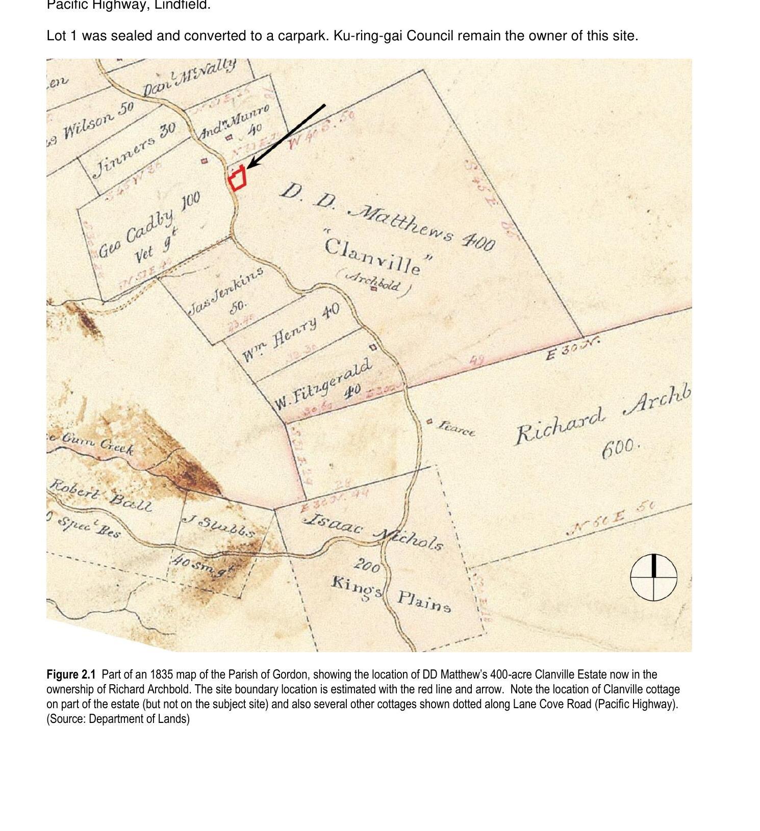
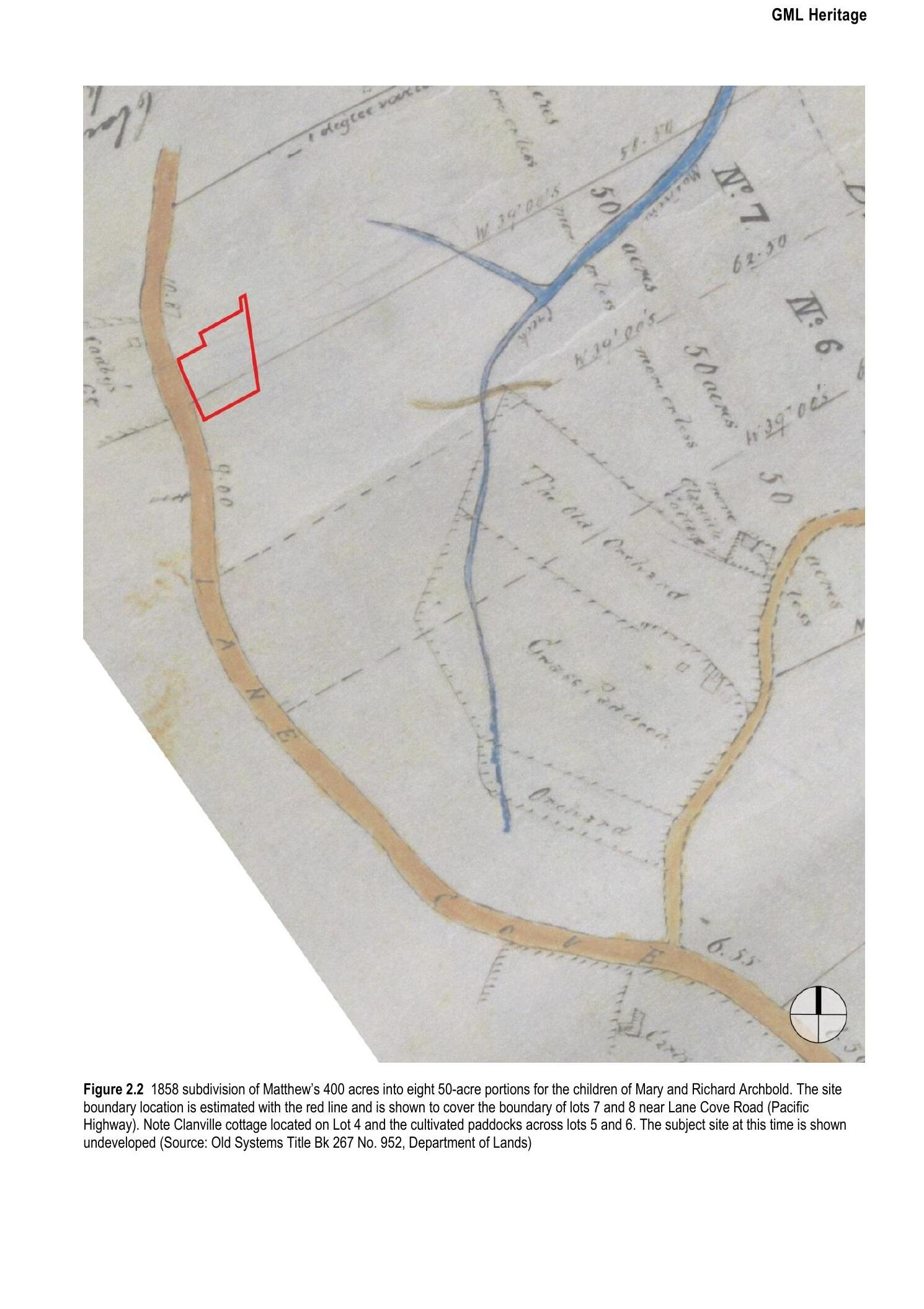
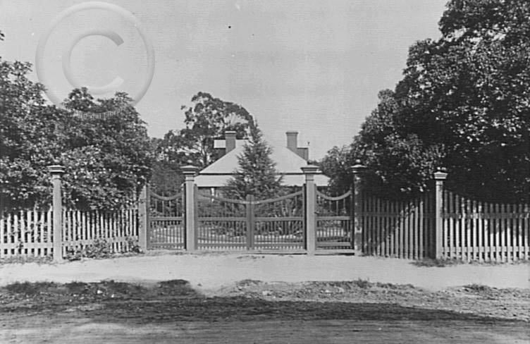
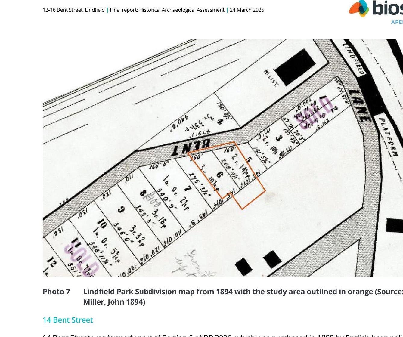
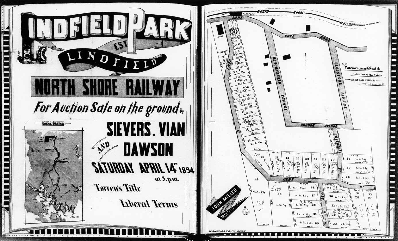
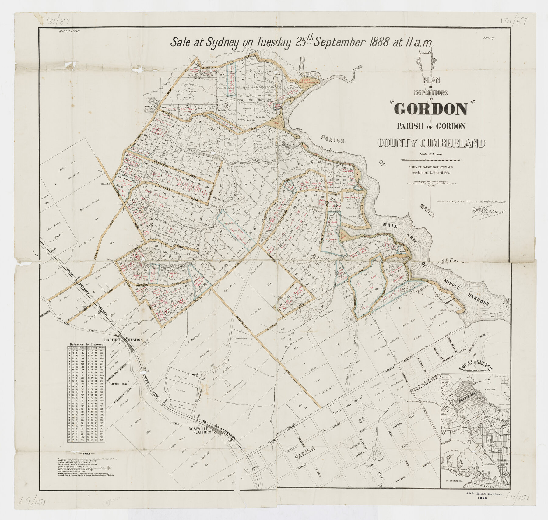
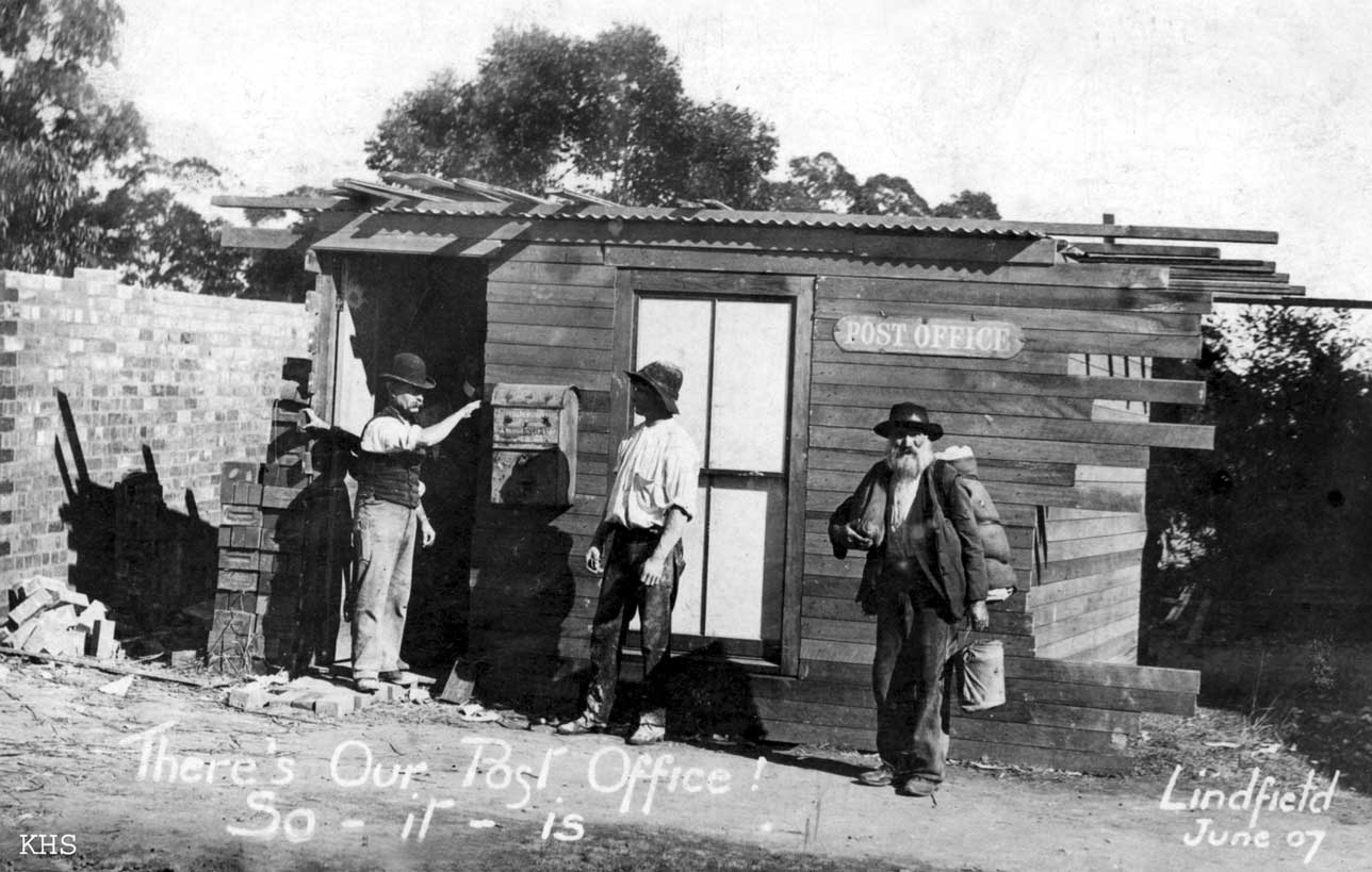
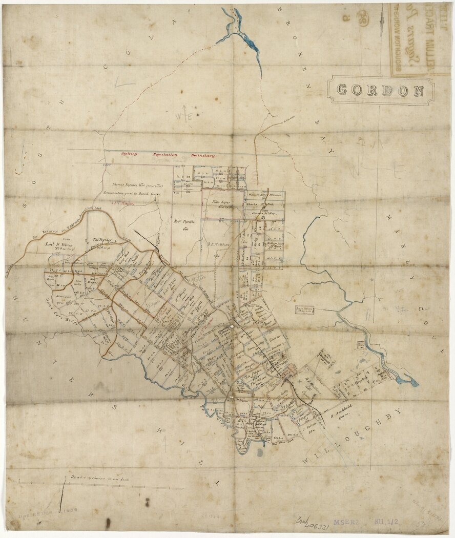
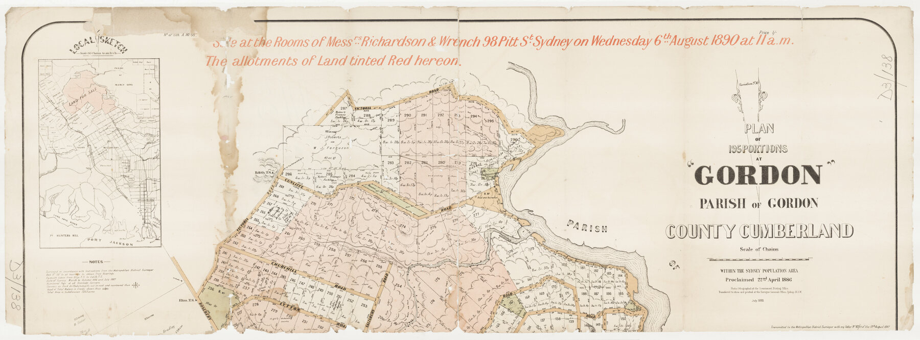
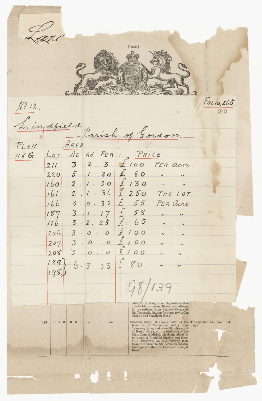
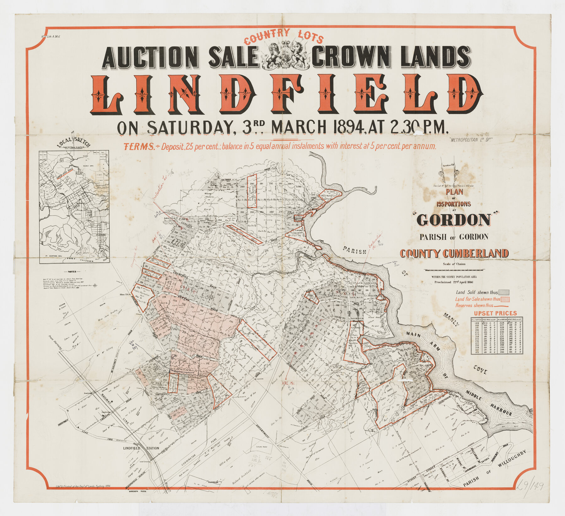
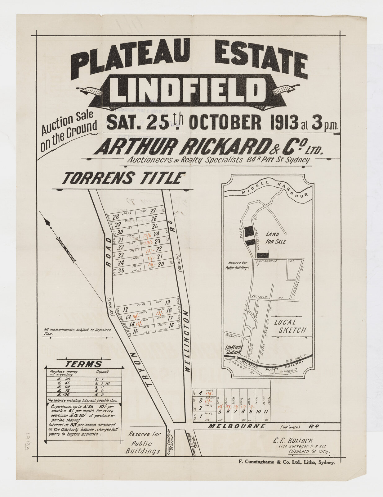
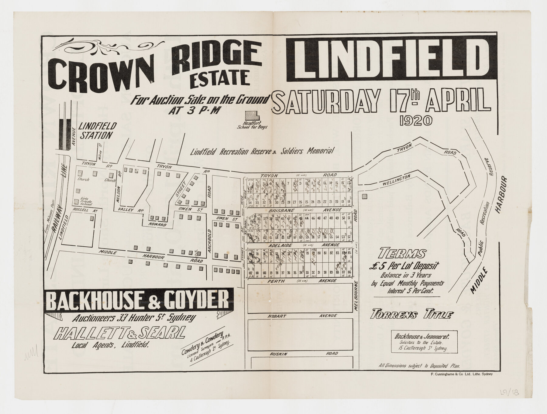
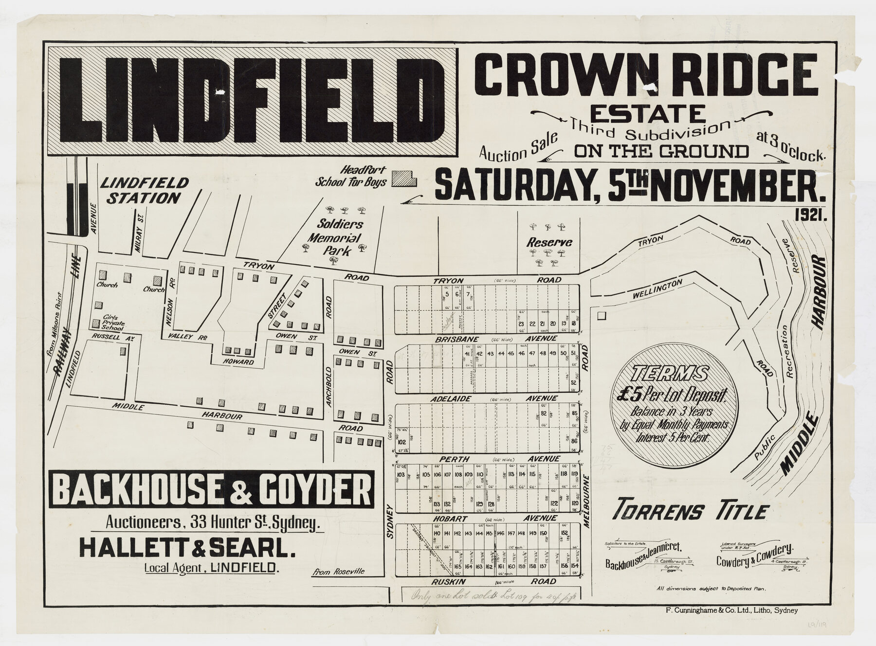
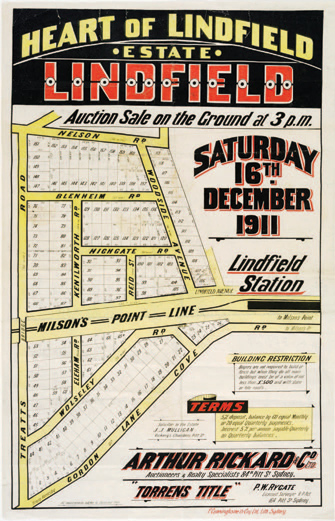
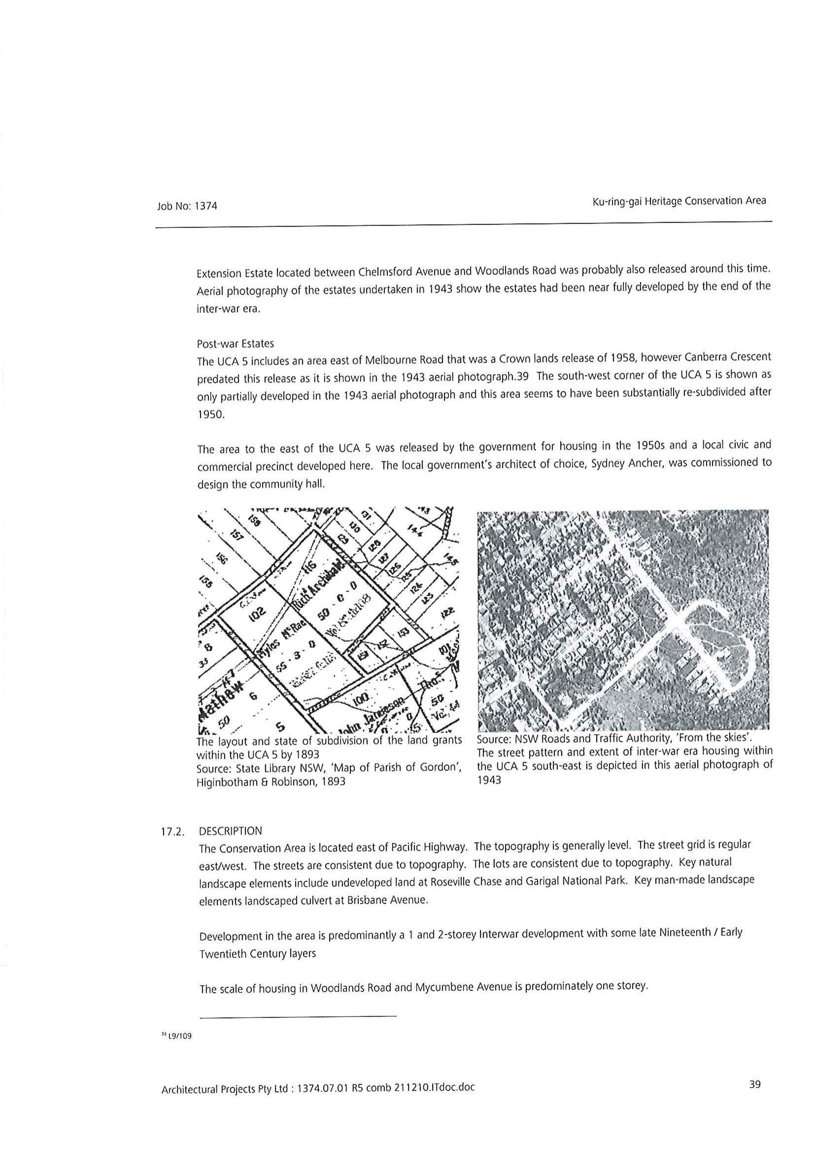
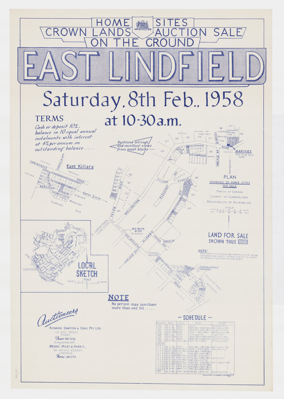
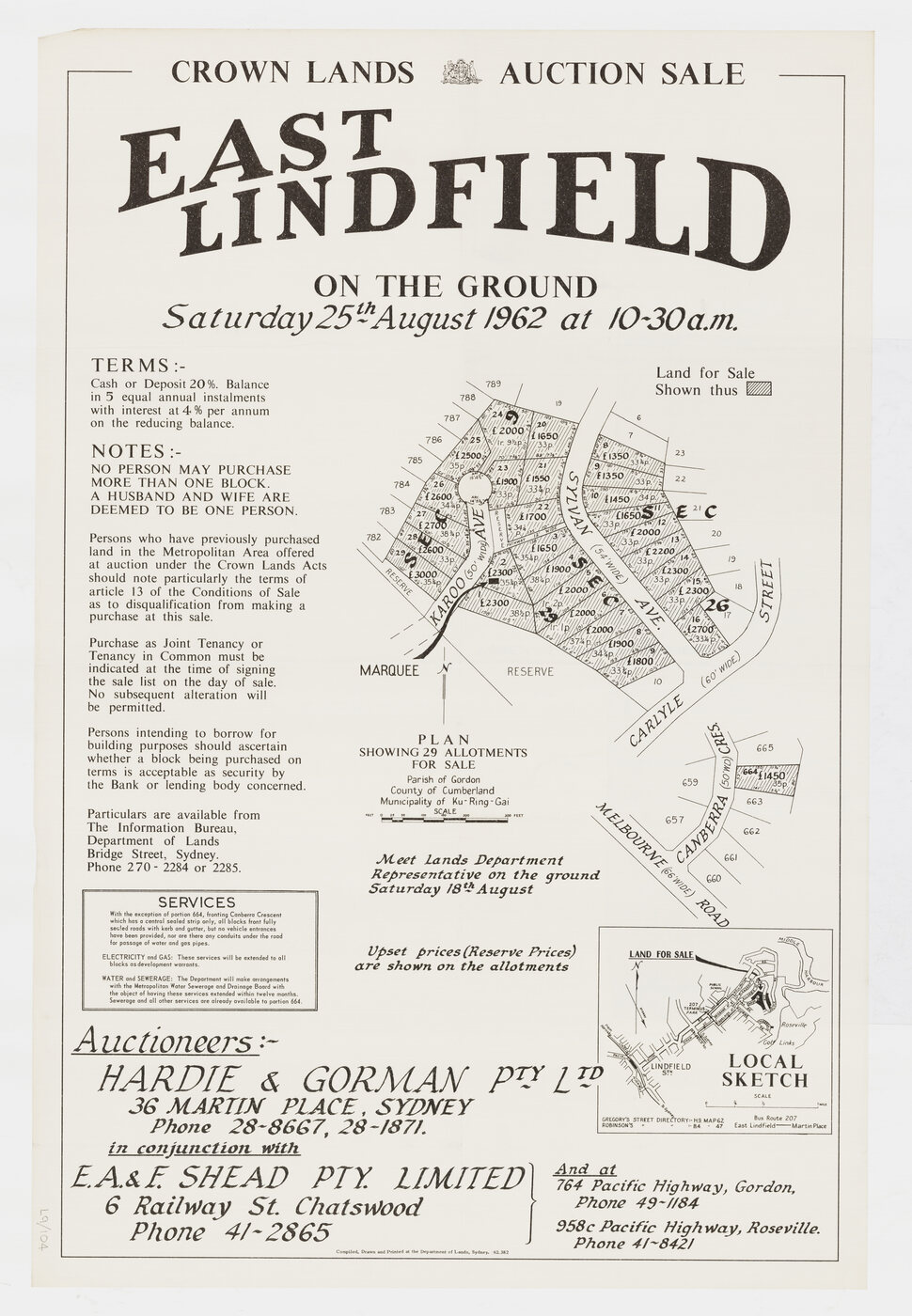
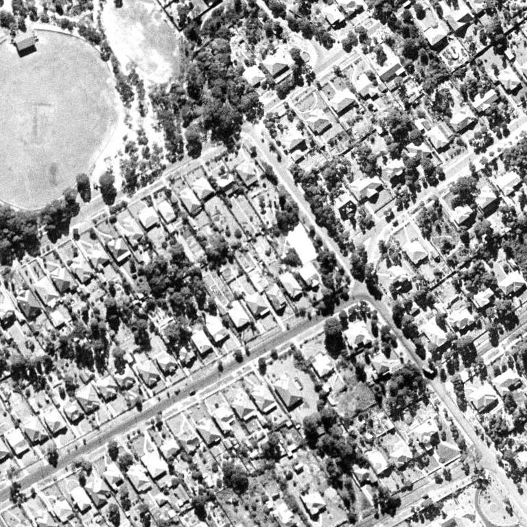
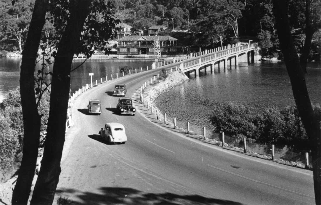
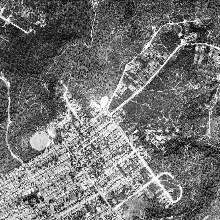
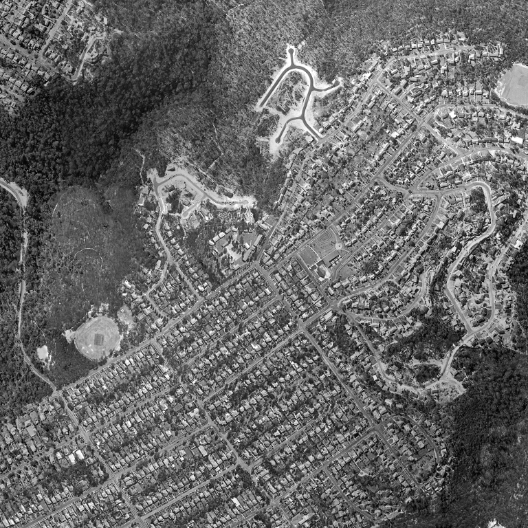
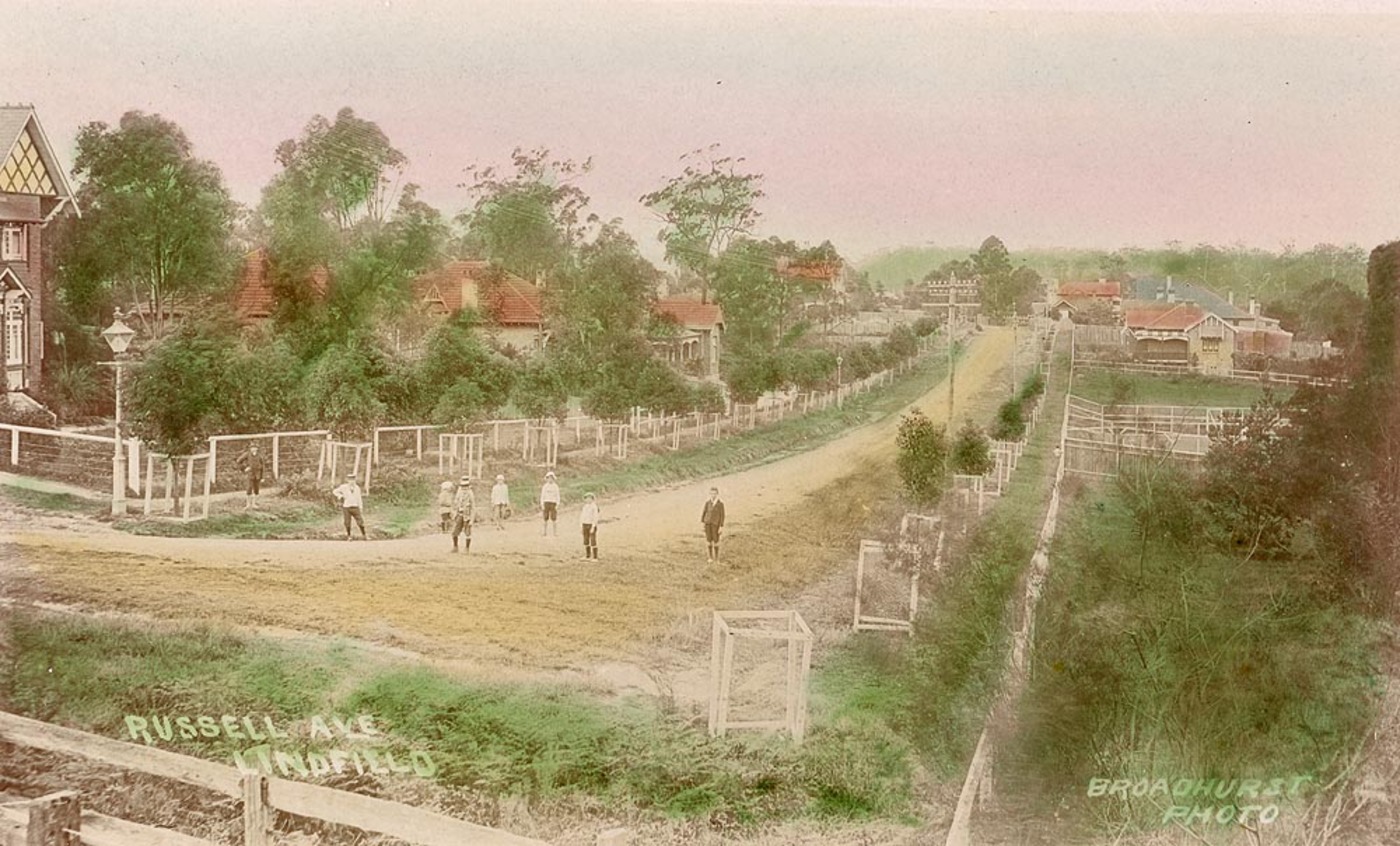
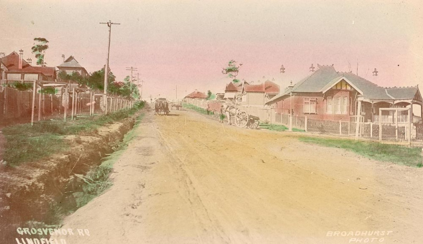
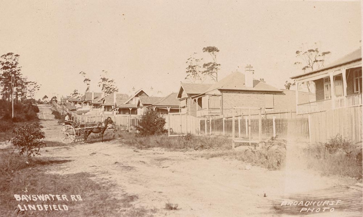
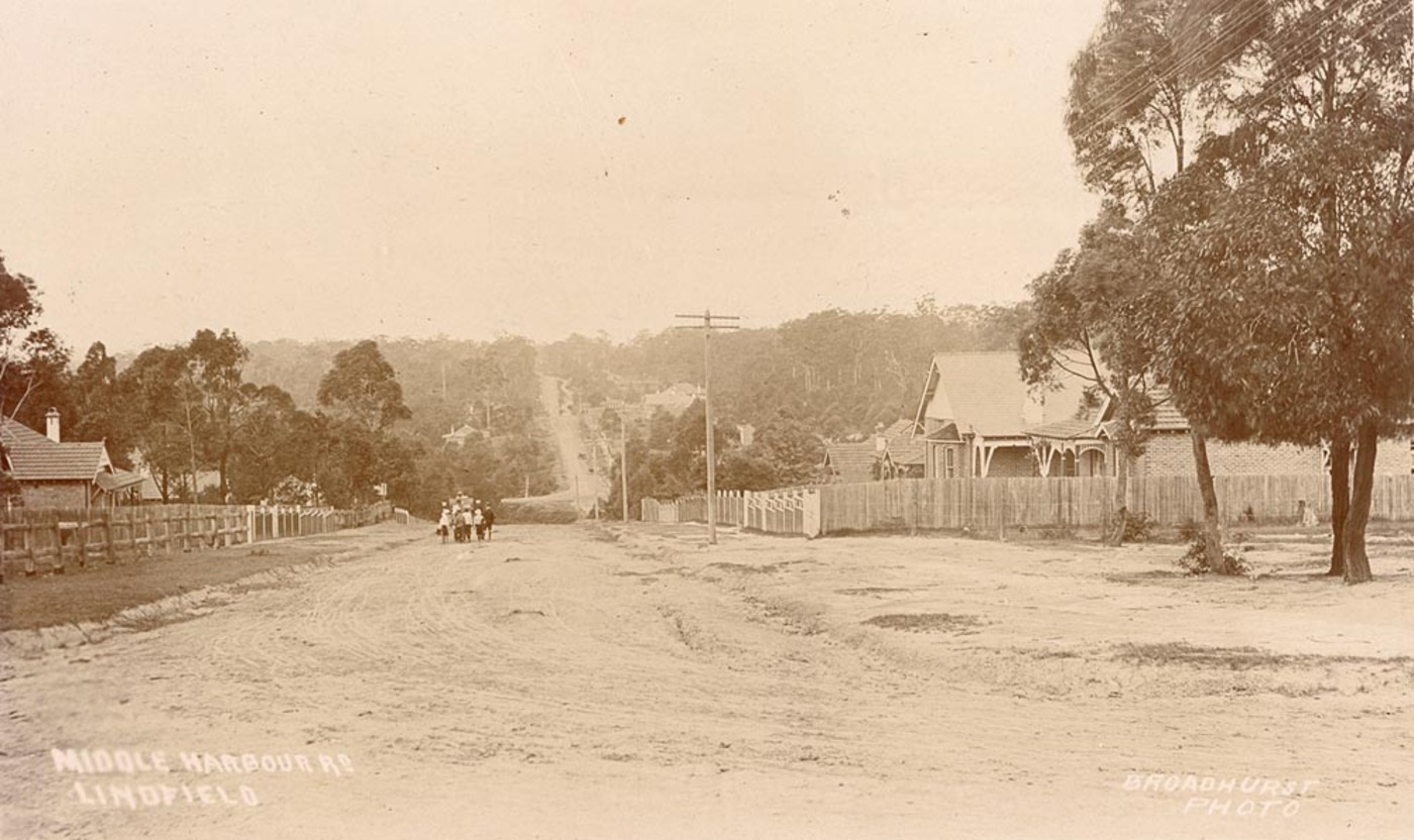
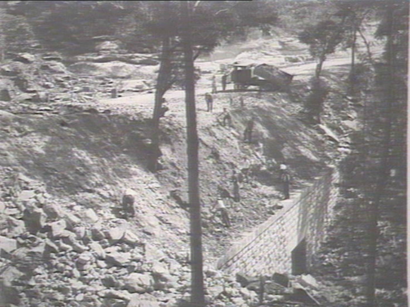
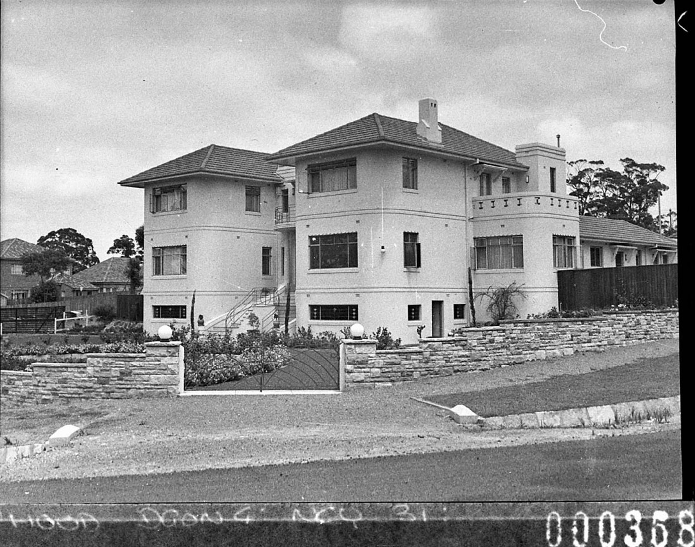
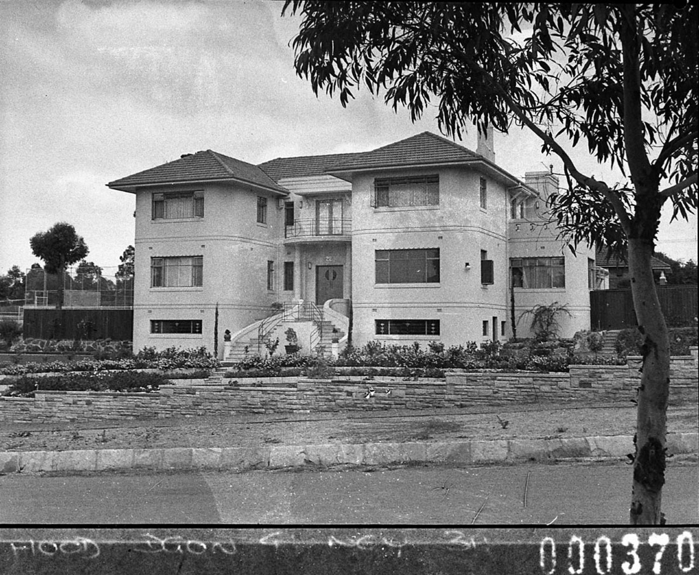
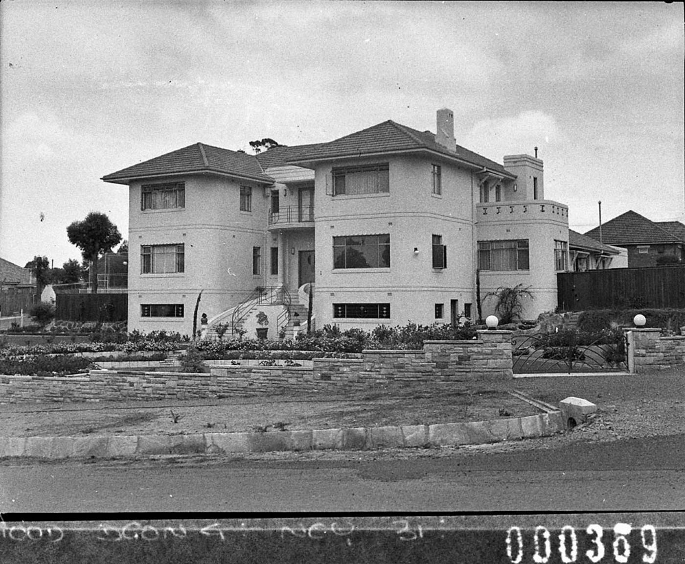
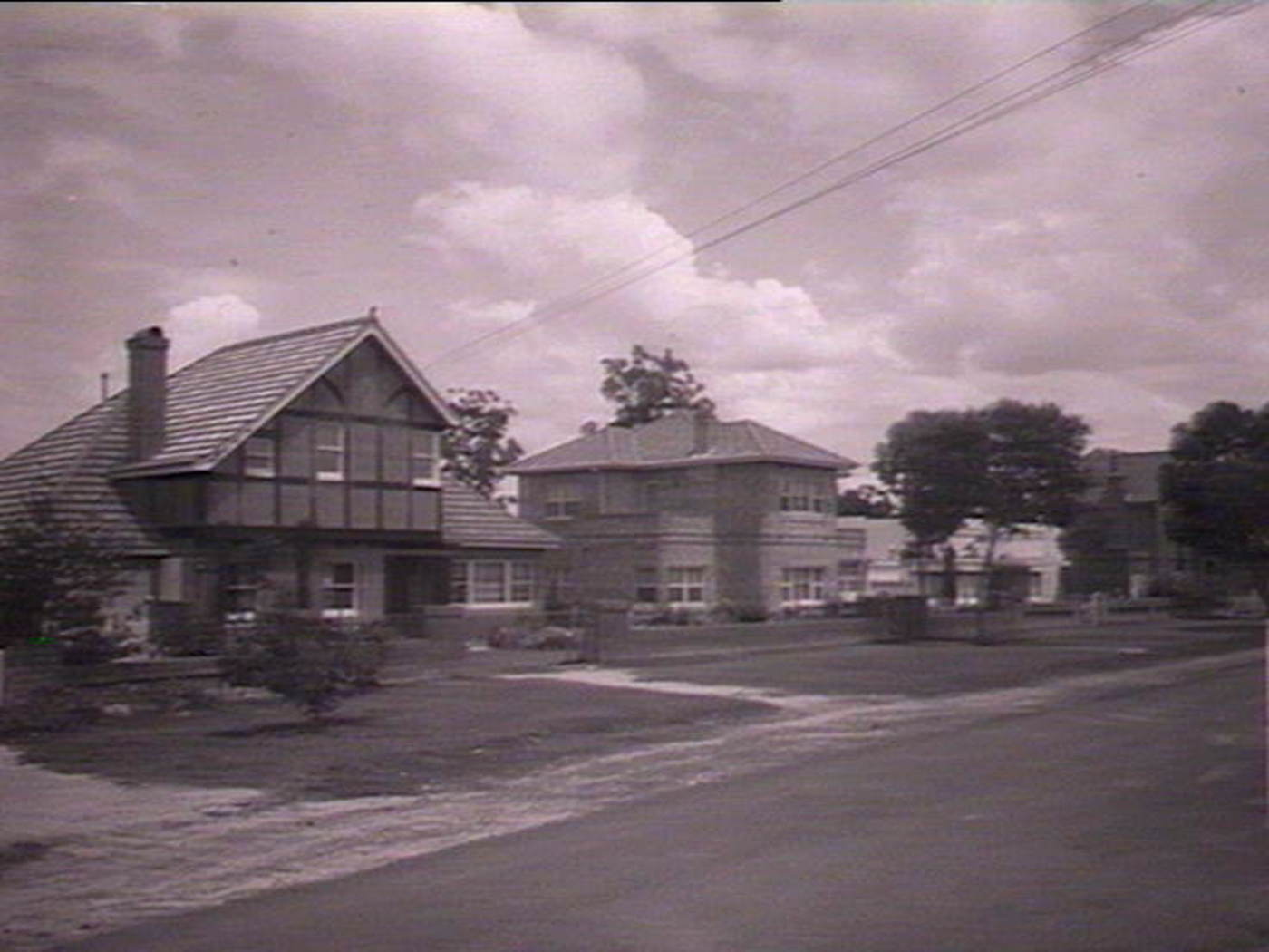
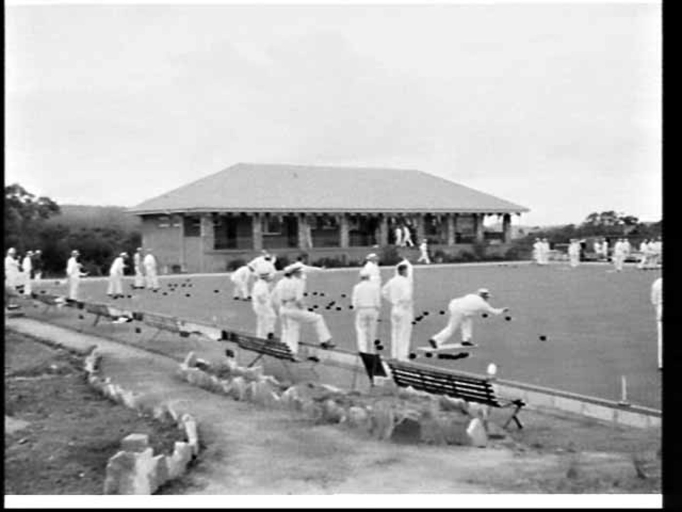
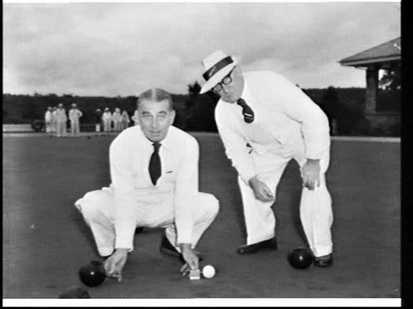
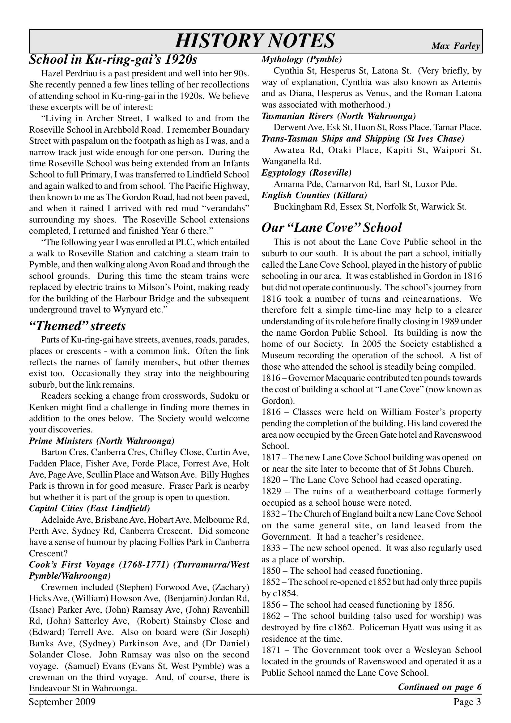
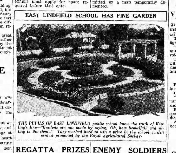
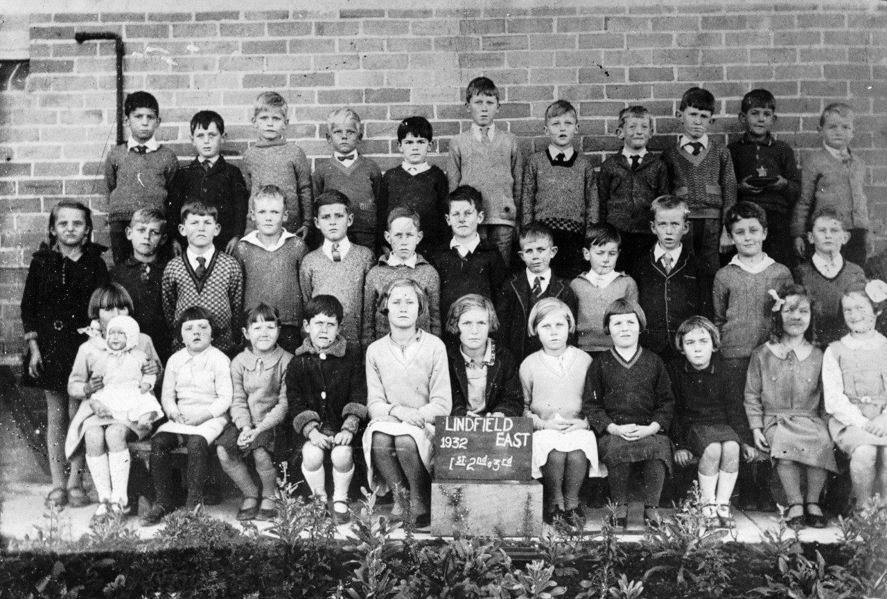
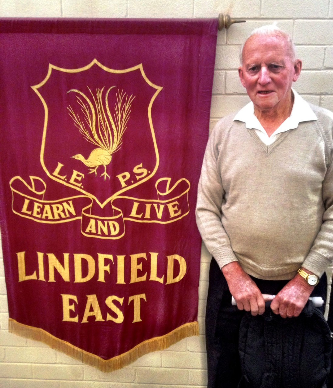
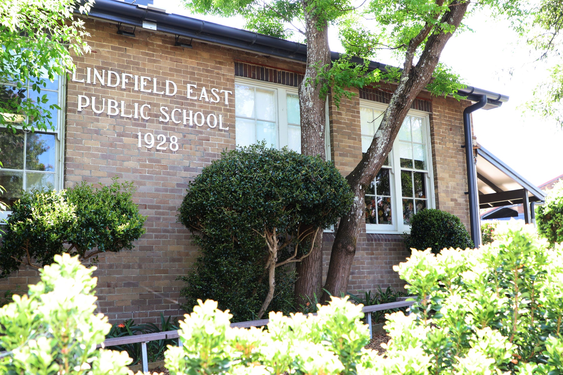
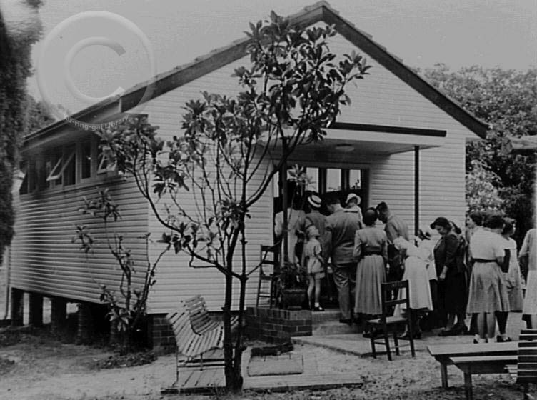
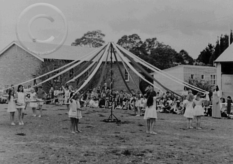
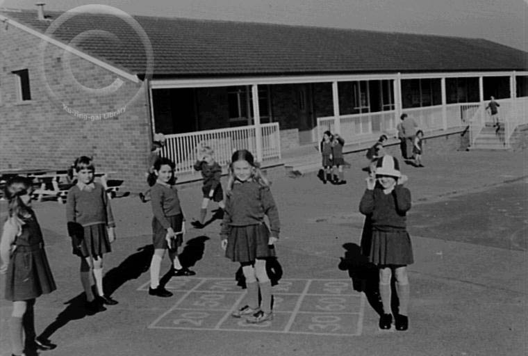
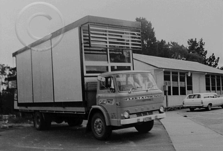
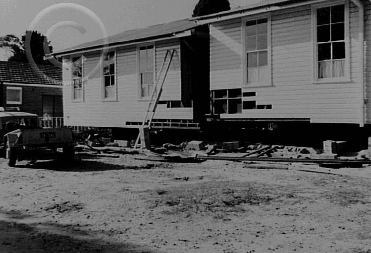
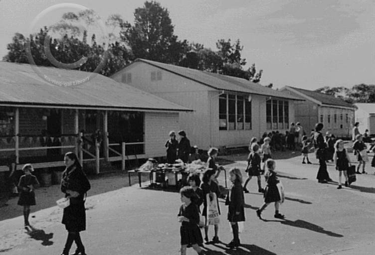
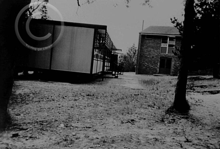
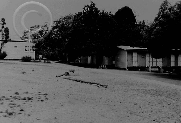
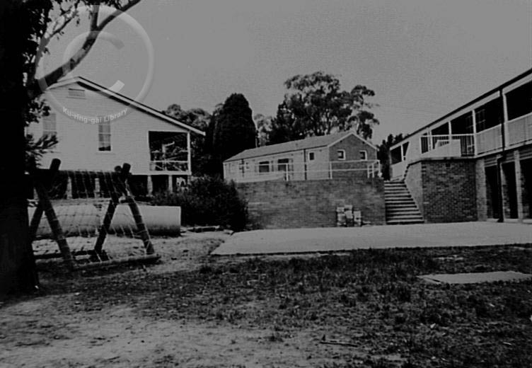
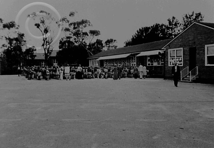
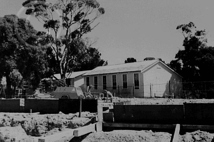
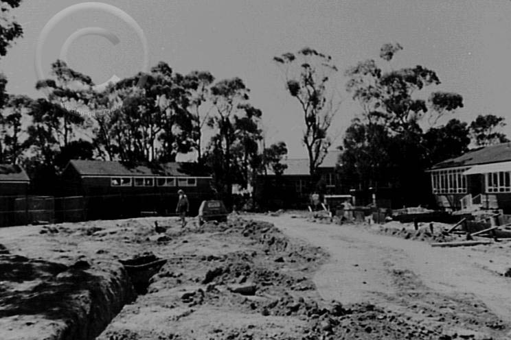
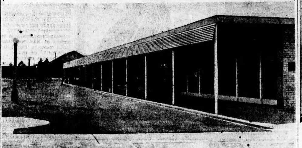
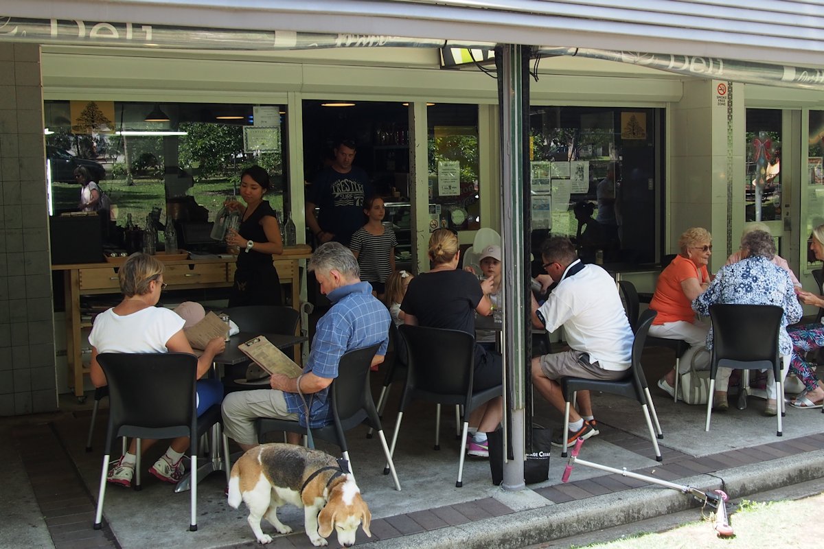
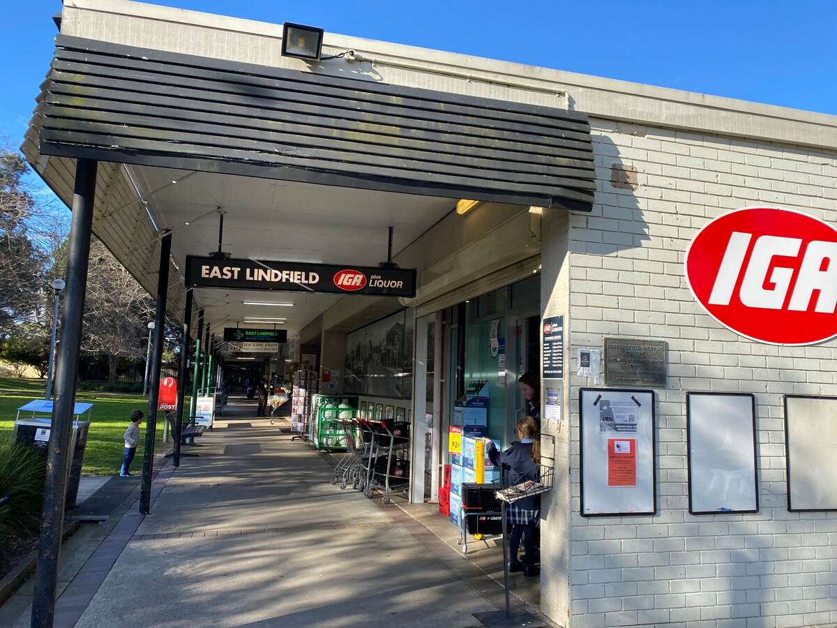
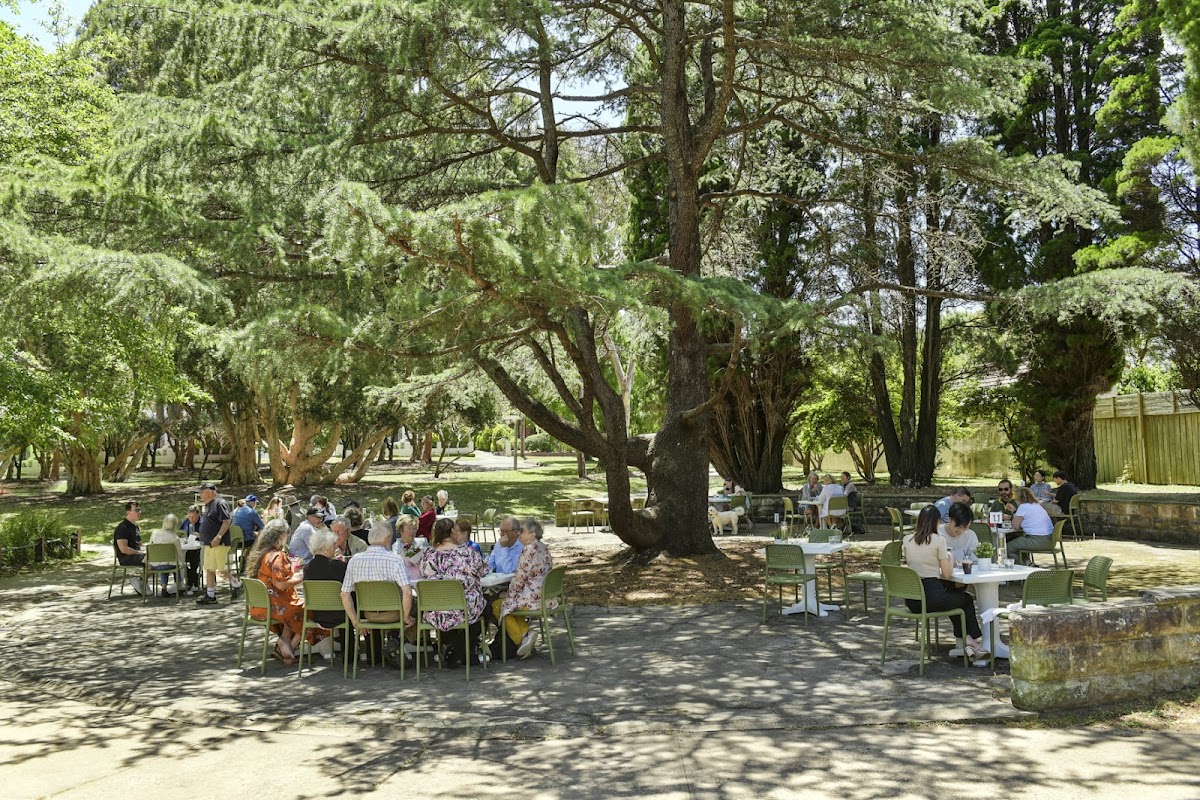

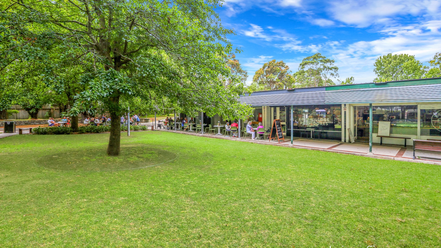
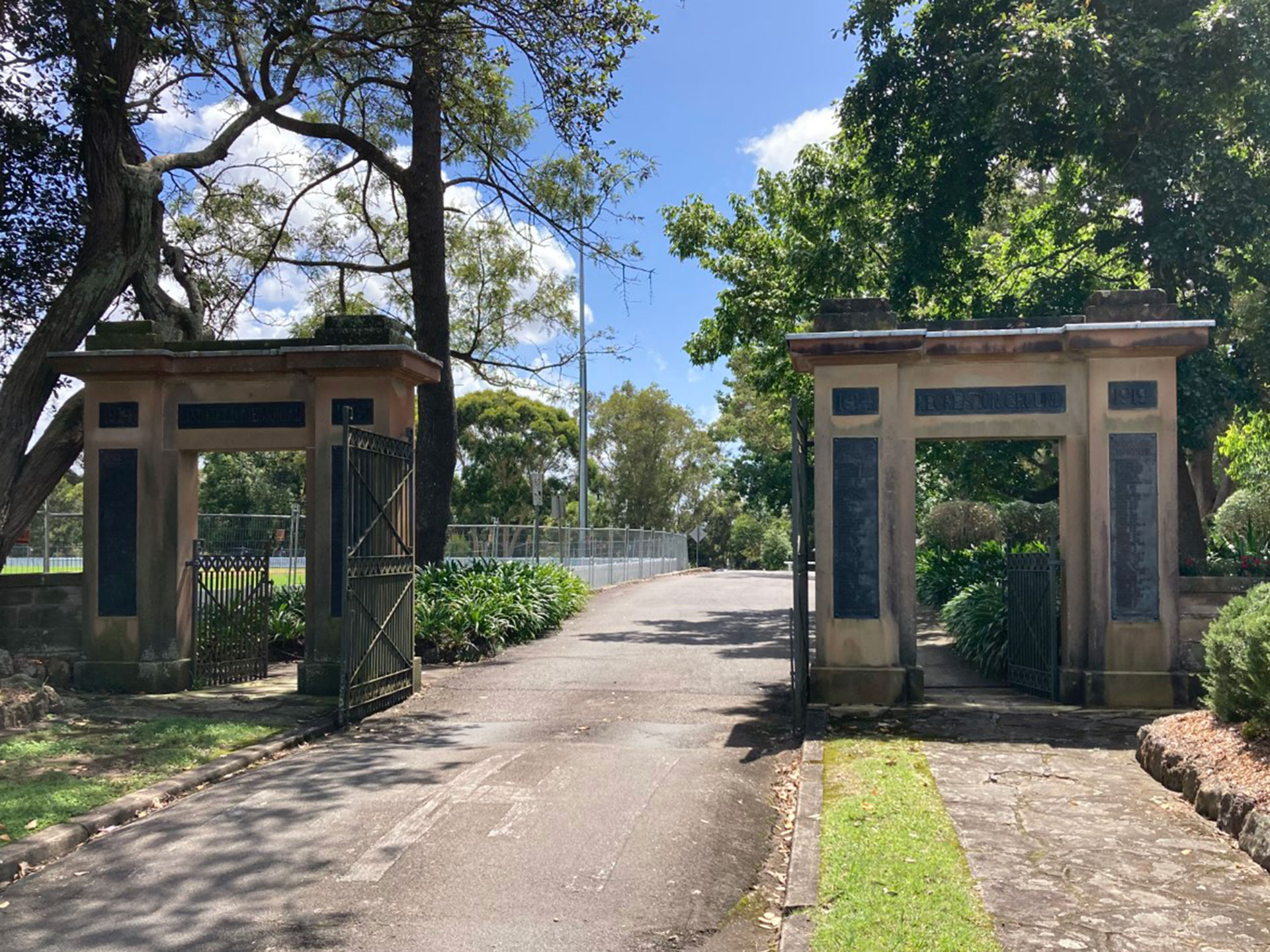
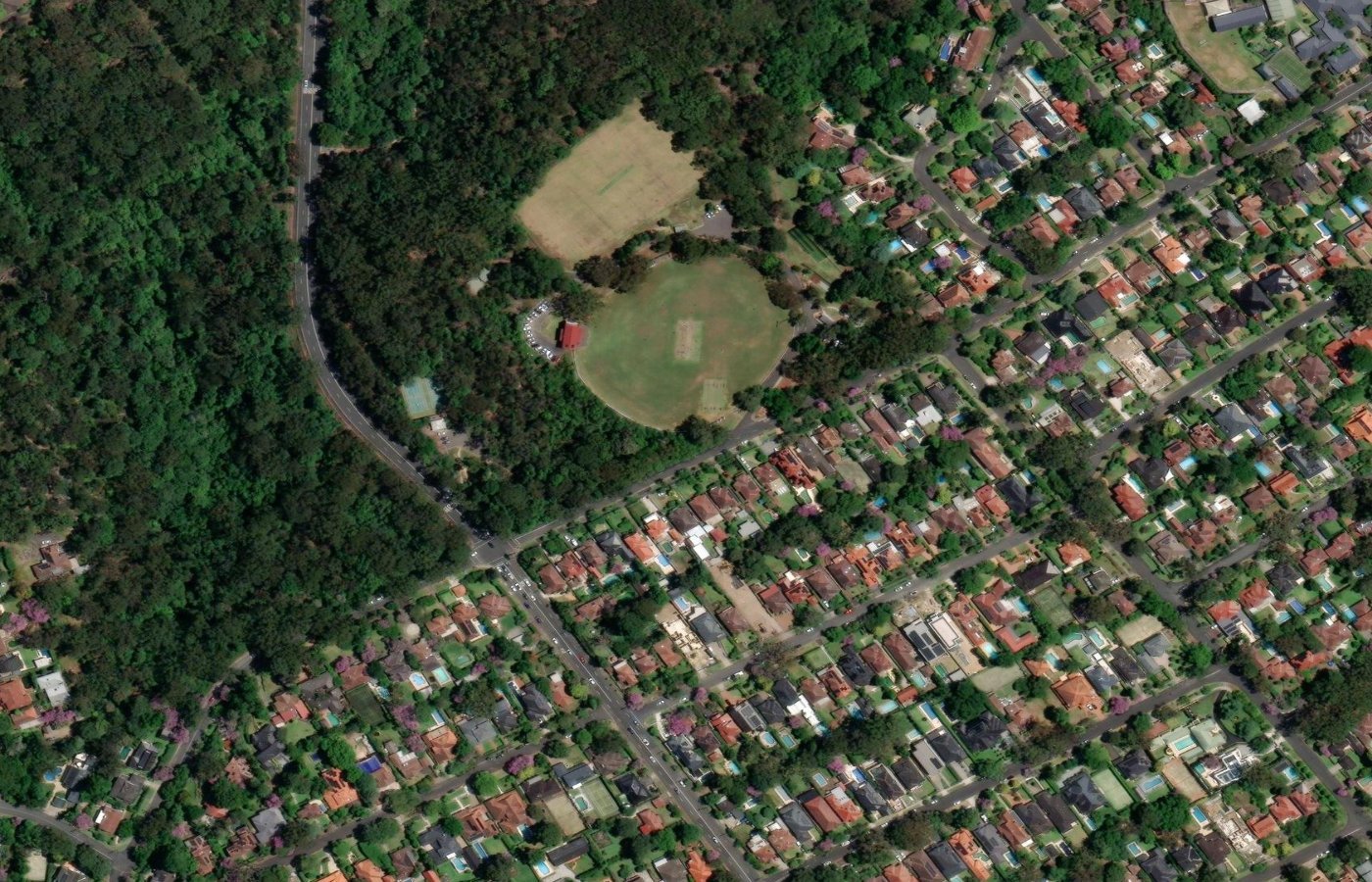
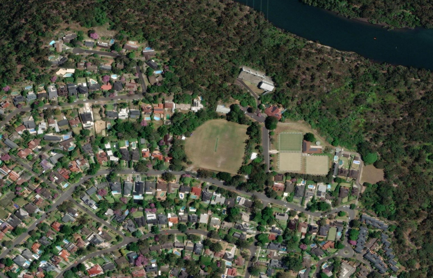
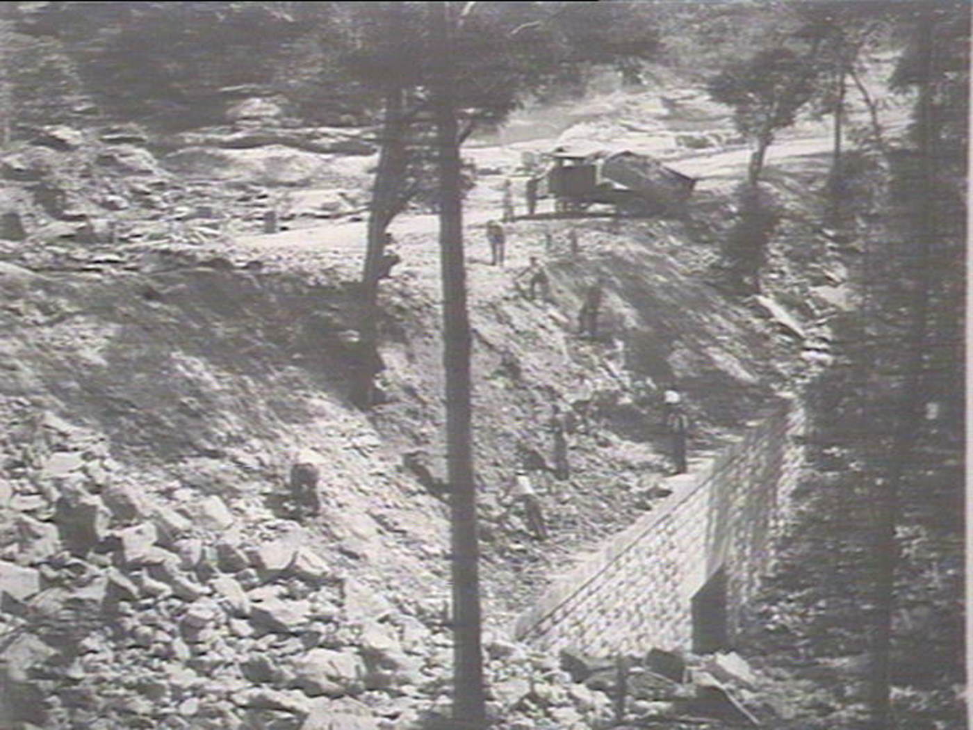
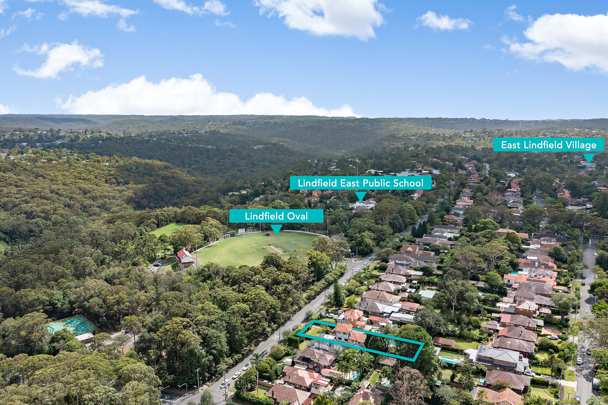
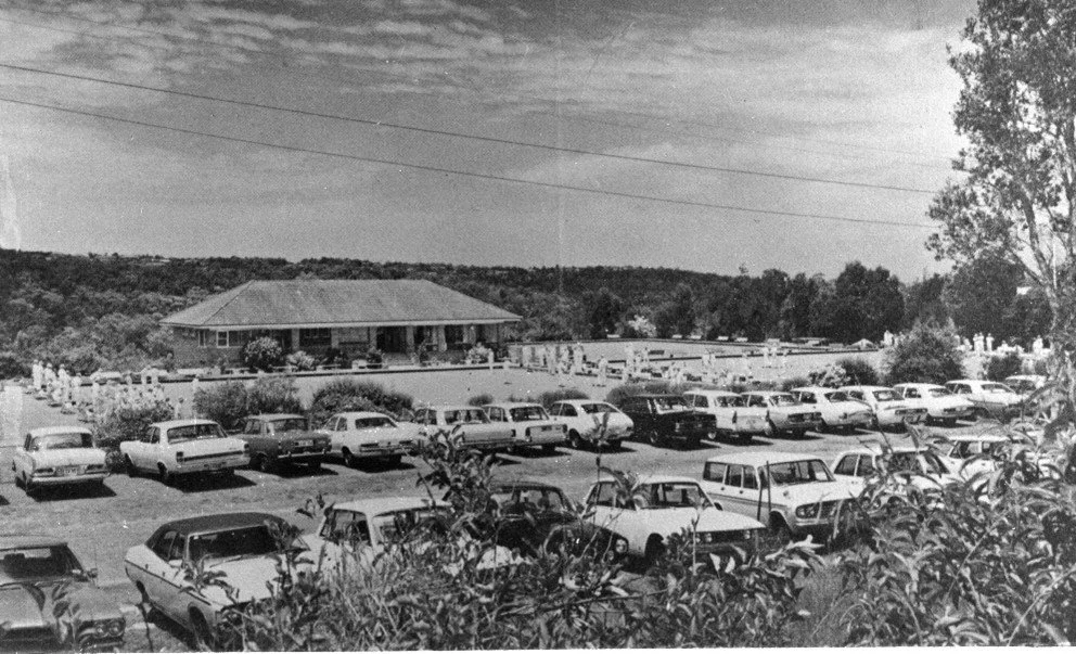
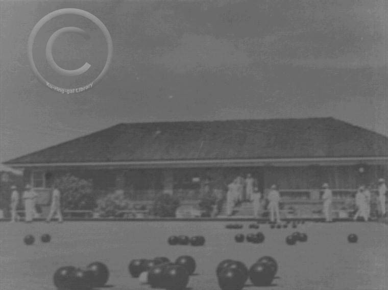
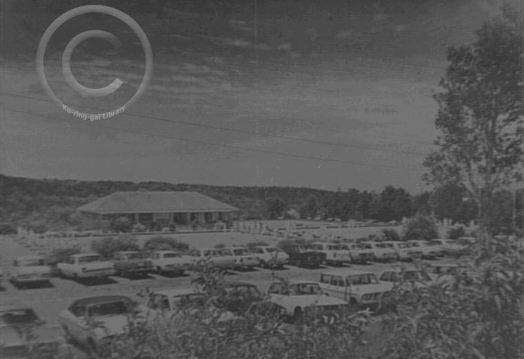
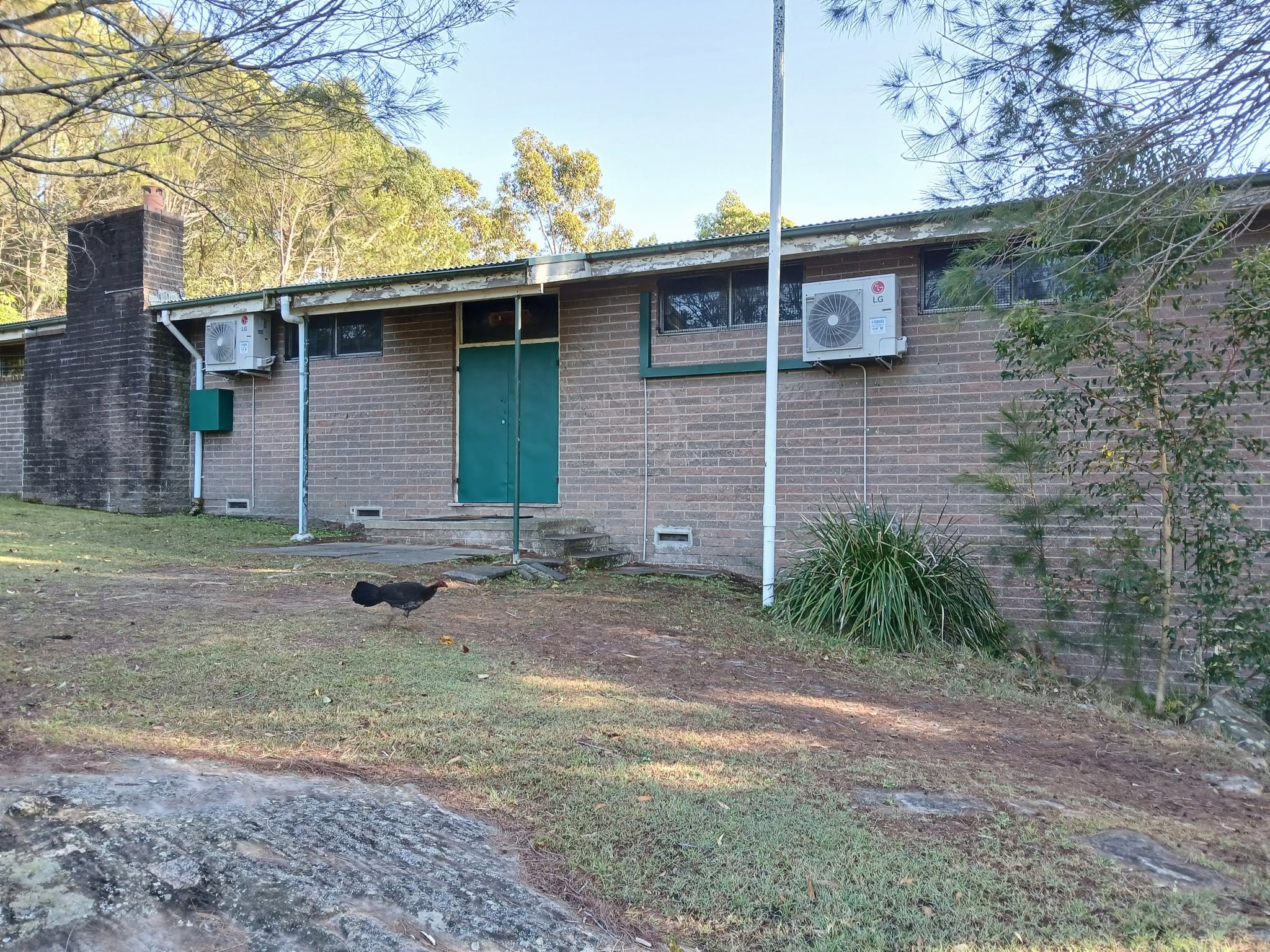
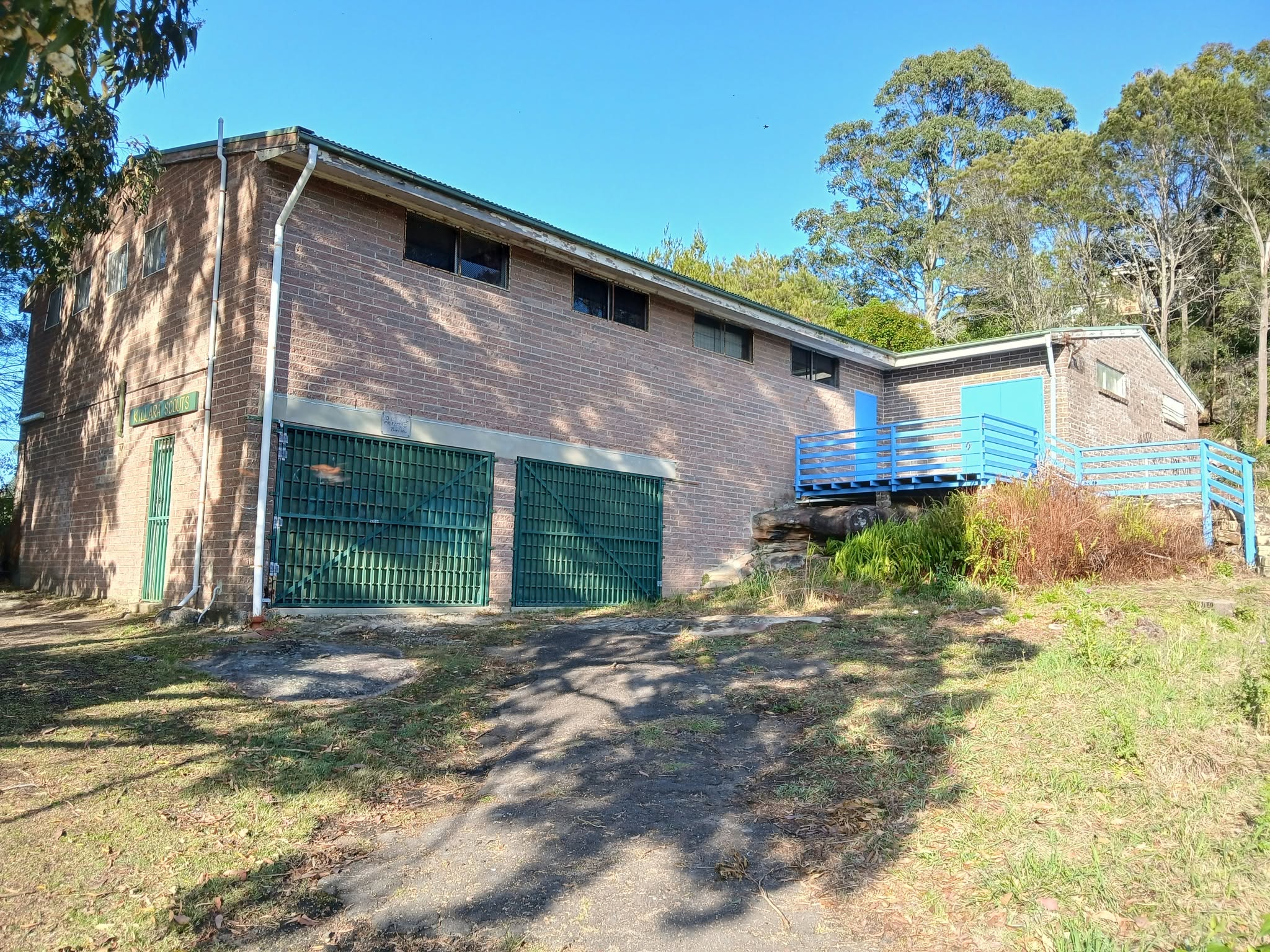
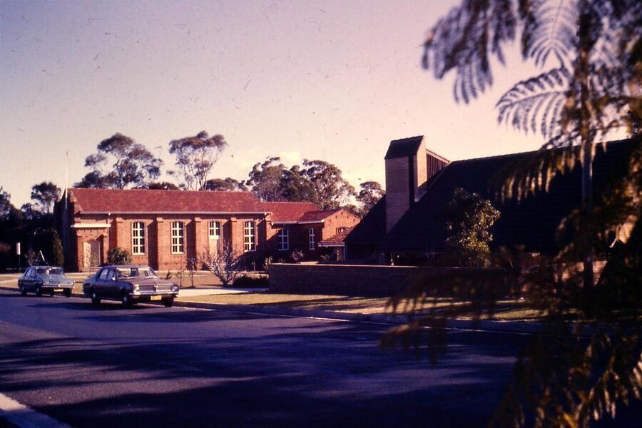
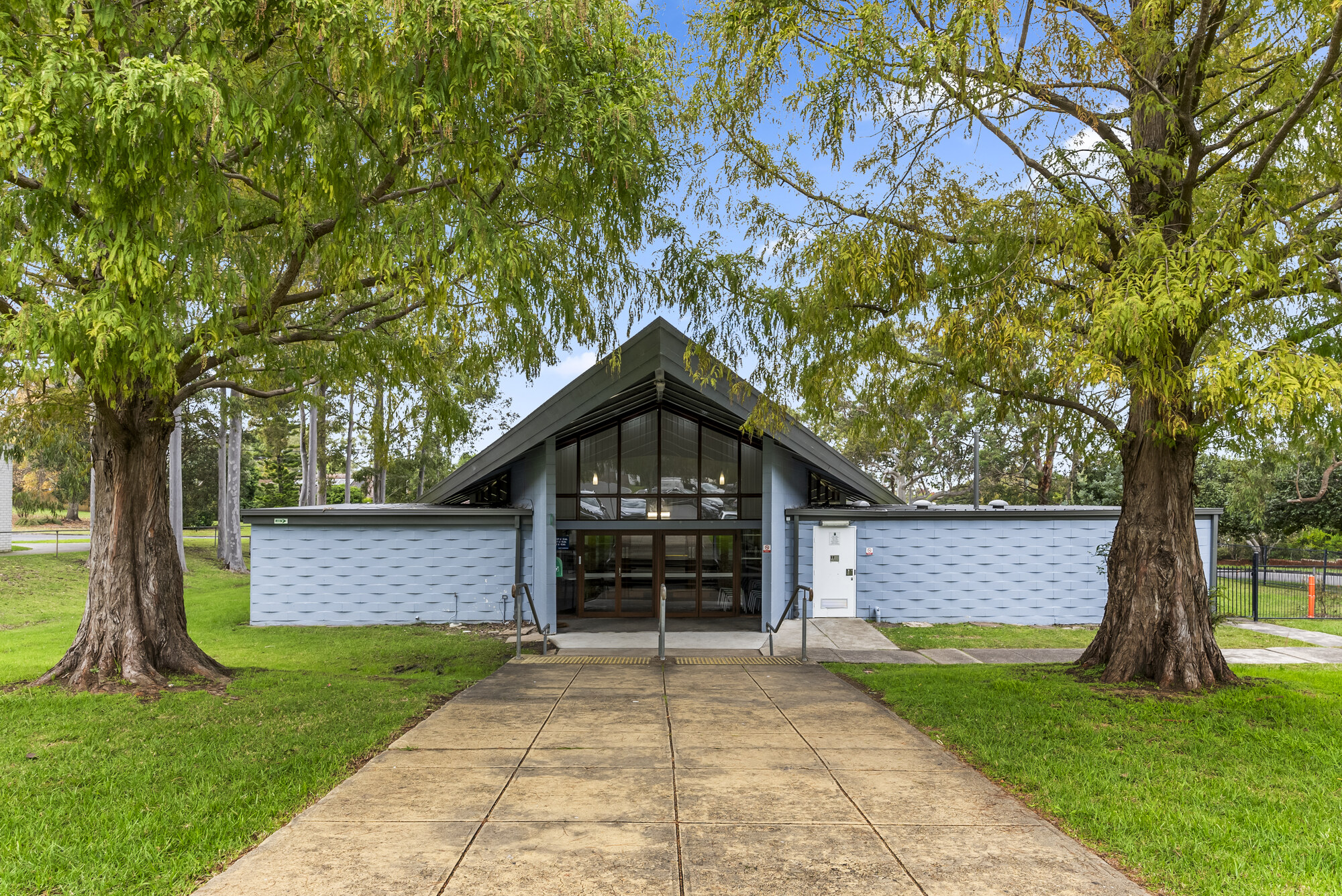
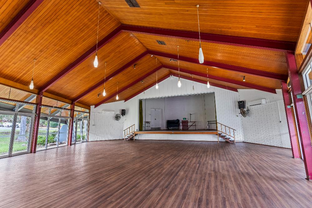
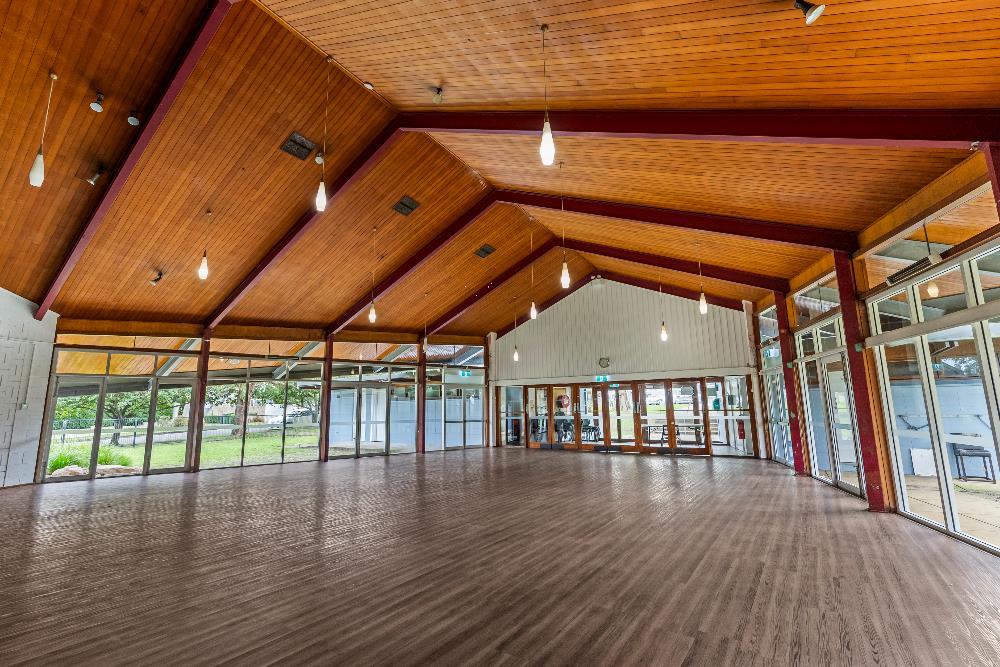
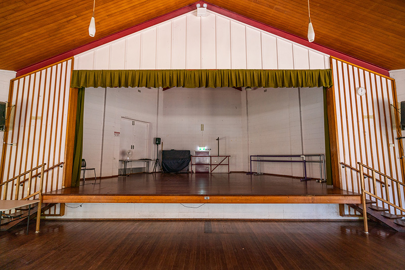
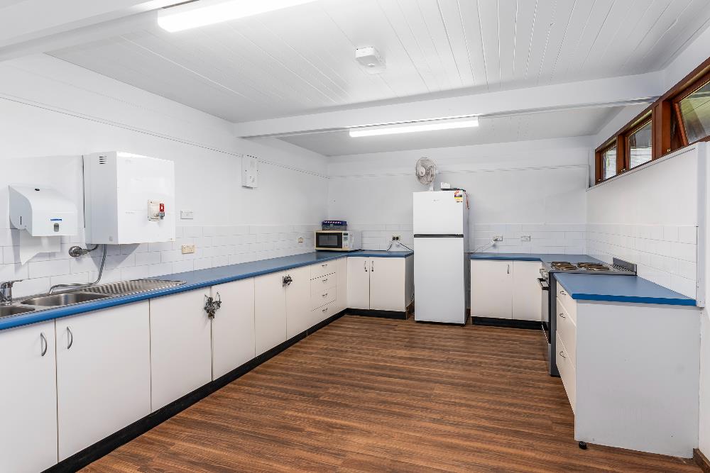
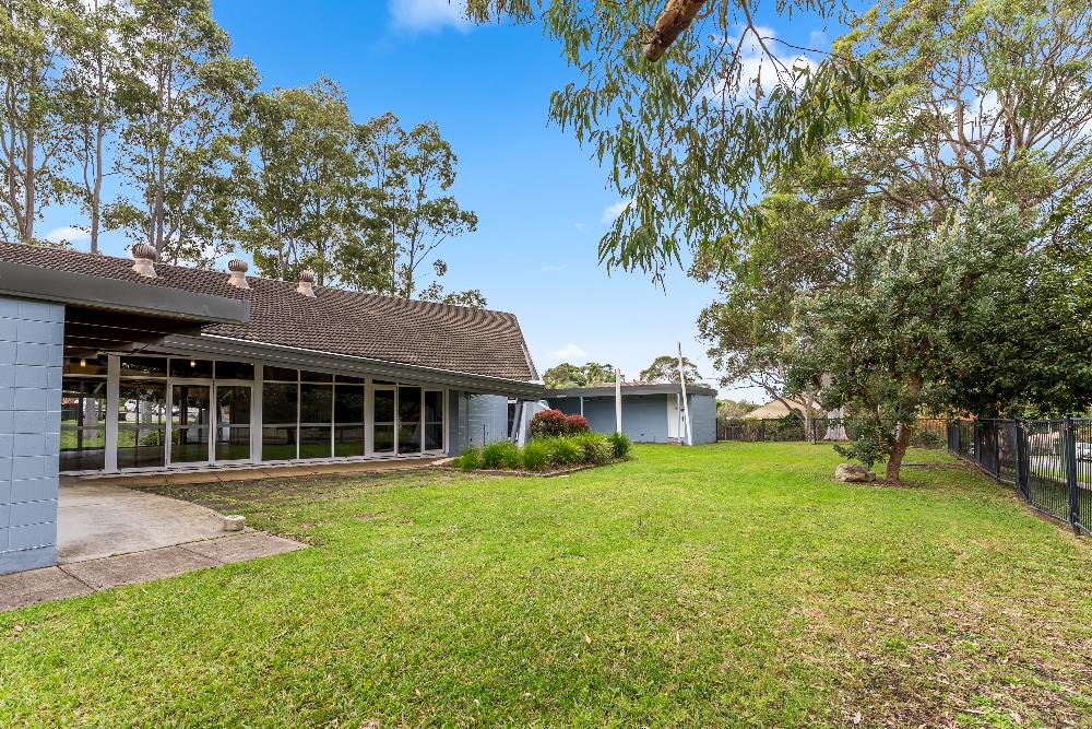
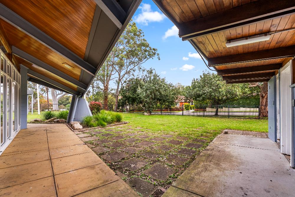
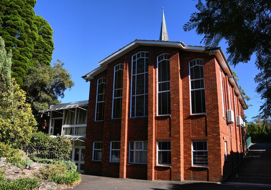
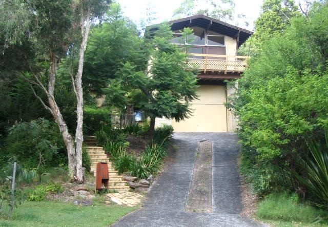
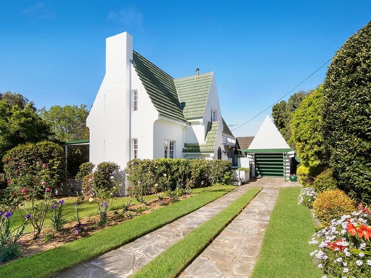
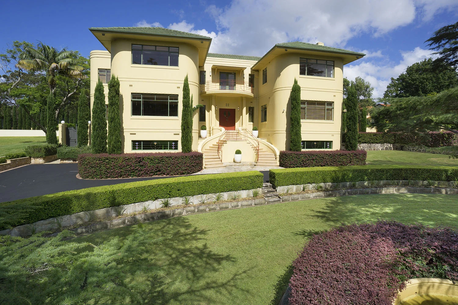
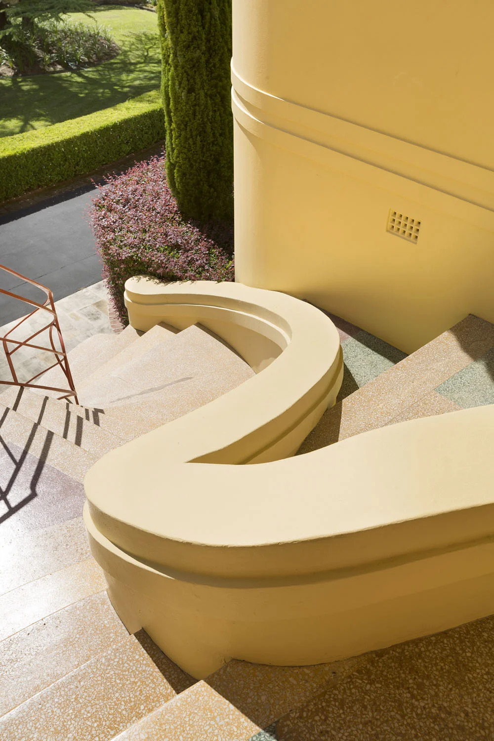
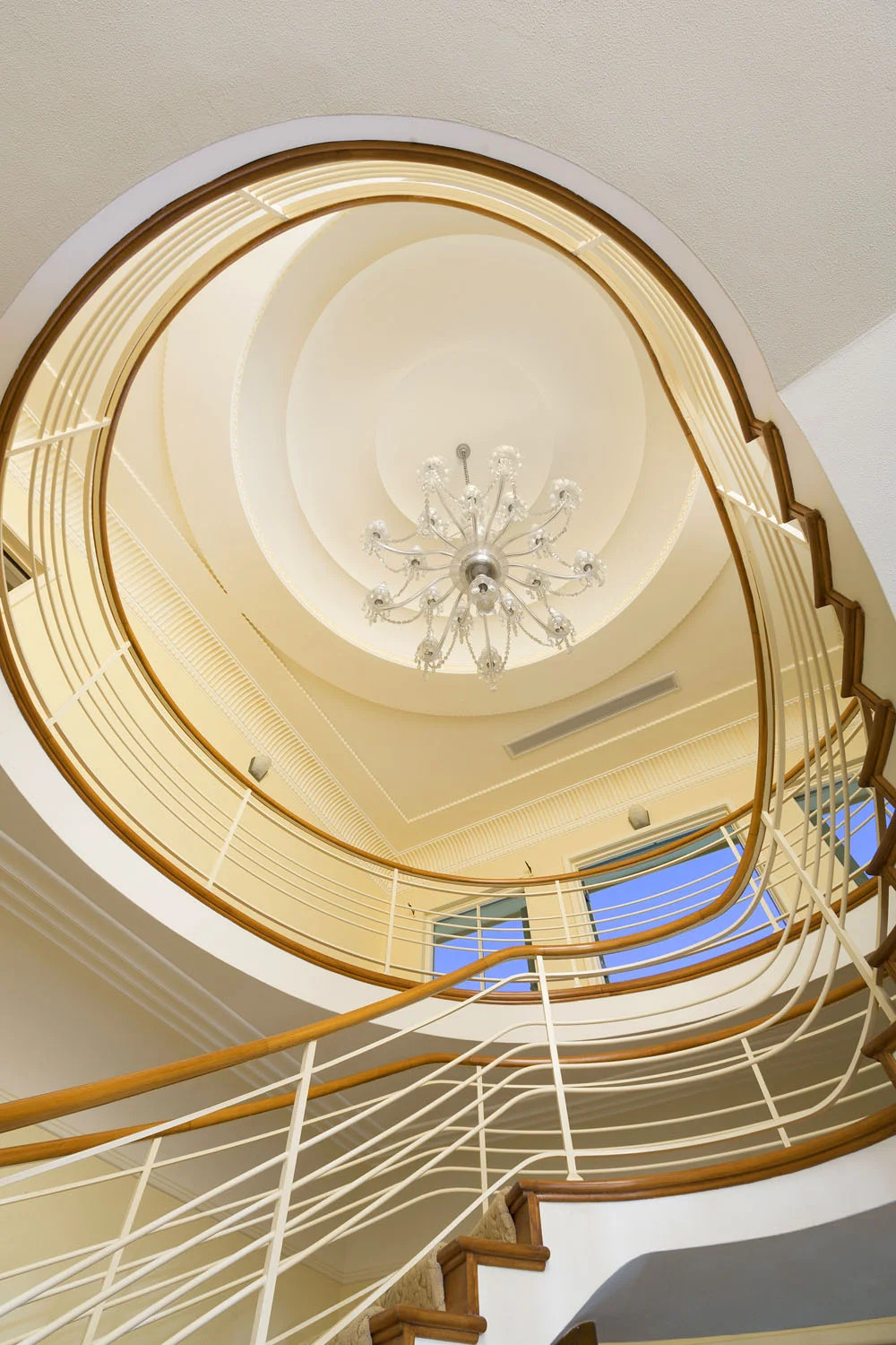
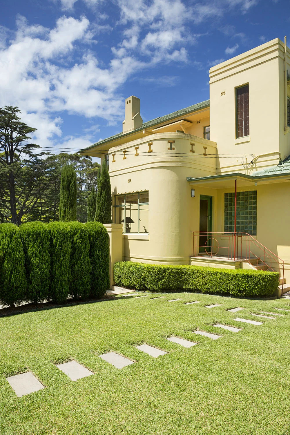
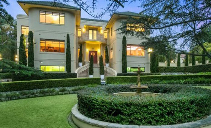
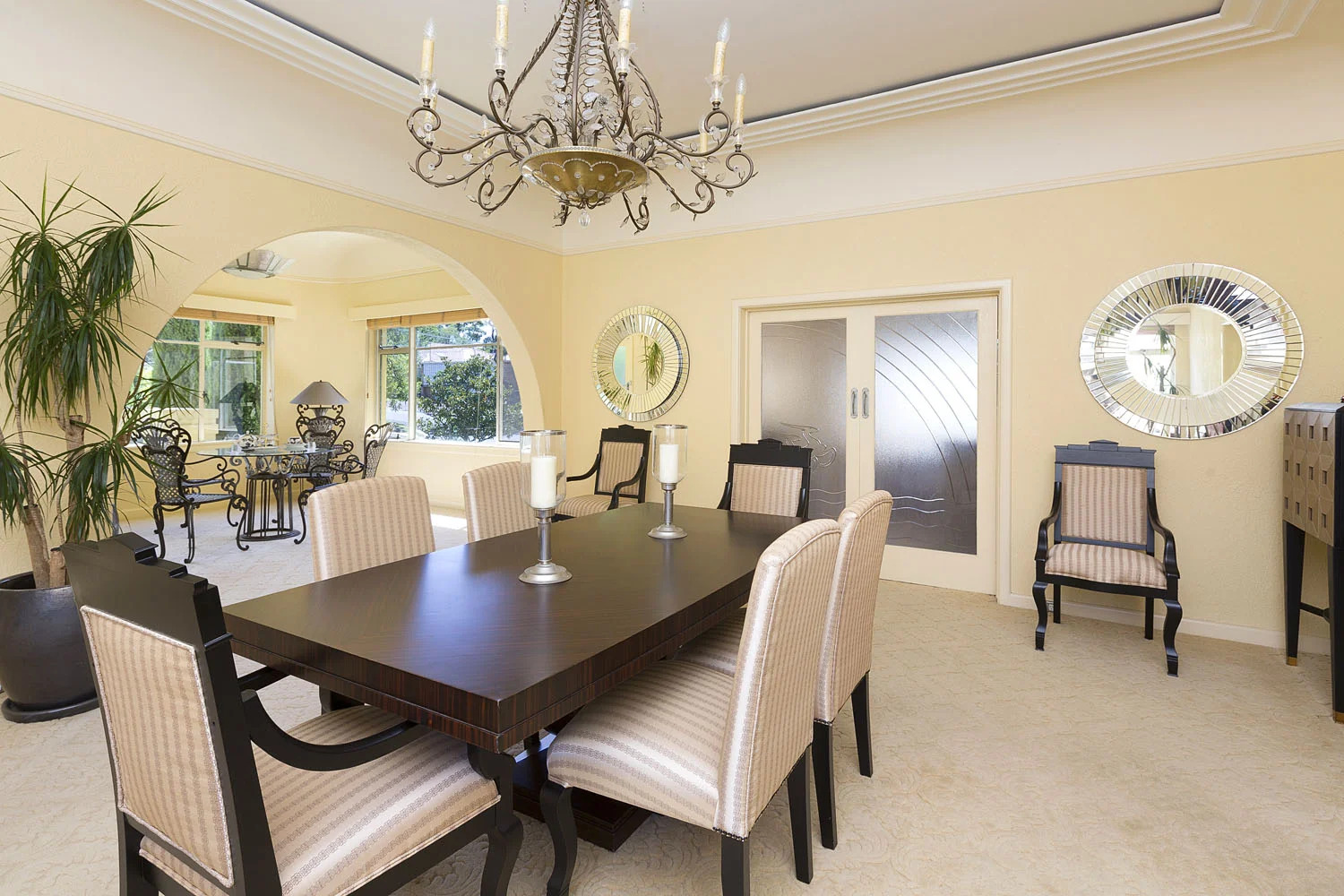
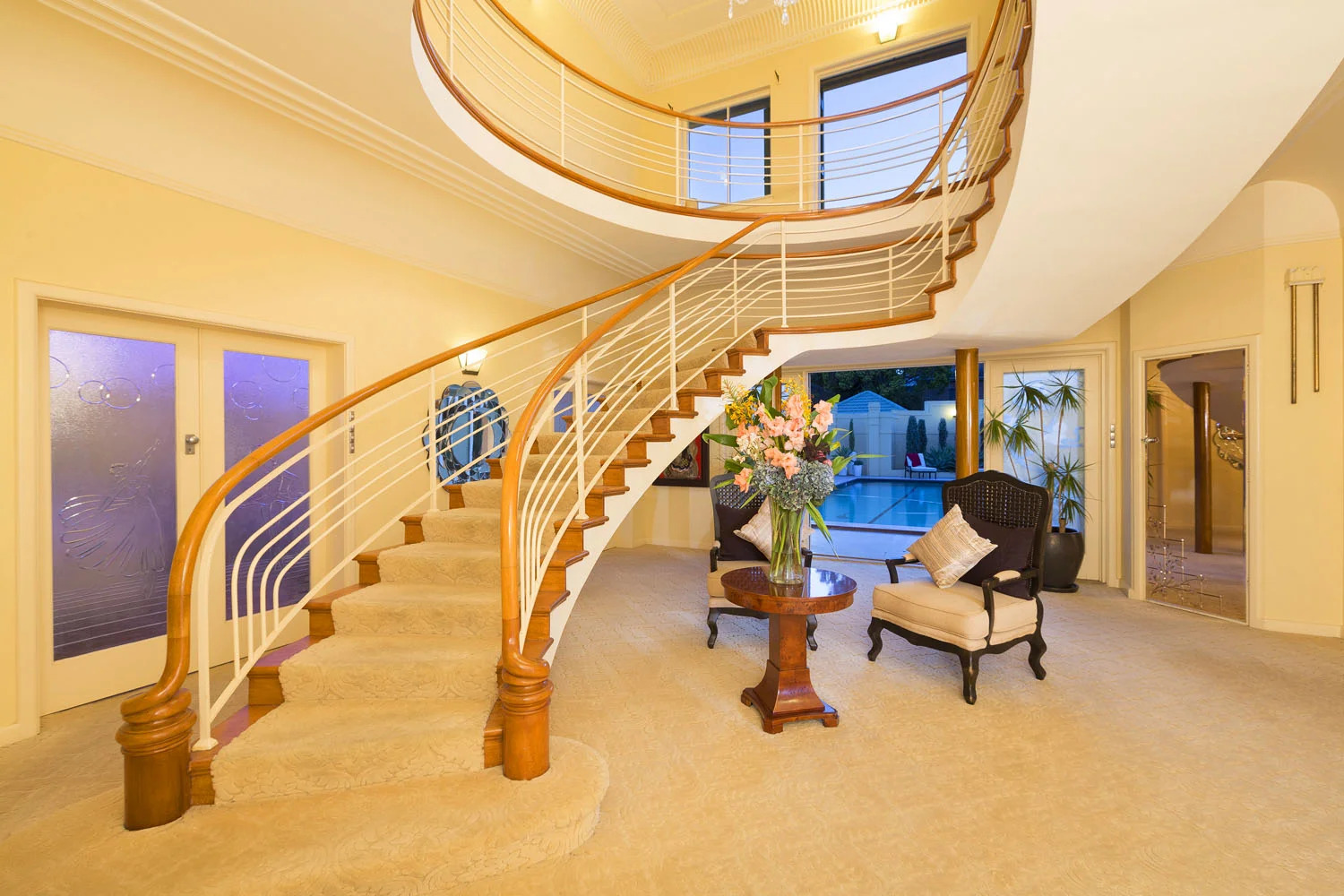
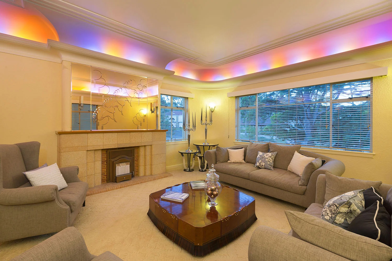
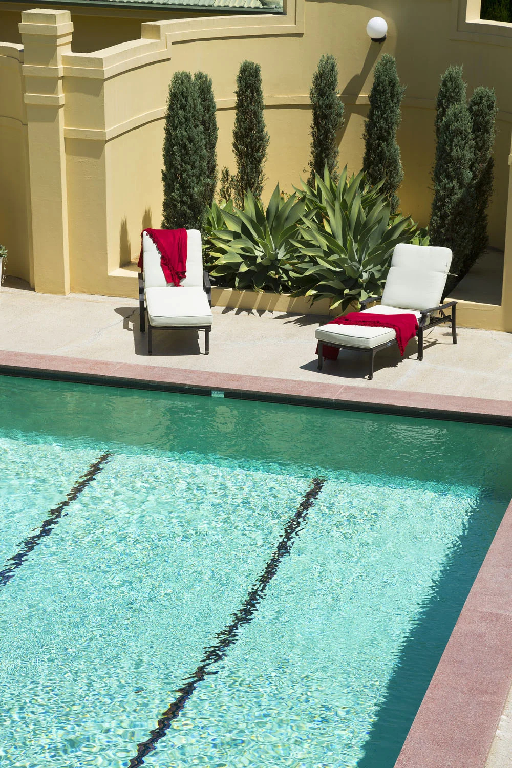
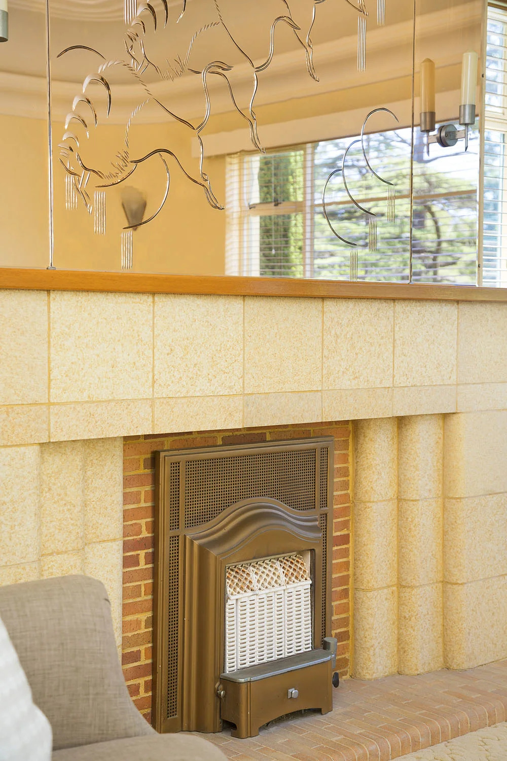

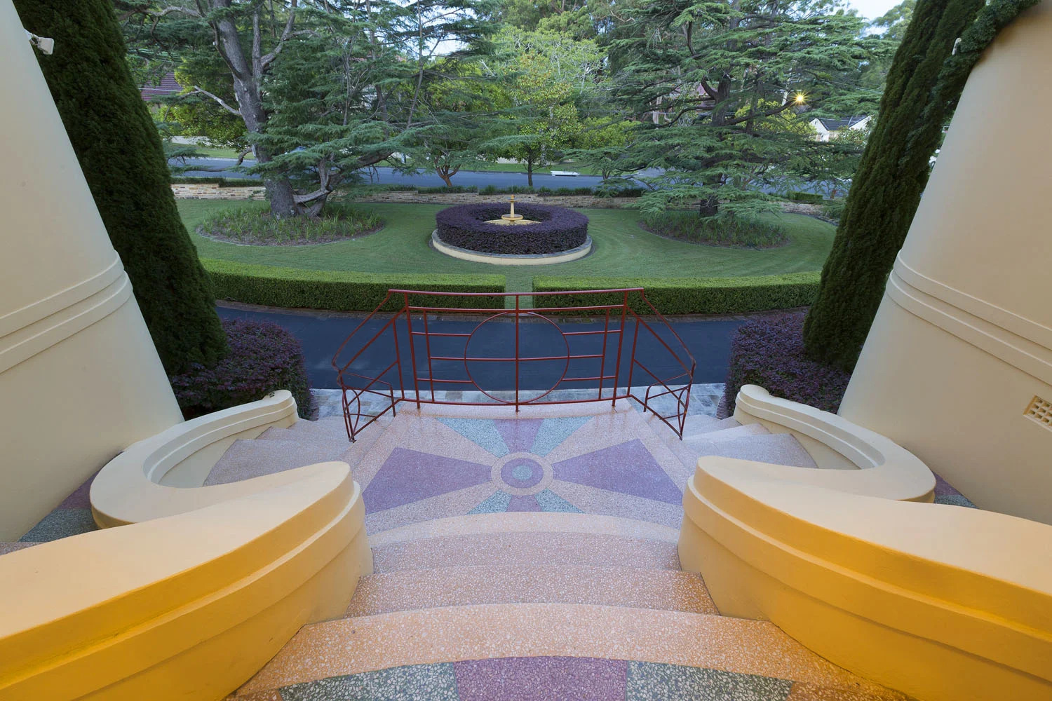
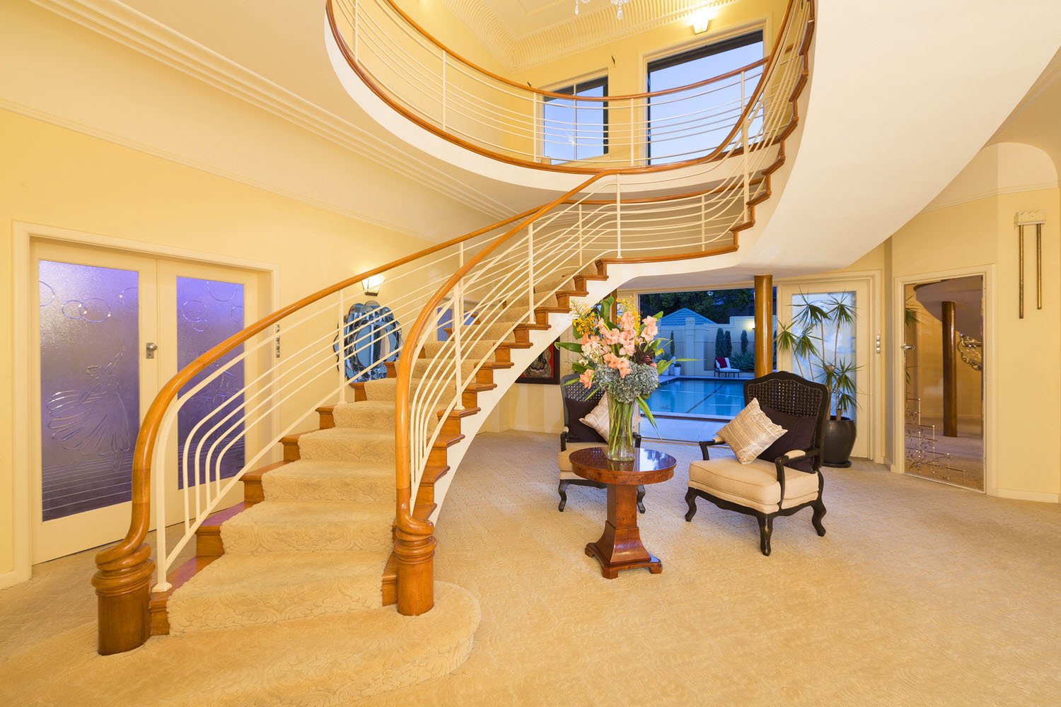
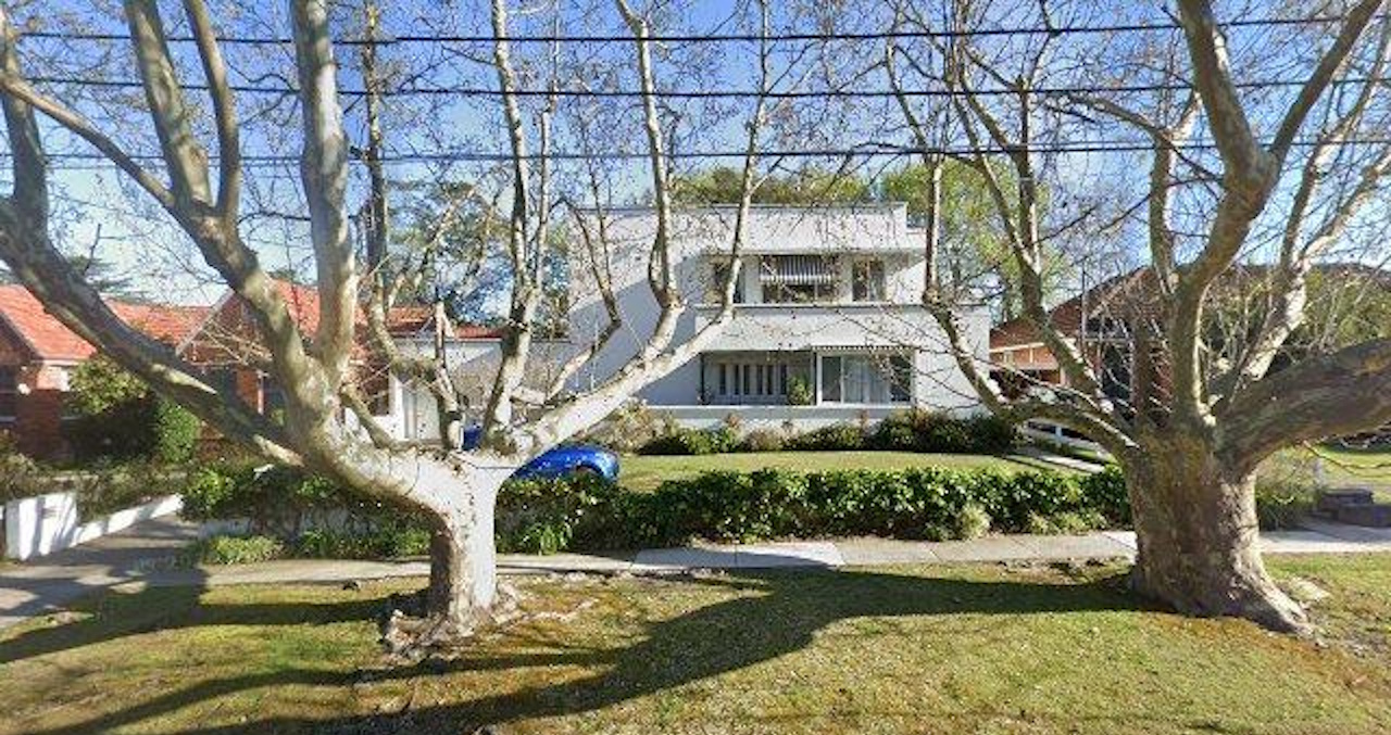
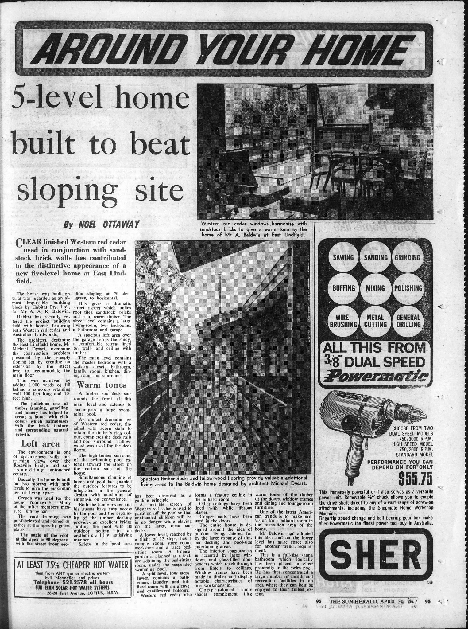
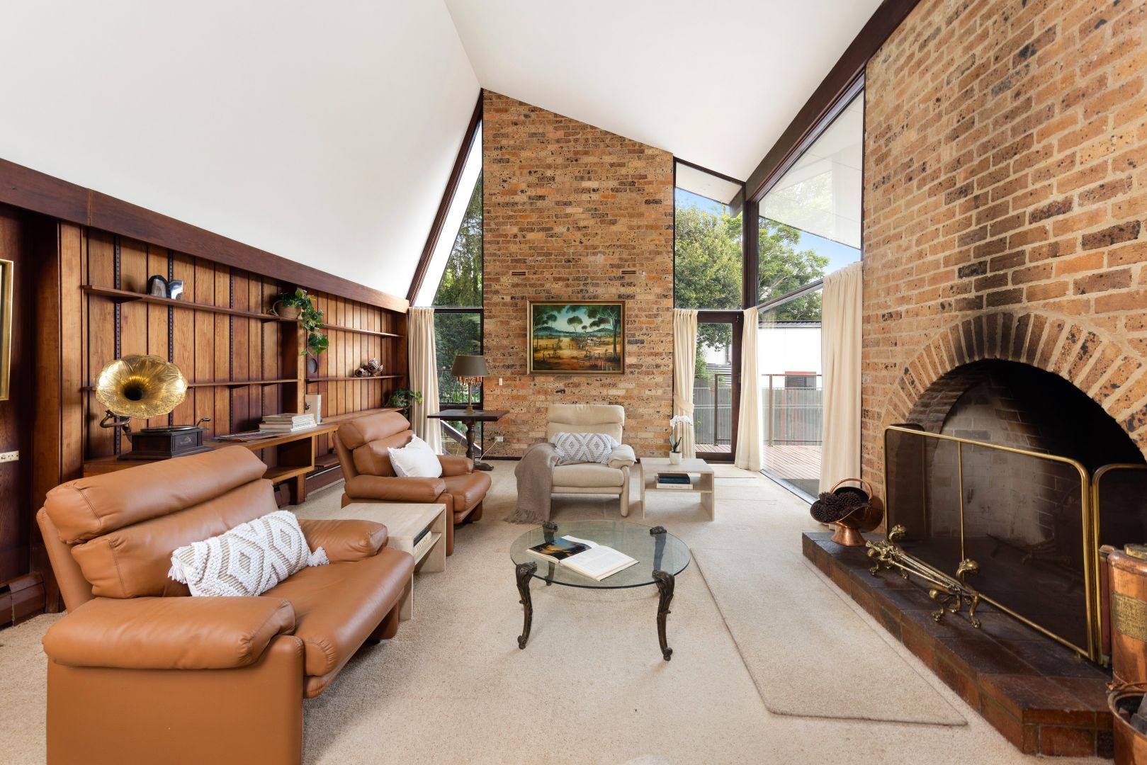
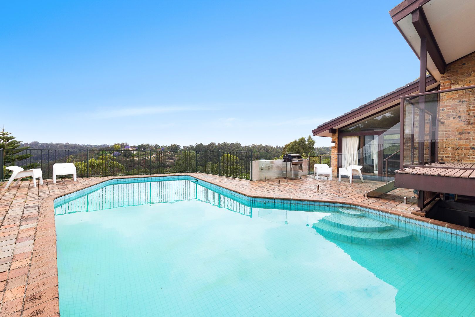
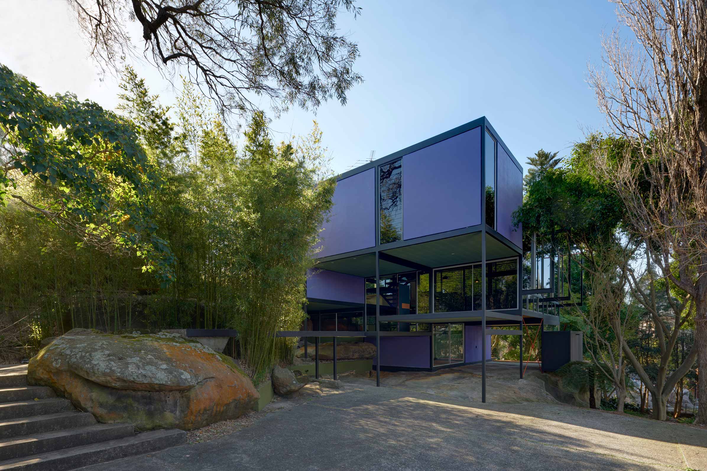
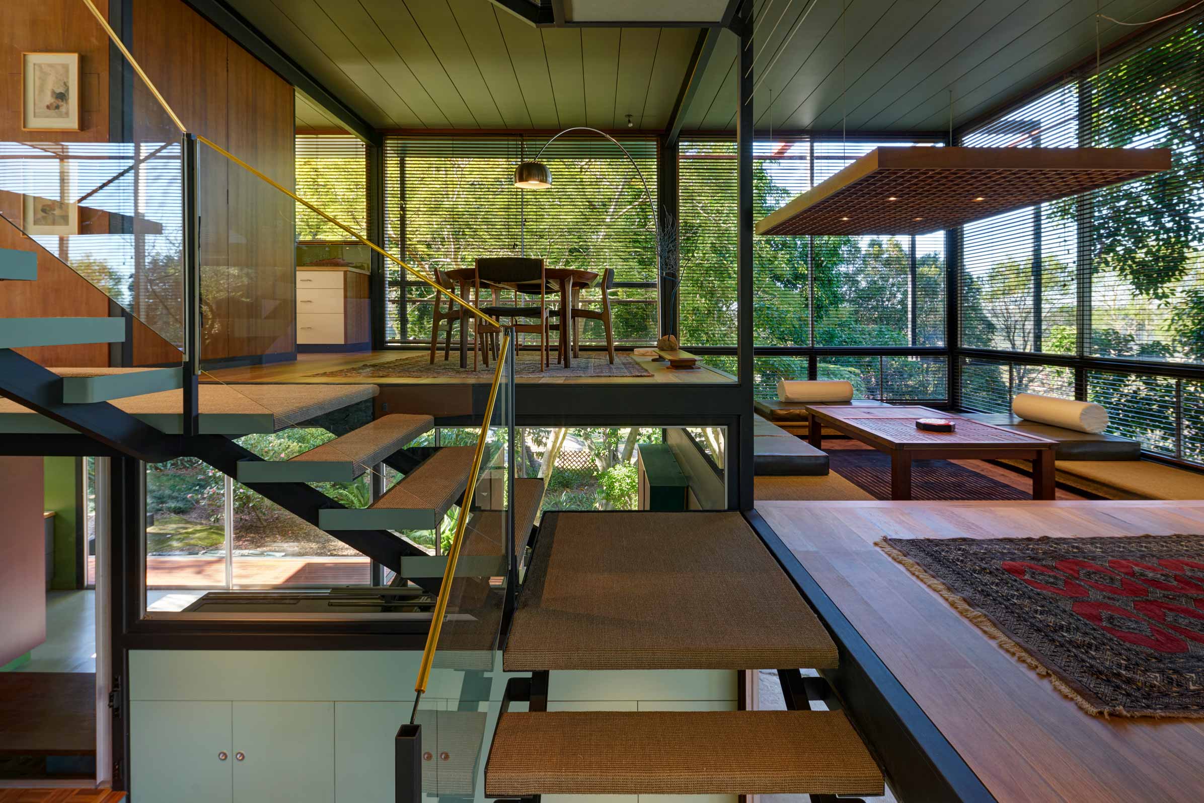
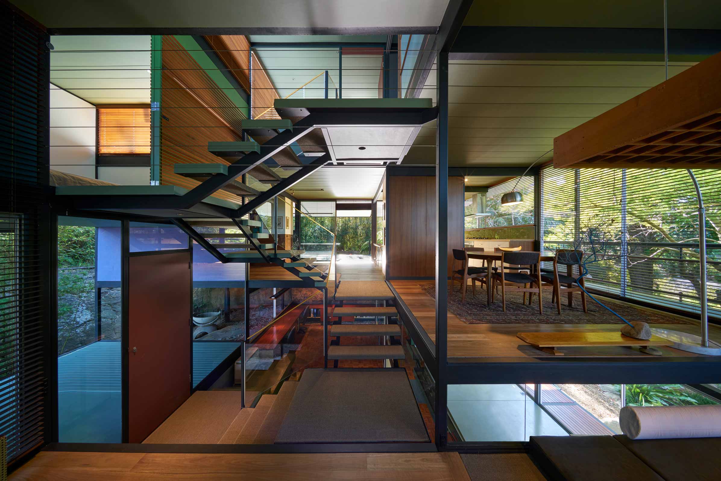
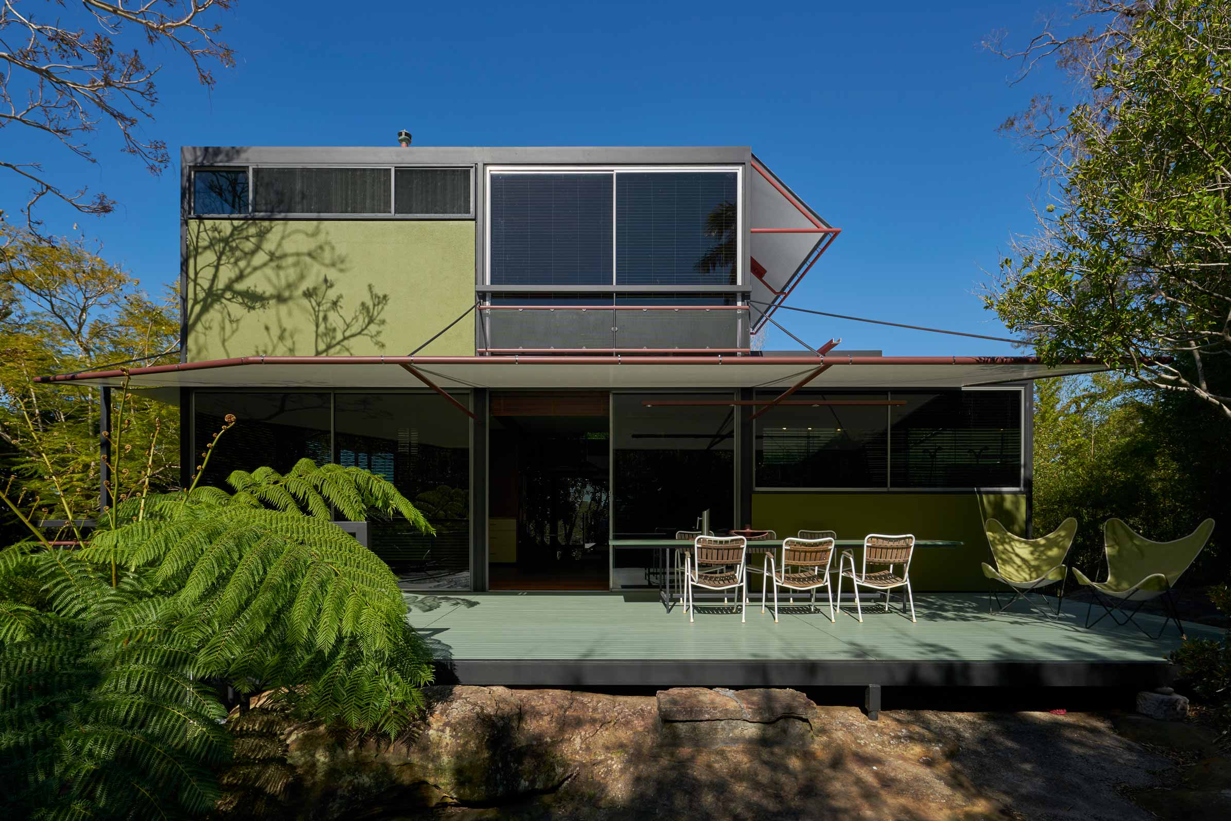
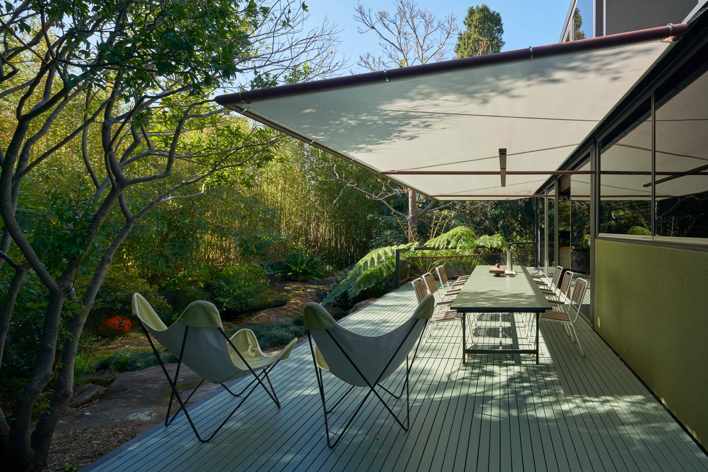
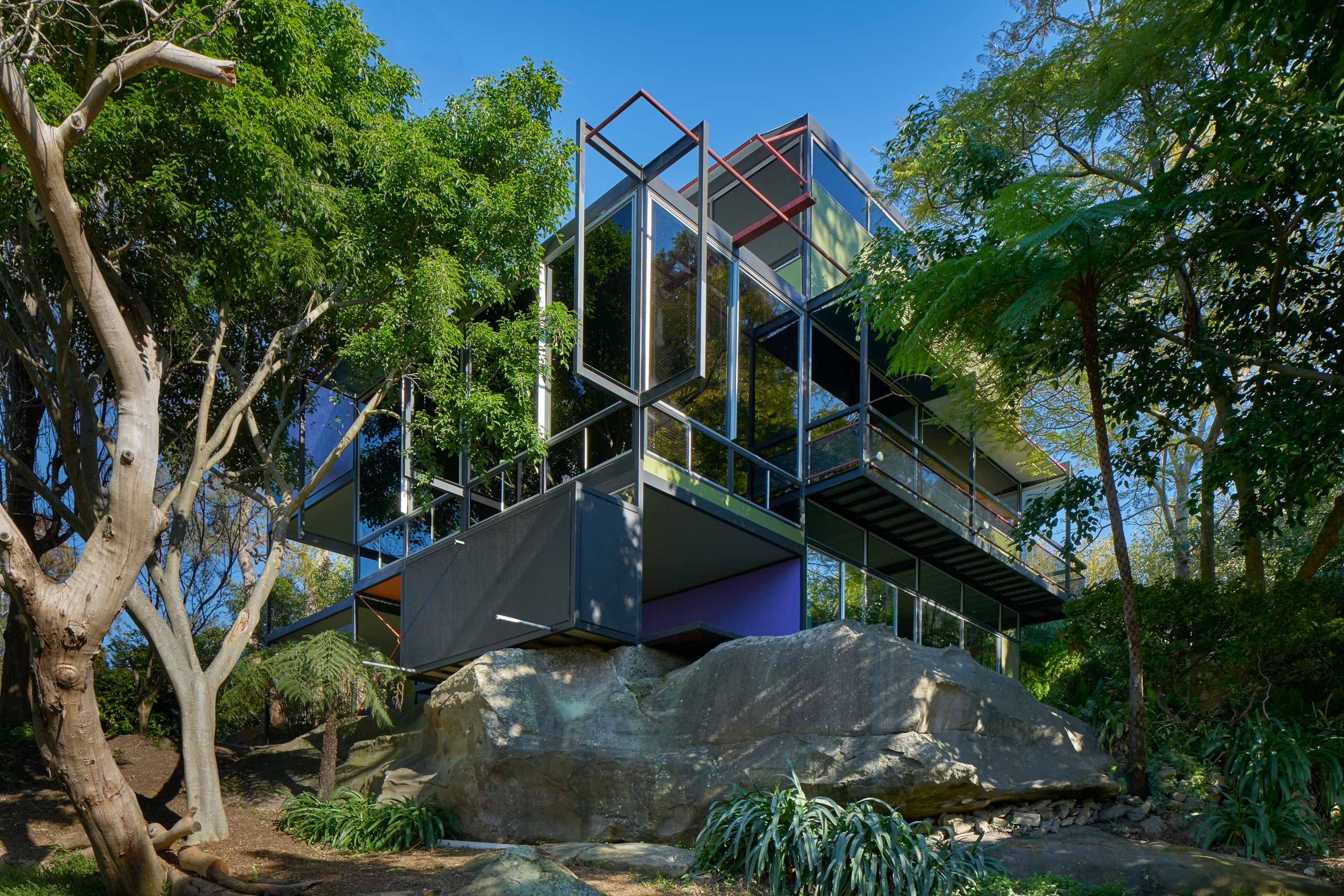
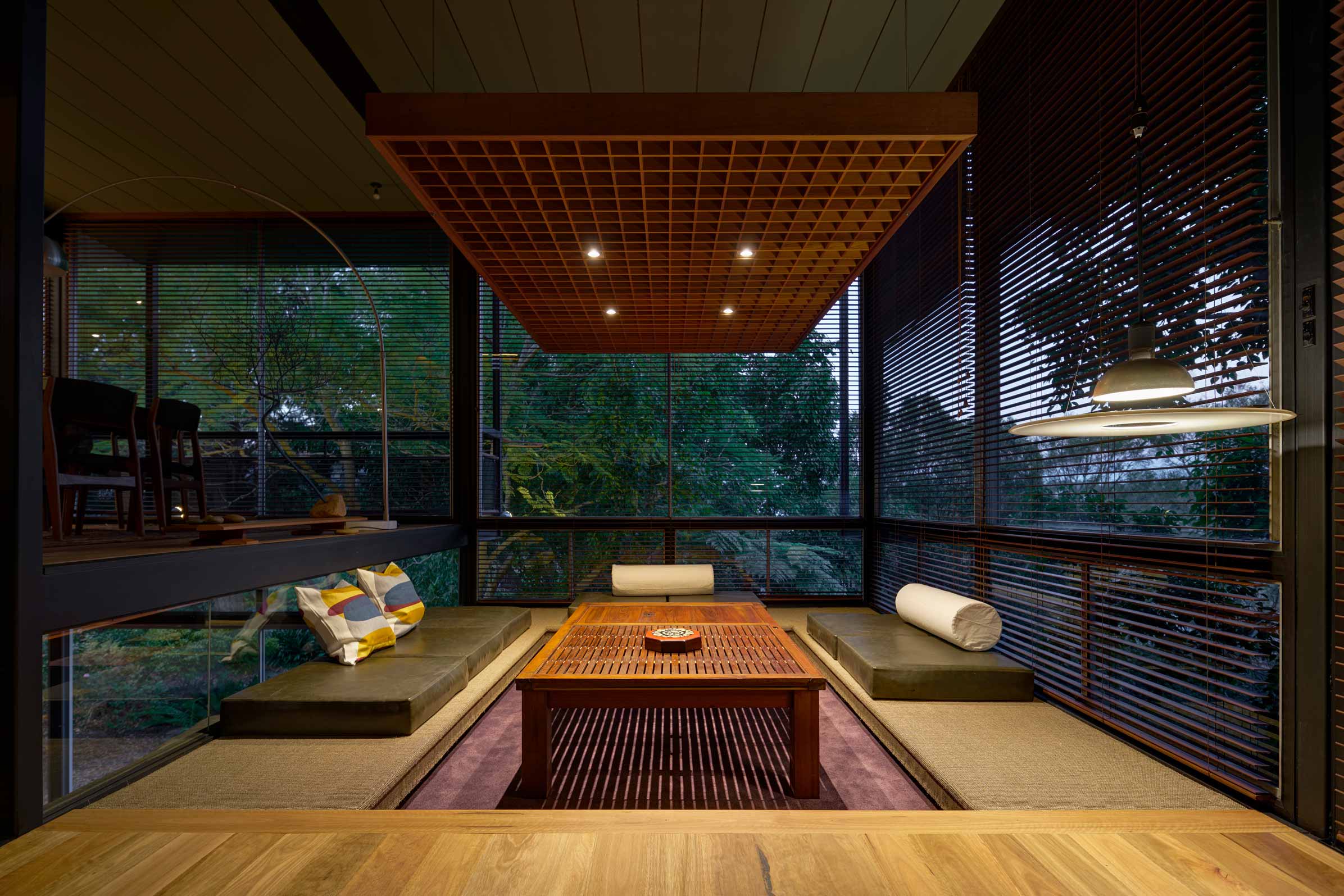
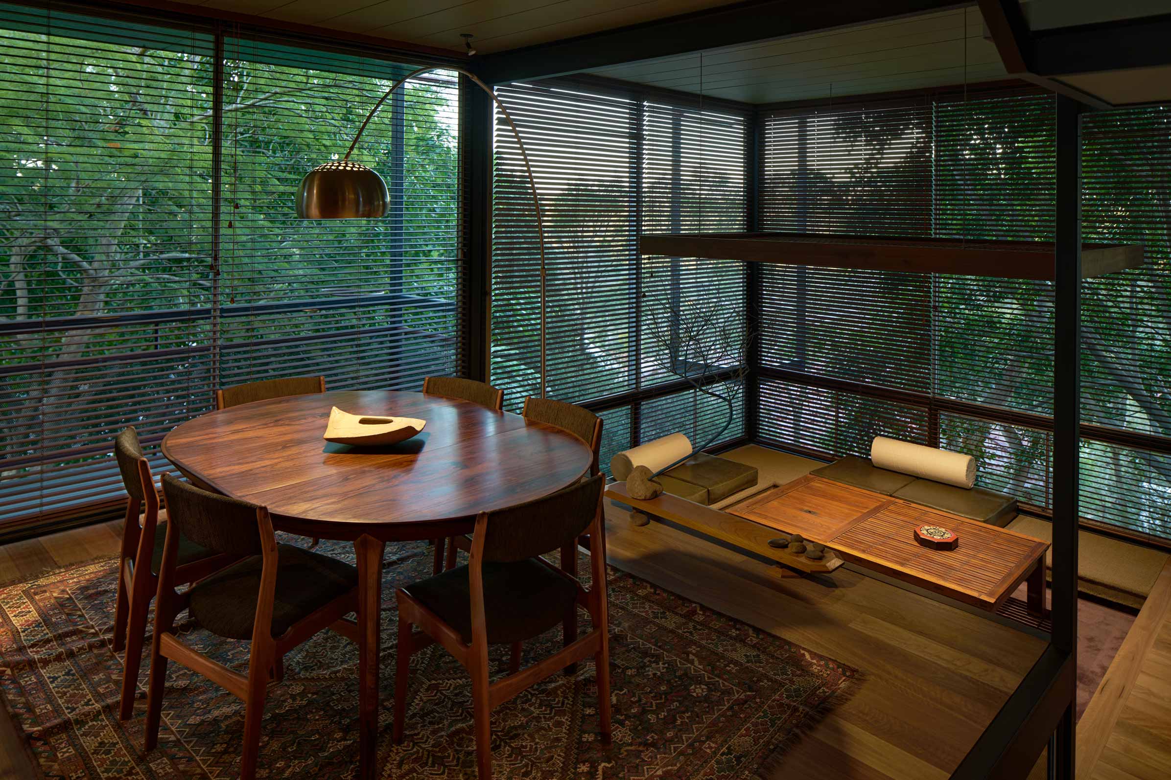
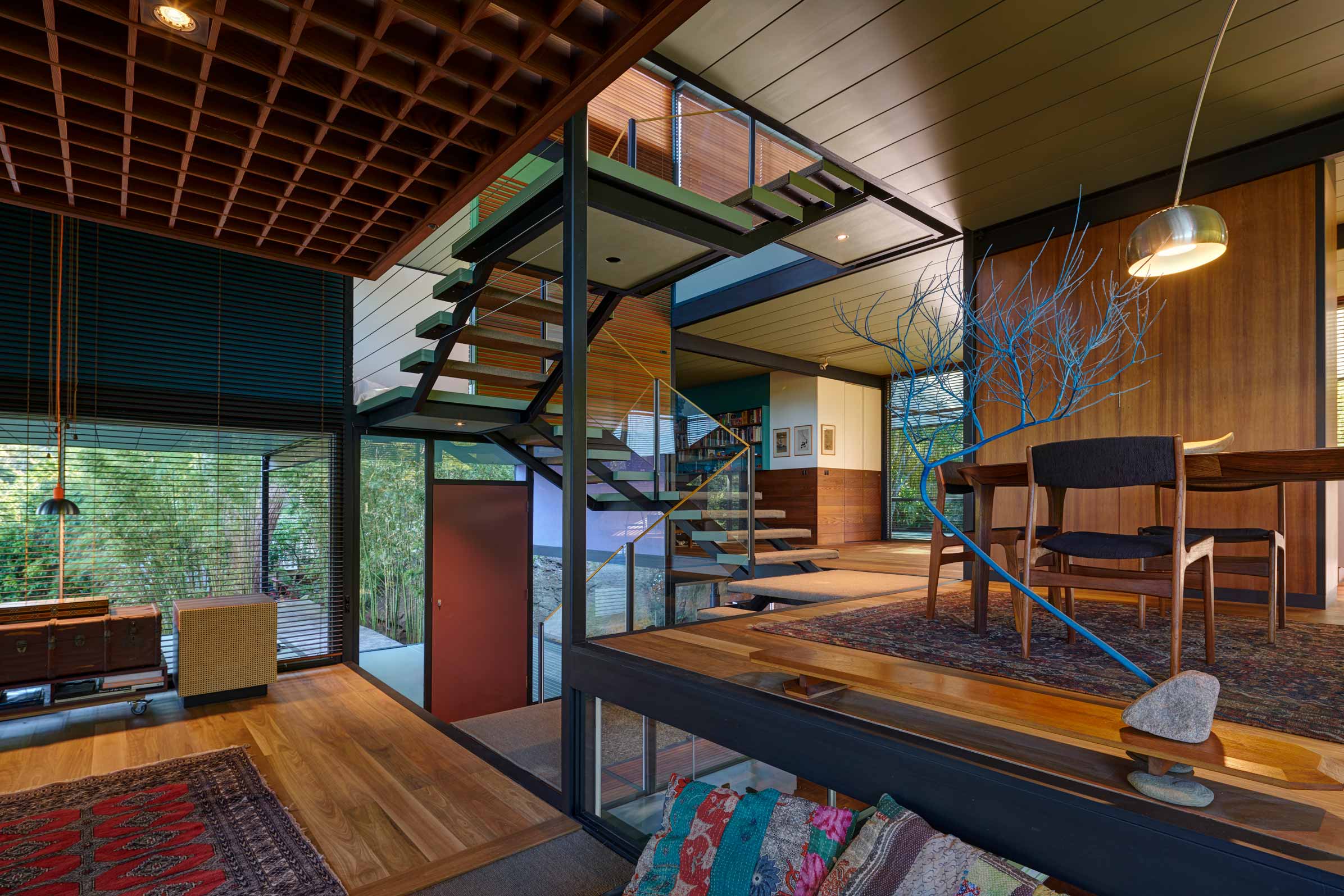
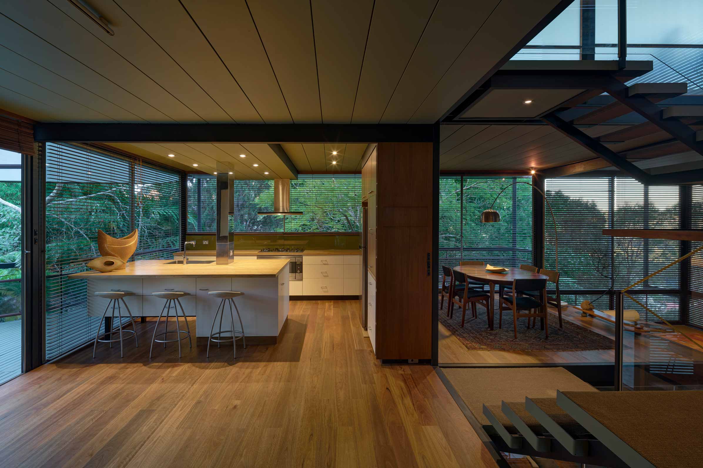
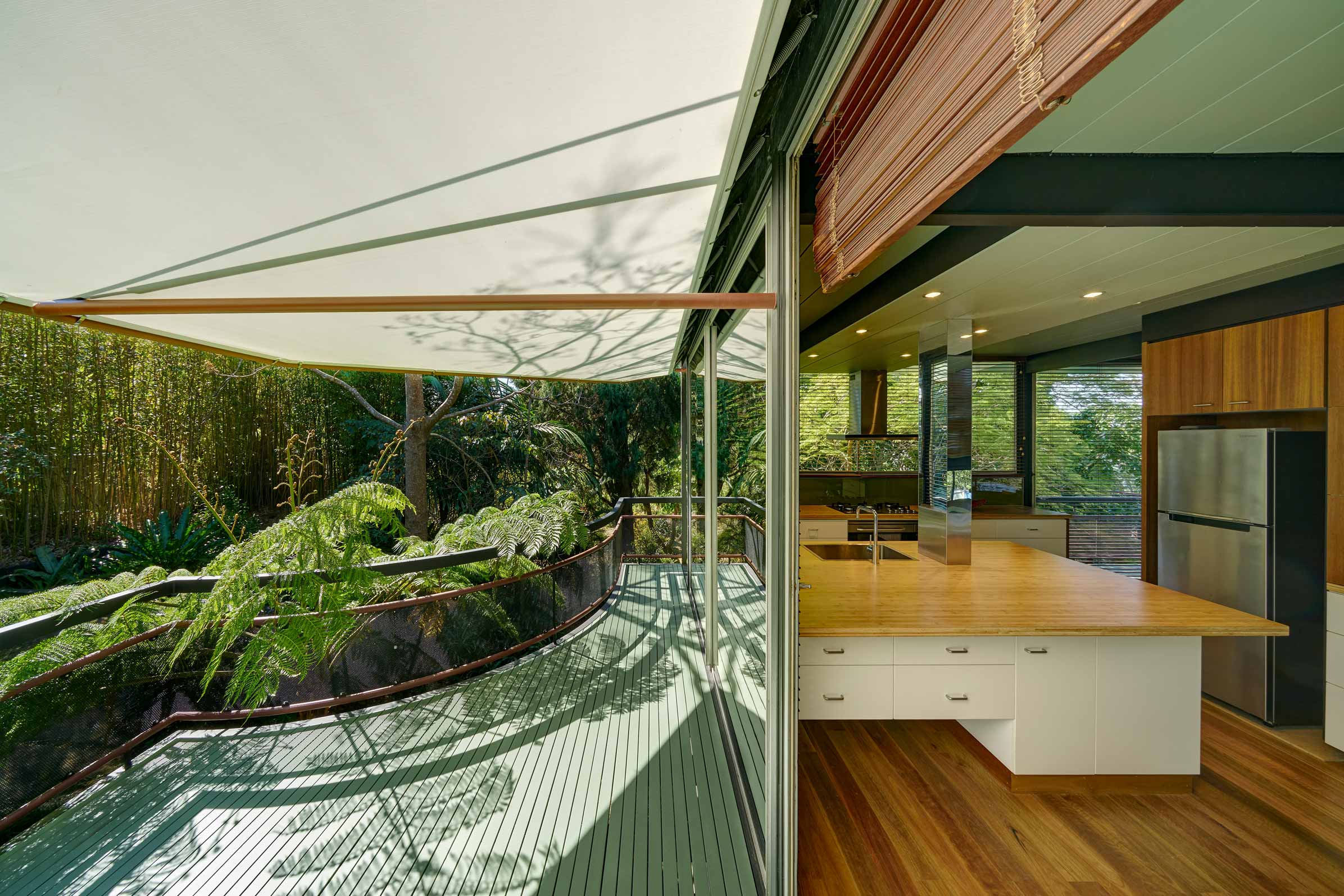
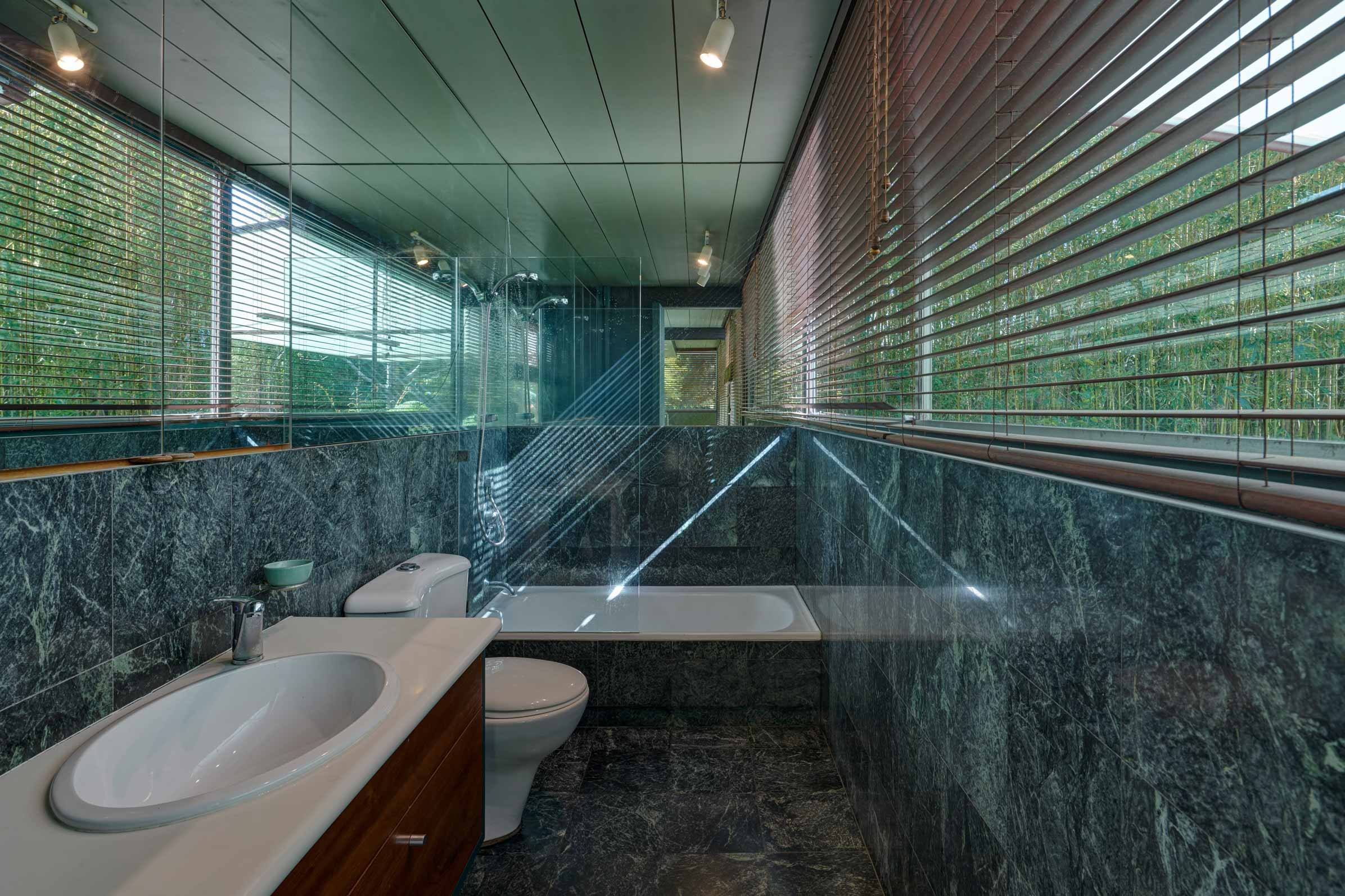
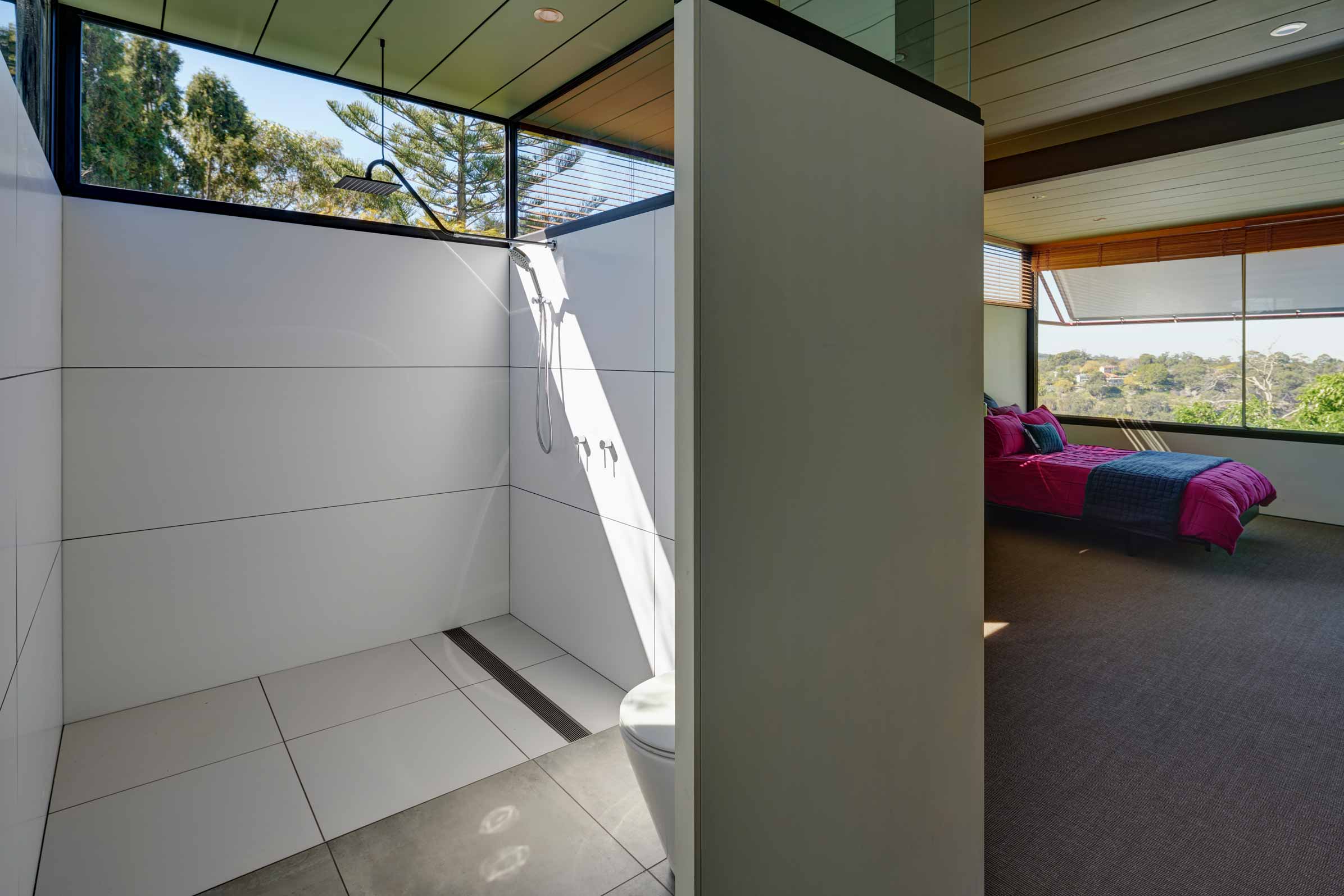
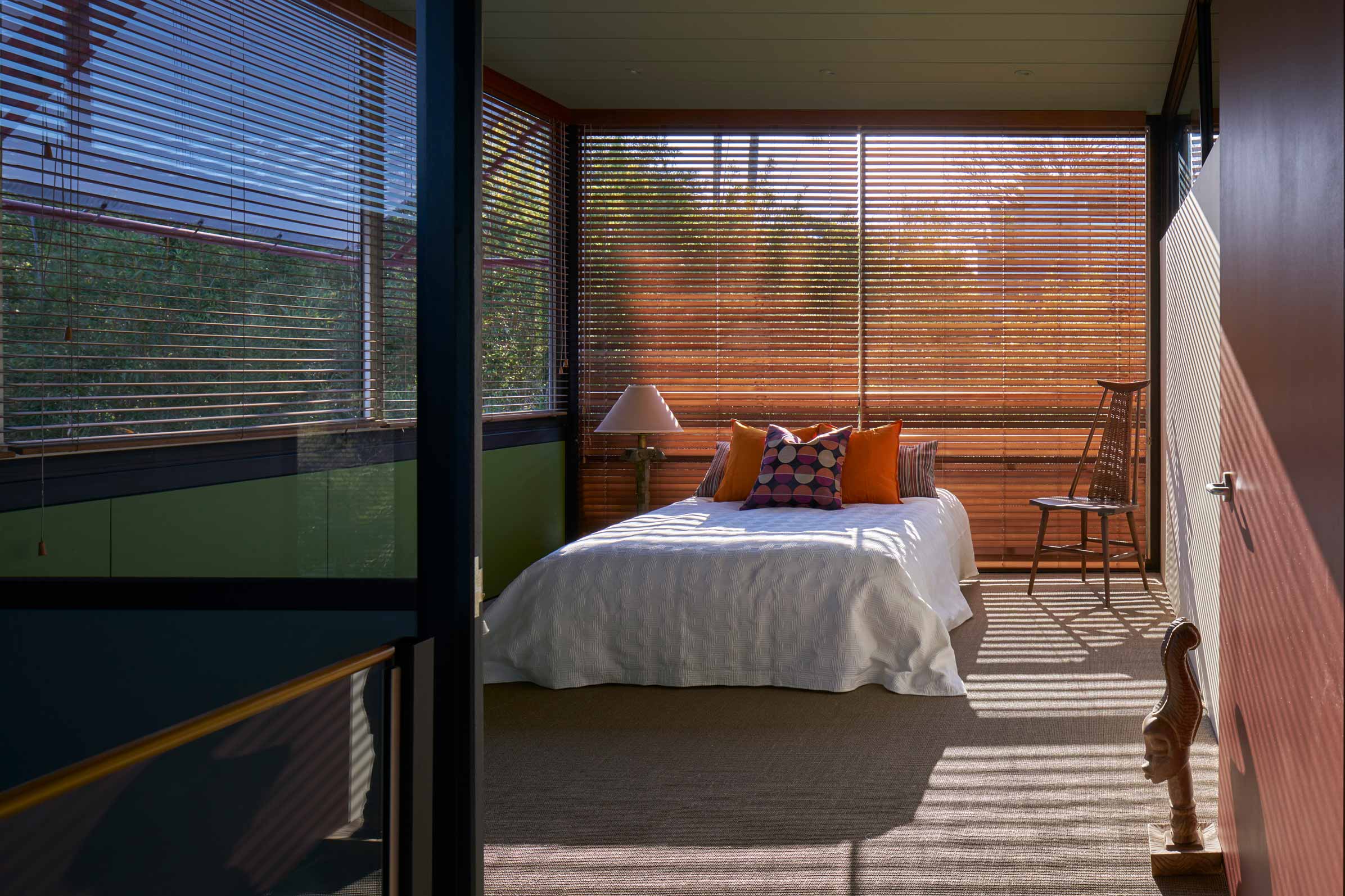
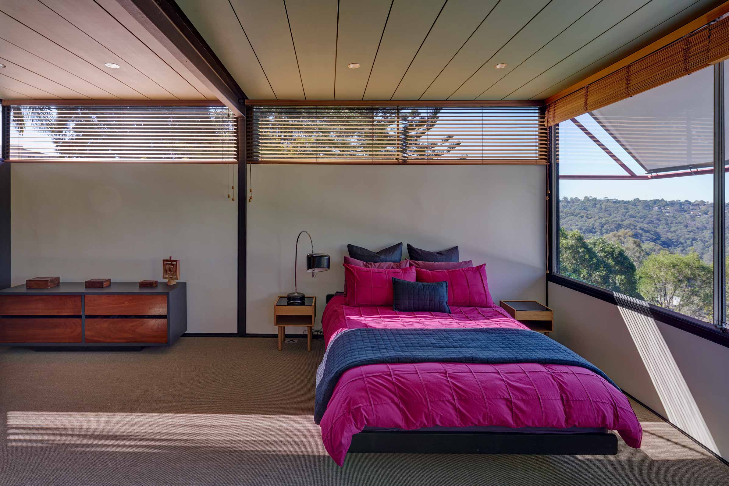
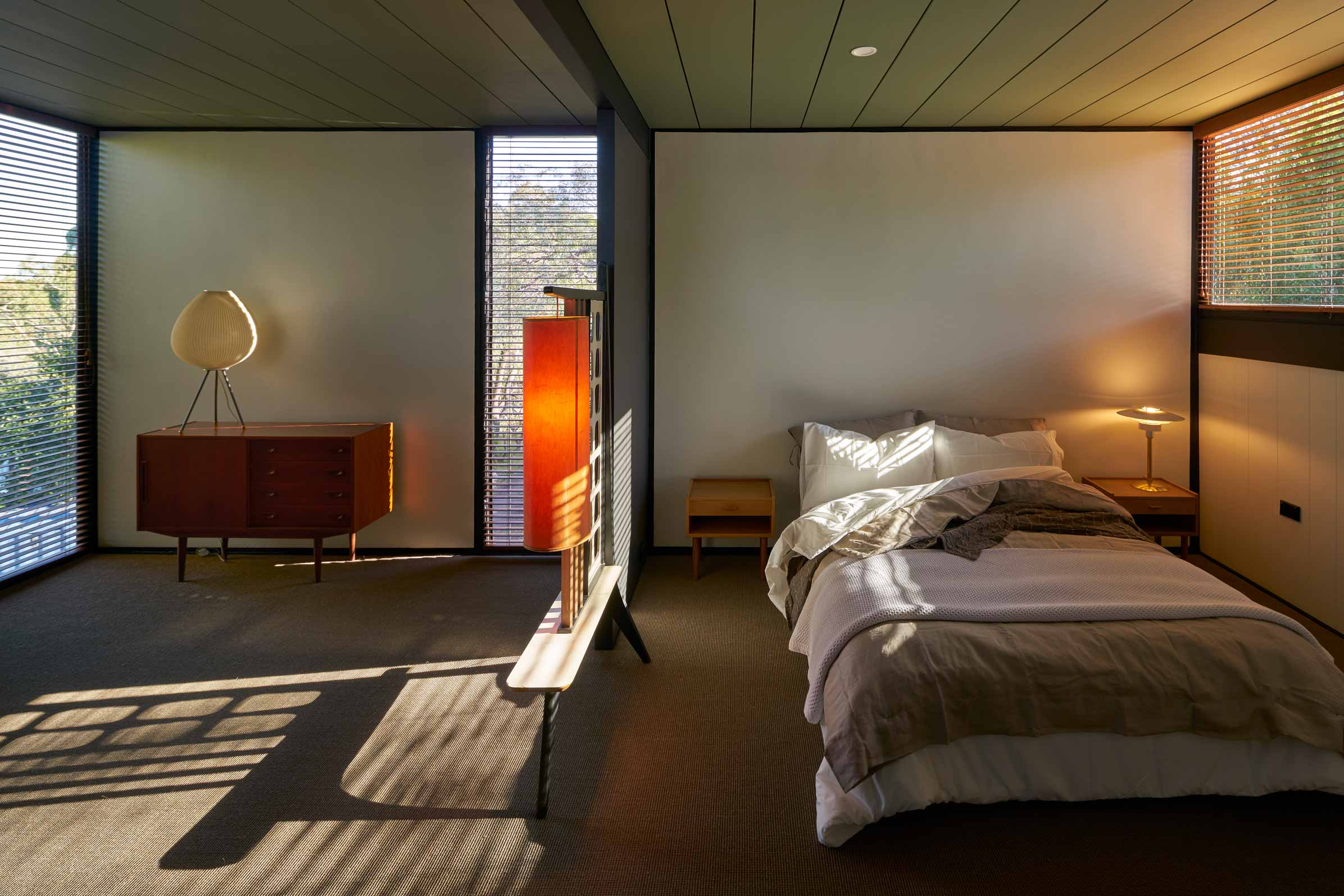
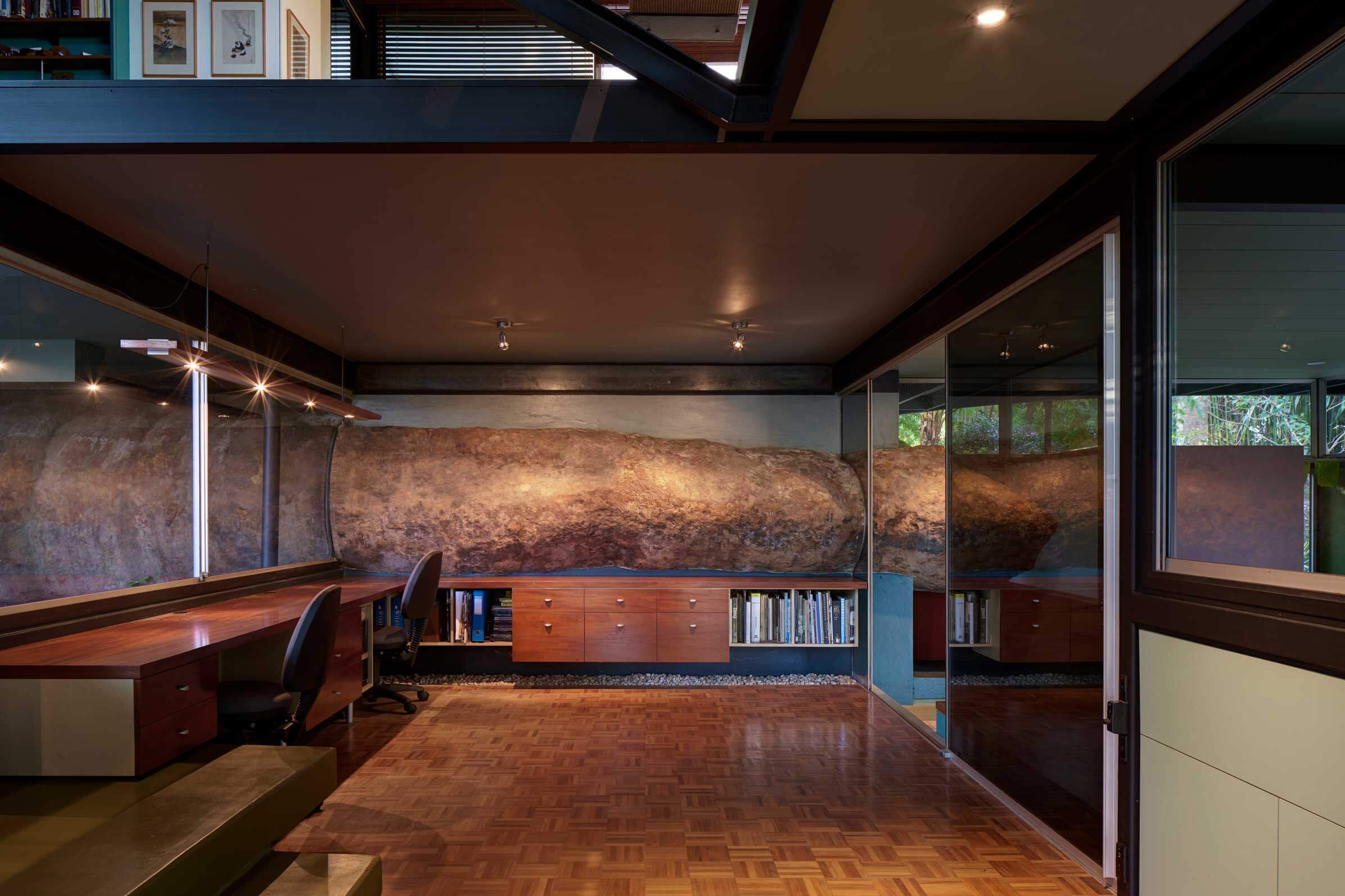
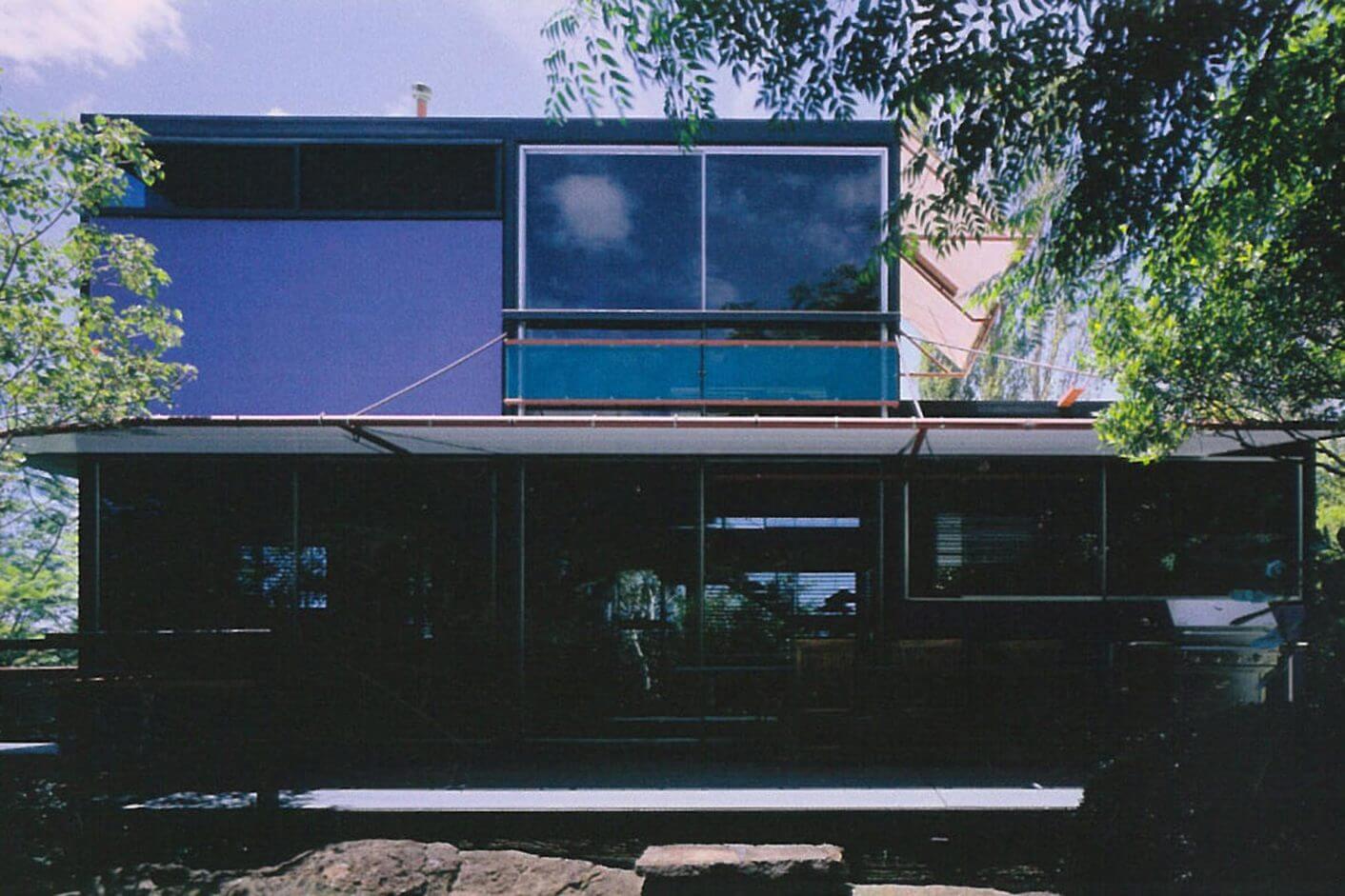
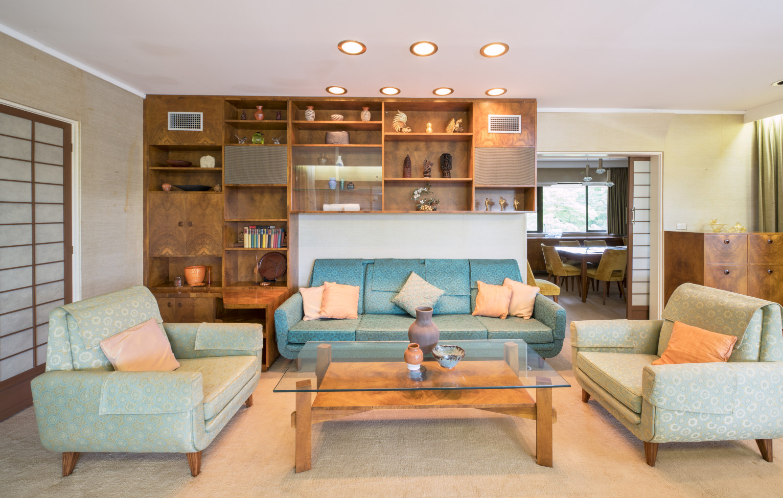
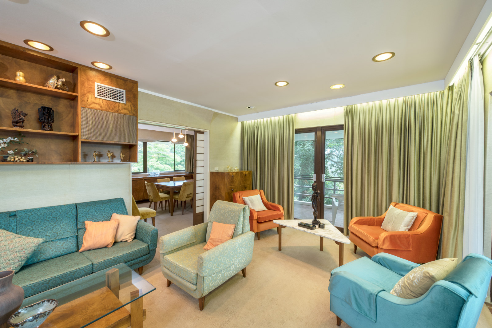
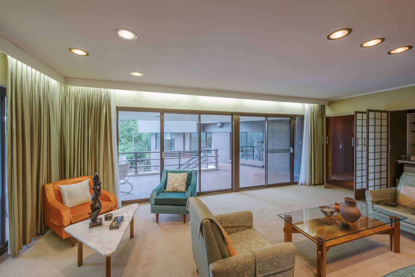
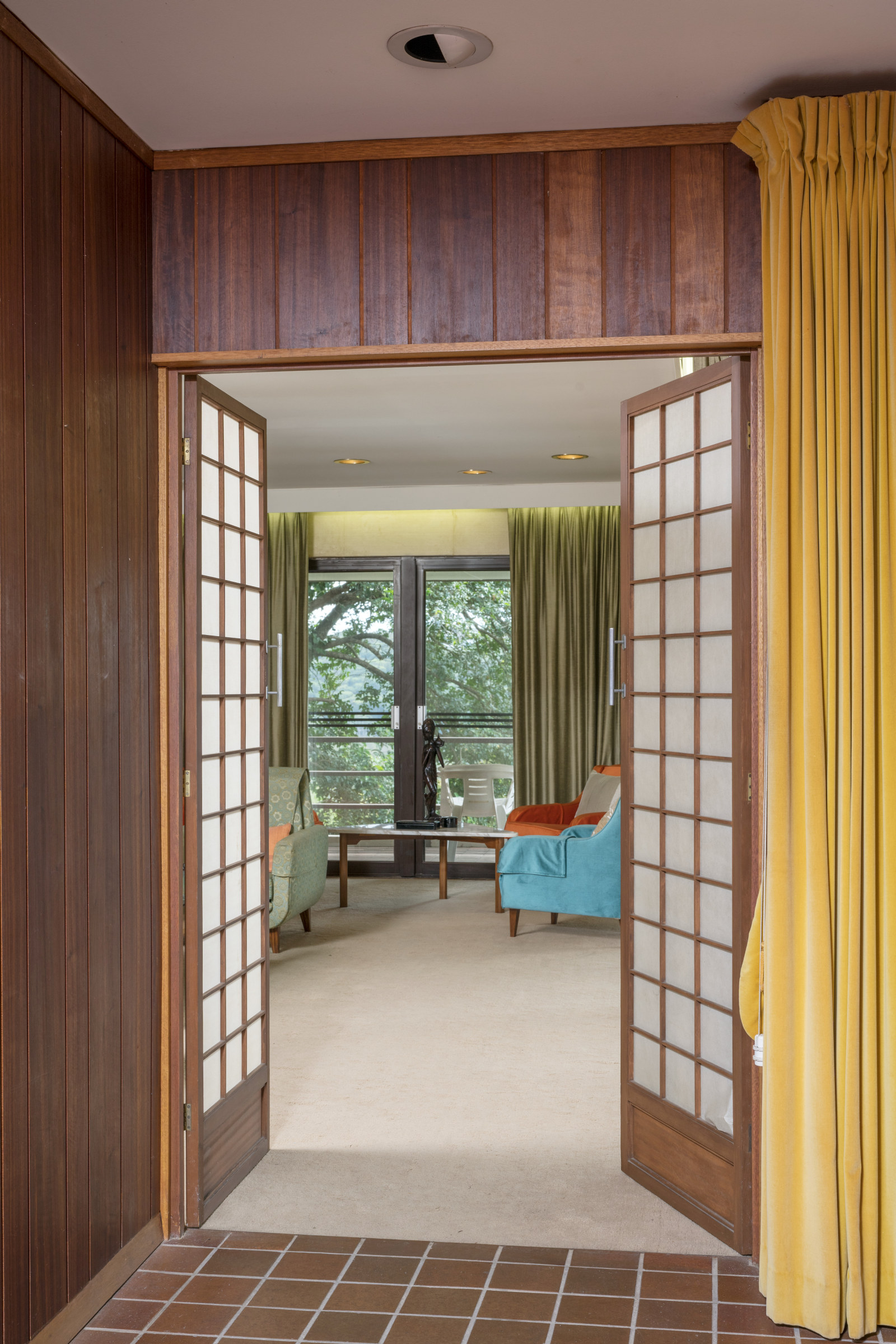
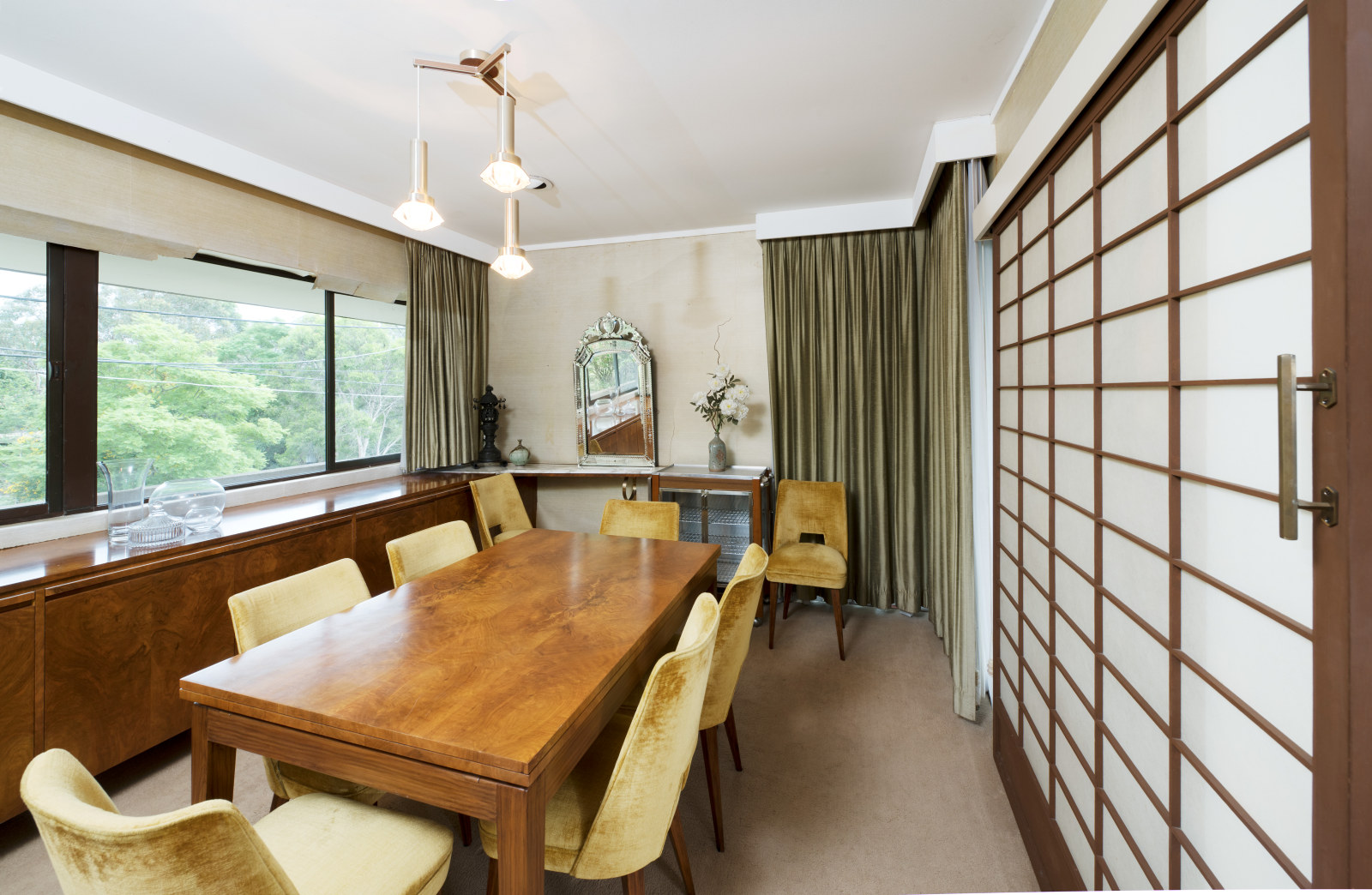
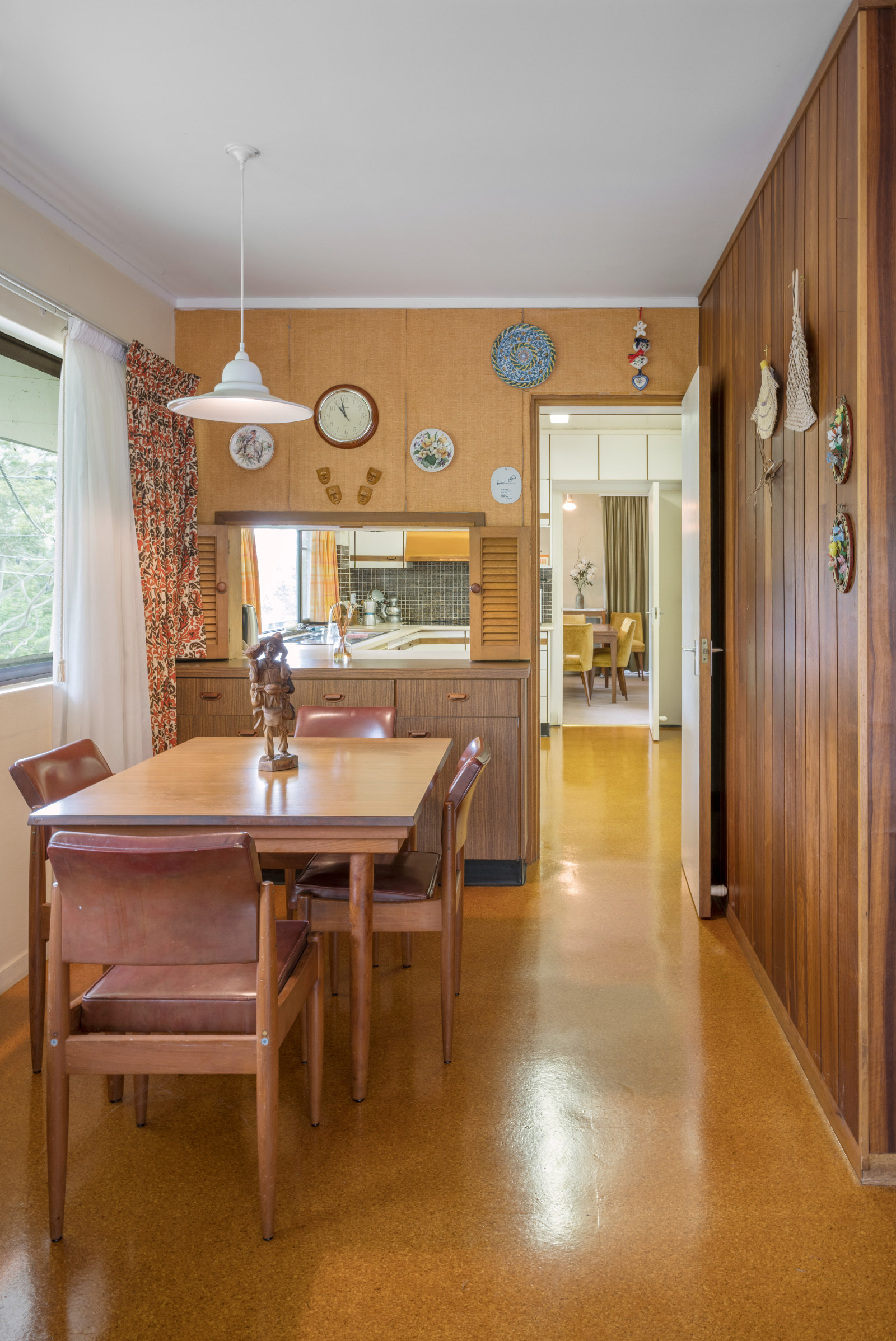
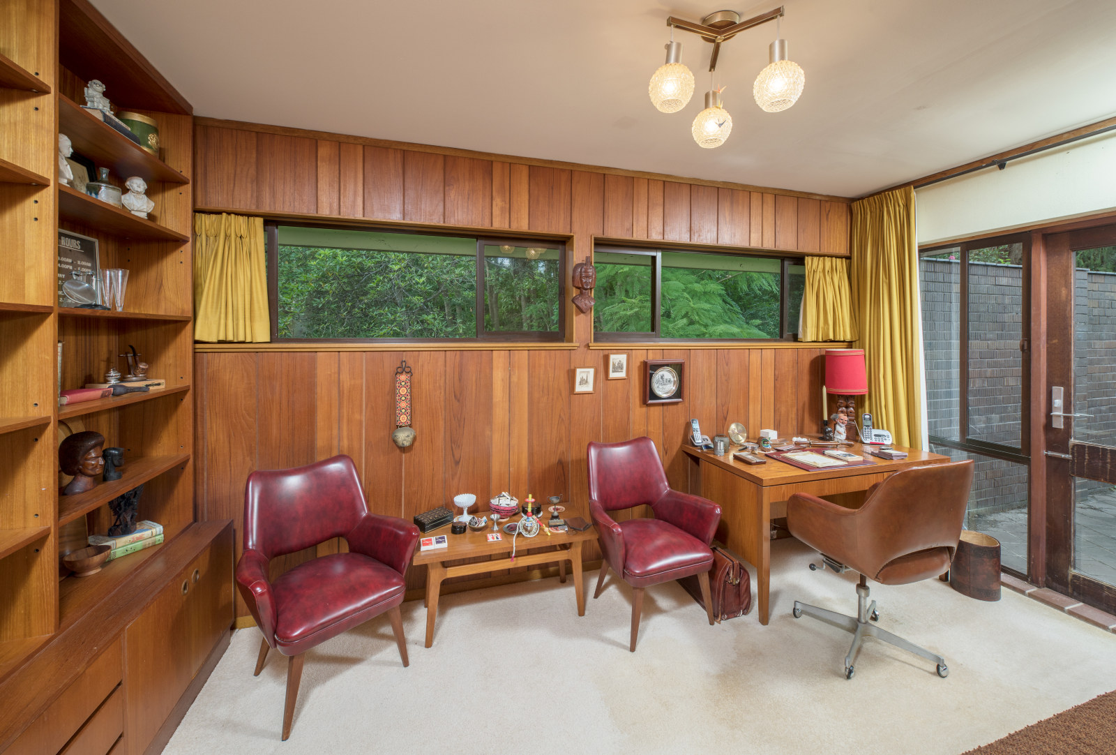
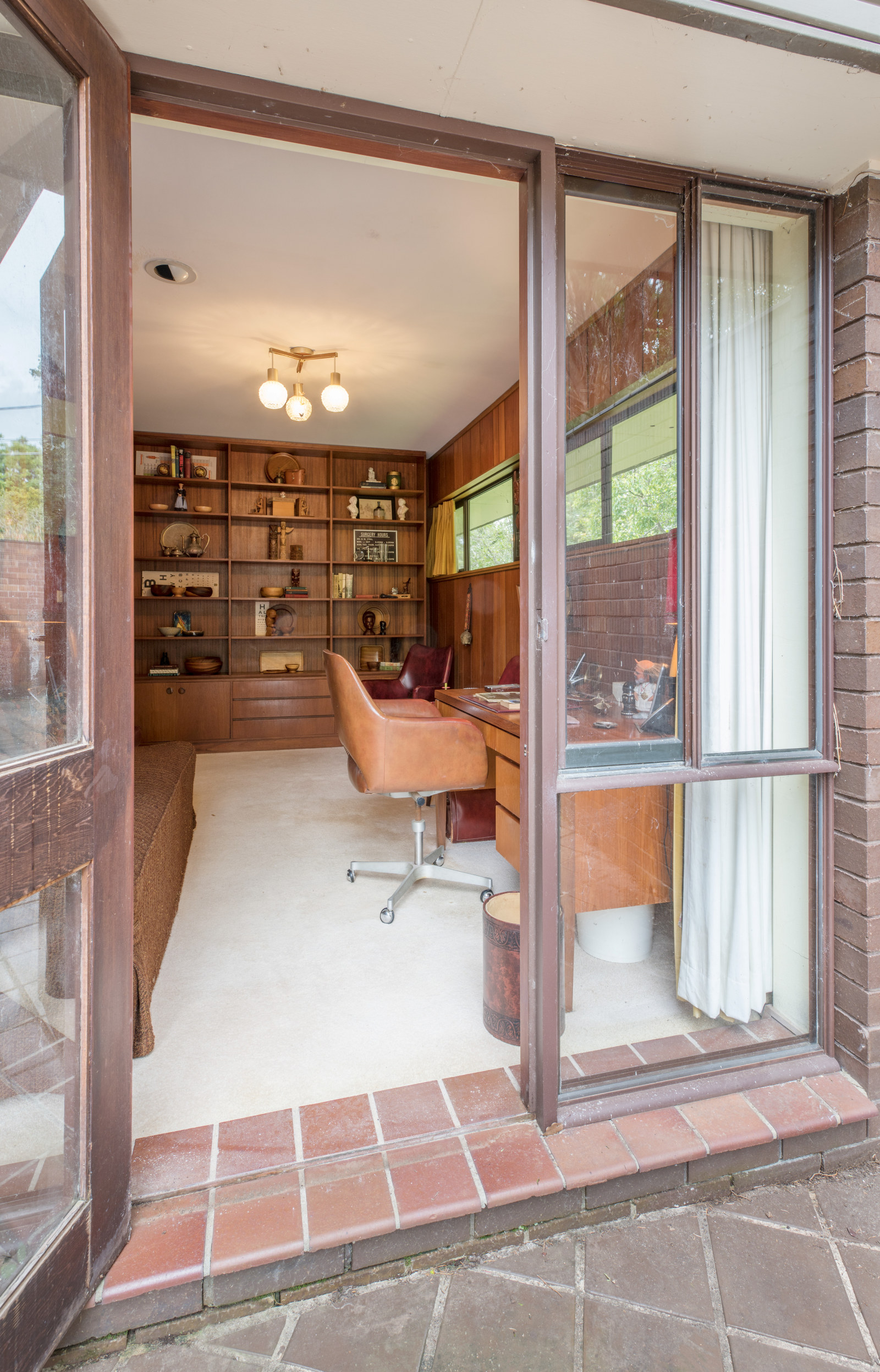
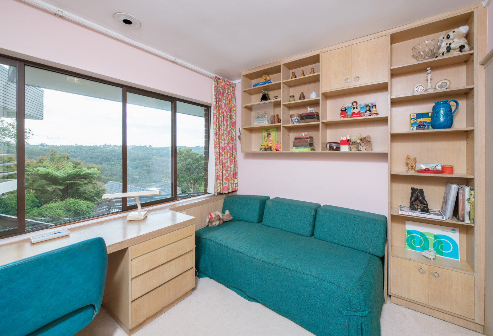
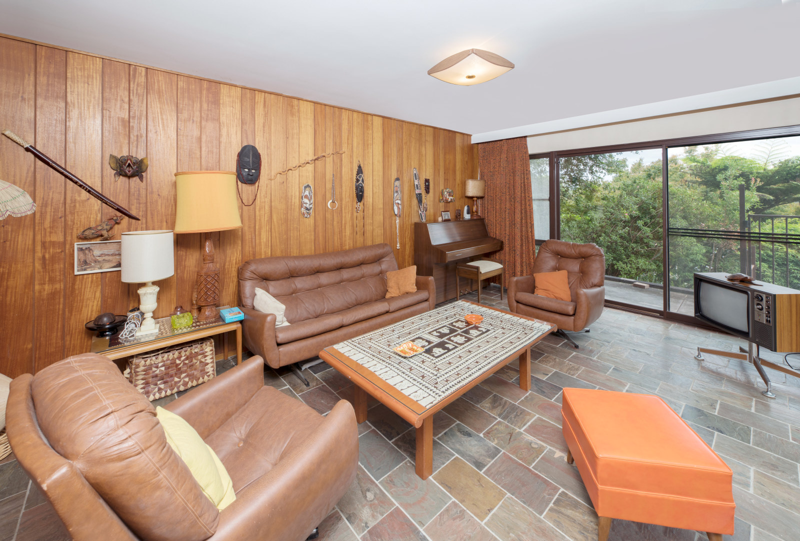
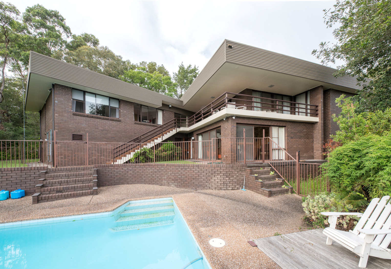
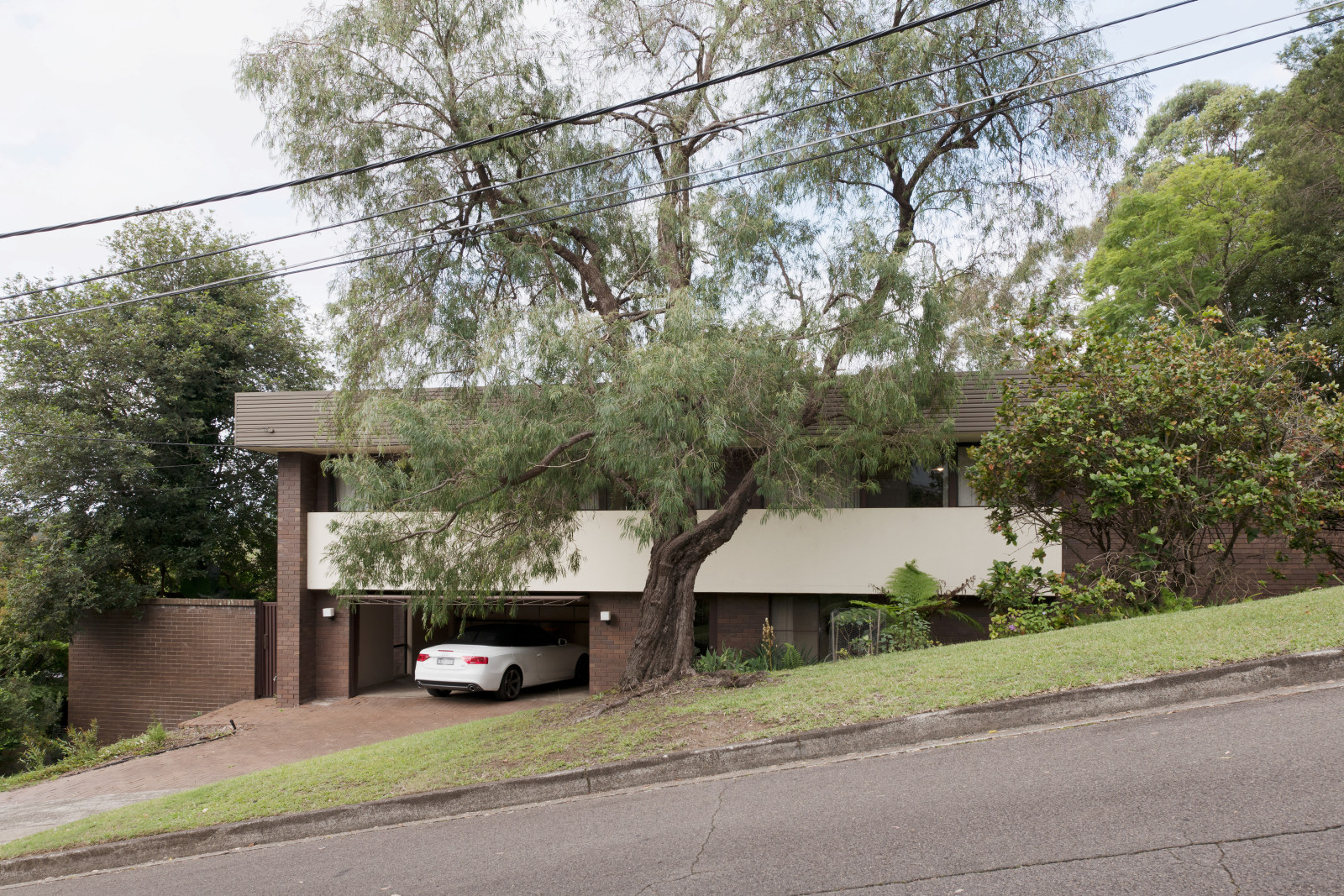
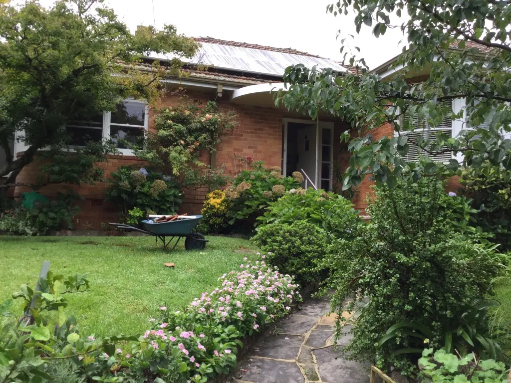

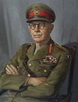
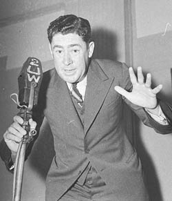
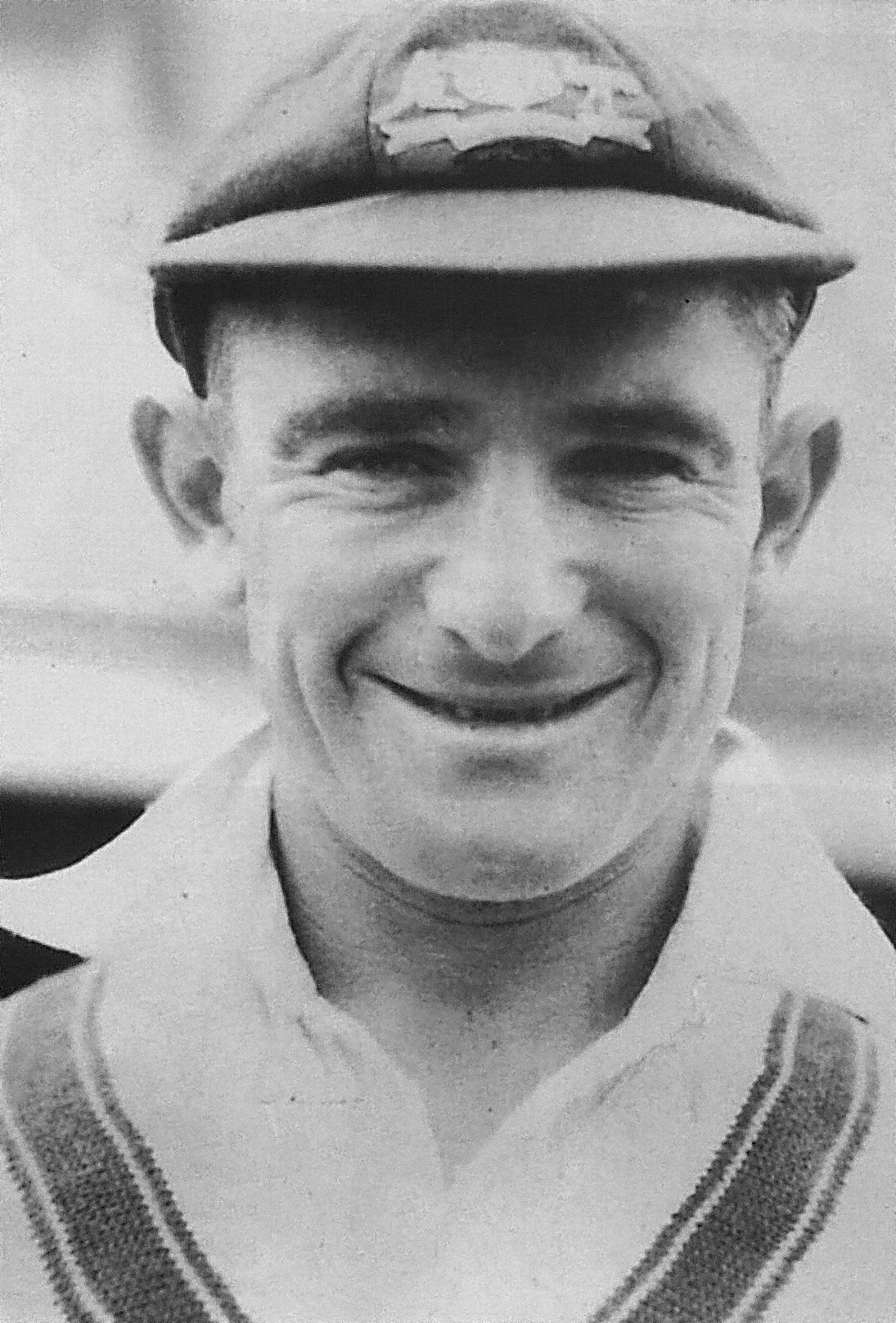



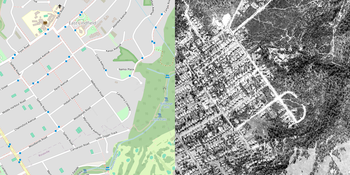


.jpg)
